
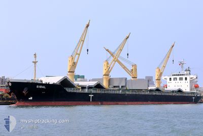
SIBAL
Cargo
Current Trip
RULUU
| Time Travelled | 19 days |
|---|---|
| Remaining Time | --- |
| Distance Travelled | 2040.69 nm |
| Remaining Distance | --- |
| AVG Speed | 9.6 Knots |
| MAX Speed | 14.1 Knots |
| AVG Wind | 11.2 knots |
| MAX Wind | 31 knots |
| MIN Temp | 15.8°C / 60.44°F |
| MAX Temp | 23°C / 73.4°F |
| Draught | 6.5 m |
| Position Received | 1 m ago |
Current Position
| Longitude | -7.98662° |
|---|---|
| Latitude | 36.58896° |
| Status | Under way using engine |
| Speed | 13.2 Knots |
| Course | 279.4° |
| Area | North Atlantic Ocean |
| Station | T-AIS |
| Position Received | 1 m ago |
Info
Information
The current position of SIBAL is in North Atlantic Ocean with coordinates 36.58896° / -7.98662° as reported on 2024-06-02 06:23 by AIS to our vessel tracker app. The vessel's current speed is 13.2 Knots
The vessel SIBAL (IMO: 9712620, MMSI: 256505000) is a Cargo It's sailing under the flag of [MT] Malta.
In this page you can find informations about the vessels current position, last detected port calls, and current voyage information. If the vessels is not in coverage by AIS you will find the latest position.
The current position of SIBAL is detected by our AIS receivers and we are not responsible for the reliability of the data. The last position was recorded while the vessel was in Coverage by the Ais receivers of our vessel tracking app.
The current draught of SIBAL as reported by AIS is 6.5 meters
Weather
| Temperature | 19.9°C / 67.82°F |
|---|---|
| Wind Speed | 7 knots |
| Direction | 81° E |
| Pressure | 1013.6 hPa |
| Humidity | 85.6 % |
| Cloud Coverage | 9 % |
Featured Company
Events
| Time | Event | Details | Position / Dest | Info |
|---|---|---|---|---|
| 2024-06-02 05:11 | Status Changed | Under way using engine Default |
36.54212 / -7.66241
RULUU
|
Speed: 13.3 kn Course: 274° |
| 2024-06-02 04:48 | Status Changed | Default Under way using engine |
36.53553 / -7.55951
RULUU
|
Speed: 13.4 kn Course: 305.1° |
| 2024-06-02 04:41 | Detected in Sea | Portuguese part of the North Atlantic Ocean |
36.52895 / -7.52759
North Atlantic Ocean
RULUU
|
Speed: 13.4 kn Course: 305.1° |
| 2024-06-02 04:40 | Status Changed | Under way using engine Default |
36.52786 / -7.52571
RULUU
|
Speed: 13.4 kn Course: 305° |
| 2024-06-02 04:36 | IN Coverage |
36.52895 / -7.52759
North Atlantic Ocean
RULUU
|
Speed: 13.4 kn Course: 305.1° |
|
| 2024-06-02 02:43 | Status Changed | Default Under way using engine |
36.27464 / -7.09068
RULUU
|
Speed: 13.4 kn Course: 305.3° |
| 2024-06-02 02:41 | OUT of Coverage |
36.26920 / -7.08131
North Atlantic Ocean
RULUU
|
Speed: 13.4 kn Course: 305.3° |
|
| 2024-06-02 02:38 | Change Sea Area | Spanish part of the North Atlantic Ocean Spanish part of the Strait of Gibraltar |
36.26311 / -7.07074
North Atlantic Ocean
RULUU
|
Speed: 13.3 kn Course: 305.6° |
| 2024-06-02 02:38 | Status Changed | Under way using engine Default |
36.26311 / -7.07074
RULUU
|
Speed: 13 kn Course: 305° |
| 2024-06-02 02:22 | IN Coverage |
36.26311 / -7.07074
North Atlantic Ocean
RULUU
|
Speed: 13.3 kn Course: 305.6° |