
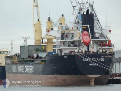
SIDER ATLANTIC
Cargo
Current Trip
| Time Travelled | 7 days |
|---|---|
| Remaining Time | 1 h, 8 mins |
| Distance Travelled | 591.54 nm |
| Remaining Distance | 12.87 nm |
| AVG Speed | 9.2 Knots |
| MAX Speed | 13 Knots |
| AVG Wind | 9.1 knots |
| MAX Wind | 17 knots |
| MIN Temp | 16.3°C / 61.34°F |
| MAX Temp | 22.1°C / 71.78°F |
| Draught | 5 m |
| Position Received | Now |
Current Position
| Longitude | -0.80534° |
|---|---|
| Latitude | 37.50352° |
| Status | Under way using engine |
| Speed | 8.9 Knots |
| Course | 275° |
| Area | Mediterranean Sea - Western Basin |
| Station | T-AIS |
| Position Received | Now |
Info
Information
The current position of SIDER ATLANTIC is in Mediterranean Sea - Western Basin with coordinates 37.50352° / -0.80534° as reported on 2024-05-18 04:38 by AIS to our vessel tracker app. The vessel's current speed is 8.9 Knots and is heading at the port of CARTAGENA. The estimated time of arrival as calculated by vessel tracking app is 2024-05-18 05:47 LT
The vessel SIDER ATLANTIC (MMSI: 255702000) is a Cargo It's sailing under the flag of [PT] Portugal.
In this page you can find informations about the vessels current position, last detected port calls, and current voyage information. If the vessels is not in coverage by AIS you will find the latest position.
The current position of SIDER ATLANTIC is detected by our AIS receivers and we are not responsible for the reliability of the data. The last position was recorded while the vessel was in Coverage by the Ais receivers of our vessel tracking app.
The current draught of SIDER ATLANTIC as reported by AIS is 5 meters
Weather
| Temperature | 18.2°C / 64.76°F |
|---|---|
| Wind Speed | 5 knots |
| Direction | 227° SW |
| Pressure | 1008.7 hPa |
| Humidity | 86.5 % |
| Cloud Coverage | 1 % |
Featured Company
Last Port Calls
| Port | Arrival | Departure | Time In Port |
|---|---|---|---|
| 2024-05-05 21:29 | 2024-05-10 21:40 | 5 d | |
| 2024-05-02 20:18 | 2024-05-03 16:30 | 20 h | |
| 2024-04-27 10:11 | 2024-04-28 18:50 | 1 d | |
| 2024-04-15 04:06 | 2024-04-16 18:47 | 1 d | |
| 2024-04-12 01:54 | 2024-04-13 09:10 | 1 d | |
| 2024-04-10 06:58 | 2024-04-10 07:42 | 44 m | |
| 2024-04-07 19:00 | 2024-04-10 05:55 | 2 d | |
| 2024-04-01 10:05 | 2024-04-02 12:20 | 1 d | |
| 2024-03-22 14:58 | 2024-03-28 09:16 | 5 d | |
| 2024-03-07 17:34 | 2024-03-09 21:56 | 2 d |
Last Trips
| Origin | Departure | Destination | Arrival | Distance | |
|---|---|---|---|---|---|
| 2024-05-03 18:30 | 2024-05-05 22:29 | 541.09 nm | |||
| 2024-04-28 20:50 | 2024-05-02 22:18 | 1071.04 nm | |||
| 2024-04-16 20:47 | 2024-04-27 12:11 | 2688.74 nm | |||
| 2024-04-13 11:10 | 2024-04-15 06:06 | 362.72 nm | |||
| 2024-04-10 09:42 | 2024-04-12 03:54 | 282.90 nm | |||
| 2024-04-10 07:55 | 2024-04-10 08:58 | 4.56 nm | |||
| 2024-04-02 12:20 | 2024-04-07 21:00 | 1478.46 nm | |||
| 2024-03-28 09:16 | 2024-04-01 10:05 | 218.49 nm | |||
| 2024-03-09 21:56 | 2024-03-22 14:58 | 1353.26 nm | |||
| 2024-03-06 20:57 | 2024-03-07 17:34 | 167.15 nm |
Events
| Time | Event | Details | Position / Dest | Info |
|---|---|---|---|---|
| 2024-05-18 04:30 | START Moving | 9.89 nm, South East of ESCOMBRERAS |
37.50117 / -.77777
ES CAR
|
Speed: 8.9 kn Course: 279° |
| 2024-05-18 04:29 | STOP Moving | 10.02 nm, South East of ESCOMBRERAS |
37.50079 / -.77500
ES CAR
|
Speed: Course: 280° |
| 2024-05-18 04:26 | START Moving | 10.48 nm, South East of ESCOMBRERAS |
37.49949 / -.76504
ES CAR
|
Speed: 8.9 kn Course: 280° |
| 2024-05-18 04:24 | STOP Moving | 10.77 nm, South East of ESCOMBRERAS |
37.49860 / -.75893
ES CAR
|
Speed: Course: 282° |
| 2024-05-18 04:04 | Draught Changed | 5 5.3 |
37.49072 / -.68922
ES CAR
|
Speed: 8.9 kn Course: 274° |
| 2024-05-18 04:04 | Destination Changed | ES CAR ESTAR |
37.49072 / -.68922
ES CAR
|
Speed: 8.9 kn Course: 274° |
| 2024-05-18 04:02 | Status Changed | Under way using engine Default |
37.49051 / -.68522
ESTAR
|
Speed: 9.7 kn Course: 275° |
| 2024-05-18 03:54 | IN Coverage |
37.49081 / -.69090
Mediterranean Sea - Western Basin
|
Speed: 8.9 kn Course: 272° |
|
| 2024-05-17 21:24 | Status Changed | Default Under way using engine |
37.68160 / .64971
ESTAR
|
Speed: 10.2 kn Course: 256° |
| 2024-05-17 21:16 | OUT of Coverage |
37.68665 / .67726
Mediterranean Sea - Western Basin
ESTAR
|
Speed: 10.2 kn Course: 256° |