
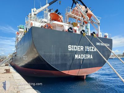
SIDER IBIZA
Cargo
Current Trip
| Time Travelled | 2 days |
|---|---|
| Remaining Time | --- |
| Distance Travelled | 531.05 nm |
| Remaining Distance | --- |
| AVG Speed | 10.7 Knots |
| MAX Speed | 11.8 Knots |
| AVG Wind | 12.9 knots |
| MAX Wind | 21.3 knots |
| MIN Temp | 22.5°C / 72.5°F |
| MAX Temp | 29.5°C / 85.1°F |
| Draught | 4.6 m |
| Position Received | 41 m ago |
Current Position
| Longitude | 16.84743° |
|---|---|
| Latitude | 38.46542° |
| Status | Under way using engine |
| Speed | 10.6 Knots |
| Course | 220.2° |
| Area | Ionian Sea |
| Station | T-AIS |
| Position Received | 41 m ago |
Info
Information
The current position of SIDER IBIZA is in Ionian Sea with coordinates 38.46542° / 16.84743° as reported on 2024-06-10 14:41 by AIS to our vessel tracker app. The vessel's current speed is 10.6 Knots and is heading at the port of RADES. The estimated time of arrival as calculated by vessel tracking app is 2024-06-12 01:00 LT
The vessel SIDER IBIZA (IMO: 9861524, MMSI: 255806286) is a Cargo It's sailing under the flag of [PT] Portugal.
In this page you can find informations about the vessels current position, last detected port calls, and current voyage information. If the vessels is not in coverage by AIS you will find the latest position.
The current position of SIDER IBIZA is detected by our AIS receivers and we are not responsible for the reliability of the data. The last position was recorded while the vessel was in Coverage by the Ais receivers of our vessel tracking app.
The current draught of SIDER IBIZA as reported by AIS is 4.6 meters
Weather
| Temperature | 23°C / 73.4°F |
|---|---|
| Wind Speed | 18 knots |
| Direction | 197° SSW |
| Pressure | 1009.1 hPa |
| Humidity | 80.7 % |
| Cloud Coverage | --- |
Featured Company
Last Port Calls
| Port | Arrival | Departure | Time In Port |
|---|---|---|---|
| 2024-06-07 11:16 | 2024-06-08 13:37 | 1 d | |
| 2024-05-31 06:36 | 2024-06-03 17:53 | 3 d | |
| 2024-05-22 13:14 | 2024-05-25 10:39 | 2 d | |
| 2024-05-18 18:14 | 2024-05-20 20:21 | 2 d | |
| 2024-05-17 13:40 | |||
| 2024-05-09 08:46 | 2024-05-10 13:29 | 1 d | |
| 2024-05-06 04:32 | 2024-05-08 08:33 | 2 d | |
| 2024-04-29 11:59 | 2024-05-04 14:14 | 5 d | |
| 2024-04-26 05:34 | 2024-04-27 18:23 | 1 d | |
| 2024-04-20 10:22 | 2024-04-23 00:41 | 2 d |
Most Visited Ports (Last year)
| Port | Arrivals | |
|---|---|---|
| 11 | ||
| 5 | ||
| 4 | ||
| 3 | ||
| 3 | ||
| 3 |
Last Trips
| Origin | Departure | Destination | Arrival | Distance | |
|---|---|---|---|---|---|
| 2024-06-03 19:53 | 2024-06-07 13:16 | 503.40 nm | |||
| 2024-05-25 12:39 | 2024-05-31 08:36 | 868.23 nm | |||
| 2024-05-20 21:21 | 2024-05-22 15:14 | 431.21 nm | |||
| 2024-05-17 15:40 | 2024-05-18 19:14 | 263.63 nm | |||
| 2024-05-08 10:33 | 2024-05-09 10:46 | 225.13 nm | |||
| 2024-05-04 16:14 | 2024-05-06 06:32 | 341.38 nm | |||
| 2024-04-27 20:23 | 2024-04-29 13:59 | 365.90 nm | |||
| 2024-04-23 02:41 | 2024-04-26 07:34 | 354.24 nm | |||
| 2024-04-16 17:04 | 2024-04-20 12:22 | 1002.64 nm | |||
| 2024-04-09 10:14 | 2024-04-12 01:56 | 577.69 nm |
Events
| Time | Event | Details | Position / Dest | Info |
|---|---|---|---|---|
| 2024-06-10 14:41 | Status Changed | Default Under way using engine |
38.46504 / 16.84703
TN LGN
|
Speed: 10.6 kn Course: 220.2° |
| 2024-06-10 14:41 | Status Changed | Under way using engine Default |
38.46542 / 16.84743
TN LGN
|
Speed: 10.8 kn Course: 219° |
| 2024-06-10 14:41 | IN Coverage |
38.46542 / 16.84743
Ionian Sea
TN LGN
|
Speed: 10.6 kn Course: 220.2° |
|
| 2024-06-10 11:09 | Status Changed | Default Under way using engine |
38.94480 / 17.39366
TN LGN
|
Speed: 10.6 kn Course: 226.6° |
| 2024-06-10 11:02 | OUT of Coverage |
38.95920 / 17.41275
Ionian Sea
TN LGN
|
Speed: 10.6 kn Course: 226.6° |
|
| 2024-06-10 11:00 | Status Changed | Under way using engine Default |
38.96356 / 17.41874
TN LGN
|
Speed: 10.6 kn Course: 226° |
| 2024-06-10 10:57 | Status Changed | Default Under way using engine |
38.96924 / 17.42649
TN LGN
|
Speed: 10.5 kn Course: 226.2° |
| 2024-06-10 10:42 | Status Changed | Under way using engine Default |
39.00075 / 17.46868
TN LGN
|
Speed: 10.4 kn Course: 226° |
| 2024-06-10 10:29 | IN Coverage |
39.00075 / 17.46868
Ionian Sea
TN LGN
|
Speed: 10.3 kn Course: 226.4° |
|
| 2024-06-10 06:36 | OUT of Coverage |
39.51005 / 18.10692
Ionian Sea
TN LGN
|
Speed: 10.2 kn Course: 222.7° |