
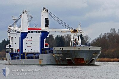
SIDER SONJA
General Cargo
Current Trip
| Time Travelled | 2 days |
|---|---|
| Remaining Time | 12 h, 49 mins |
| Distance Travelled | 558.85 nm |
| Remaining Distance | 128.99 nm |
| AVG Speed | 9.9 Knots |
| MAX Speed | 11.1 Knots |
| AVG Wind | 6.1 knots |
| MAX Wind | 13.6 knots |
| MIN Temp | 21.9°C / 71.42°F |
| MAX Temp | 30.2°C / 86.36°F |
| Draught | 7.4 m |
| Position Received | 4 m ago |
Current Position
| Longitude | 11.66928° |
|---|---|
| Latitude | 38.72886° |
| Status | Under way using engine |
| Speed | 10 Knots |
| Course | 277.7° |
| Area | Tyrrhenian Sea |
| Station | T-AIS |
| Position Received | 4 m ago |
Info
Information
The current position of SIDER SONJA is in Tyrrhenian Sea with coordinates 38.72886° / 11.66928° as reported on 2024-06-21 00:17 by AIS to our vessel tracker app. The vessel's current speed is 10 Knots and is heading at the port of CAGLIARI. The estimated time of arrival as calculated by vessel tracking app is 2024-06-21 13:11 LT
The vessel SIDER SONJA (IMO: 9432505, MMSI: 247436700) is a General Cargo that was built in 2008 ( 16 years old ). It's sailing under the flag of [IT] Italy.
In this page you can find informations about the vessels current position, last detected port calls, and current voyage information. If the vessels is not in coverage by AIS you will find the latest position.
The current position of SIDER SONJA is detected by our AIS receivers and we are not responsible for the reliability of the data. The last position was recorded while the vessel was in Coverage by the Ais receivers of our vessel tracking app.
The current draught of SIDER SONJA as reported by AIS is 7.4 meters
Weather
| Temperature | 24.4°C / 75.92°F |
|---|---|
| Wind Speed | 5 knots |
| Direction | 176° S |
| Pressure | 1016.2 hPa |
| Humidity | 68.8 % |
| Cloud Coverage | 3 % |
Featured Company
Last Port Calls
| Port | Arrival | Departure | Time In Port |
|---|---|---|---|
| 2024-06-17 04:42 | 2024-06-18 15:59 | 1 d | |
| 2024-06-07 06:33 | 2024-06-13 10:27 | 6 d | |
| 2024-06-02 07:00 | 2024-06-03 17:05 | 1 d | |
| 2024-05-27 09:49 | 2024-05-29 14:29 | 2 d | |
| 2024-05-20 05:15 | 2024-05-23 16:03 | 3 d | |
| 2024-05-15 13:42 | 2024-05-16 18:38 | 1 d | |
| 2024-05-12 14:39 | 2024-05-14 00:12 | 1 d | |
| 2024-05-10 12:53 | 2024-05-11 14:08 | 1 d | |
| 2024-05-07 04:03 | 2024-05-08 04:23 | 1 d | |
| 2024-05-03 03:07 | 2024-05-06 17:23 | 3 d |
Last Trips
| Origin | Departure | Destination | Arrival | Distance | |
|---|---|---|---|---|---|
| 2024-06-13 12:27 | 2024-06-17 07:42 | 613.79 nm | |||
| 2024-06-03 20:05 | 2024-06-07 08:33 | 833.47 nm | |||
| 2024-05-29 16:29 | 2024-06-02 10:00 | 840.82 nm | |||
| 2024-05-23 18:03 | 2024-05-27 11:49 | 913.26 nm | |||
| 2024-05-16 20:38 | 2024-05-20 07:15 | 833.20 nm | |||
| 2024-05-14 02:12 | 2024-05-15 15:42 | 301.25 nm | |||
| 2024-05-11 16:08 | 2024-05-12 16:39 | 295.27 nm | |||
| 2024-05-08 06:23 | 2024-05-10 14:53 | 295.00 nm | |||
| 2024-05-06 19:23 | 2024-05-07 06:03 | 121.78 nm | |||
| 2024-04-29 22:37 | 2024-05-03 05:07 | 594.99 nm |
Events
| Time | Event | Details | Position / Dest | Info |
|---|---|---|---|---|
| 2024-06-20 22:12 | Status Changed | Under way using engine Default |
38.66985 / 12.10168
ITCAG
|
Speed: 9.6 kn Course: 280° |
| 2024-06-20 22:07 | Status Changed | Default Under way using engine |
38.66755 / 12.11780
ITCAG
|
Speed: 9.5 kn Course: 280.2° |
| 2024-06-20 04:50 | Change Sea Area | Italian part of the Tyrrhenian Sea Italian part of the Ionian Sea |
38.25069 / 15.66415
Tyrrhenian Sea
ITCAG
|
Speed: 8.2 kn Course: 61.2° |
| 2024-06-20 01:06 | Status Changed | Under way using engine Default |
37.84923 / 15.92242
ITCAG
|
Speed: 10 kn Course: 272° |
| 2024-06-20 00:49 | IN Coverage |
37.84923 / 15.92242
Ionian Sea
ITCAG
|
Speed: 10 kn Course: 272.2° |
|
| 2024-06-19 21:52 | Status Changed | Default Under way using engine |
37.89187 / 16.58703
ITCAG
|
Speed: 9.5 kn Course: 266.9° |
| 2024-06-19 21:48 | OUT of Coverage |
37.89248 / 16.60043
Ionian Sea
ITCAG
|
Speed: 9.5 kn Course: 266.9° |
|
| 2024-06-19 21:30 | Status Changed | Under way using engine Default |
37.89363 / 16.65821
ITCAG
|
Speed: 9.5 kn Course: 271° |
| 2024-06-19 21:12 | Status Changed | Default Under way using engine |
37.89317 / 16.71916
ITCAG
|
Speed: 9.4 kn Course: 270.3° |
| 2024-06-19 19:09 | Status Changed | Under way using engine Default |
37.90387 / 17.12537
ITCAG
|
Speed: 9.6 kn Course: 267° |