
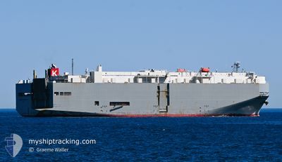
SIERRA NEVADA HWY
Vehicles Carrier
Current Trip
PA BLB
| Time Travelled | 4 days |
|---|---|
| Remaining Time | --- |
| Distance Travelled | 512.94 nm |
| Remaining Distance | --- |
| AVG Speed | 18.2 Knots |
| MAX Speed | 19.7 Knots |
| AVG Wind | 5.4 knots |
| MAX Wind | 10.6 knots |
| MIN Temp | 25.2°C / 77.36°F |
| MAX Temp | 32°C / 89.6°F |
| Draught | 8.1 m |
| Position Received | 4 d ago |
Current Position
| Longitude | -79.53813° |
|---|---|
| Latitude | 8.91008° |
| Status | Under way using engine |
| Speed | 11.7 Knots |
| Course | 321° |
| Area | North Pacific Ocean |
| Station | T-AIS |
| Position Received | 4 d ago |
Info
Information
The current position of SIERRA NEVADA HWY is in North Pacific Ocean with coordinates 8.91008° / -79.53813° as reported on 2024-05-24 14:32 by AIS to our vessel tracker app. The vessel's current speed is 11.7 Knots
The vessel SIERRA NEVADA HWY (IMO: 9325439, MMSI: 372346000) is a Vehicles Carrier that was built in 2007 ( 17 years old ). It's sailing under the flag of [PA] Panama.
In this page you can find informations about the vessels current position, last detected port calls, and current voyage information. If the vessels is not in coverage by AIS you will find the latest position.
The current position of SIERRA NEVADA HWY is detected by our AIS receivers and we are not responsible for the reliability of the data. The last position was recorded while the vessel was in Coverage by the Ais receivers of our vessel tracking app.
The current draught of SIERRA NEVADA HWY as reported by AIS is 8.1 meters
Weather
| Temperature | 24.6°C / 76.28°F |
|---|---|
| Wind Speed | 2 knots |
| Direction | 320° NW |
| Pressure | 1010.7 hPa |
| Humidity | 87.7 % |
| Cloud Coverage | 100 % |
Featured Company
Last Port Calls
| Port | Arrival | Departure | Time In Port |
|---|---|---|---|
| 2024-05-24 15:02 | 2024-05-25 01:34 | 10 h | |
| 2024-05-21 11:22 | 2024-05-21 22:26 | 11 h | |
| 2024-05-01 21:25 | 2024-05-02 08:40 | 11 h | |
| 2024-04-30 21:40 | 2024-05-01 07:27 | 9 h | |
| 2024-04-23 02:19 | 2024-04-23 15:35 | 13 h | |
| 2024-04-15 17:15 | 2024-04-18 03:48 | 2 d | |
| 2024-04-02 21:23 | 2024-04-03 06:01 | 8 h | |
| 2024-03-31 21:56 | 2024-04-01 04:01 | 6 h | |
| 2024-03-30 20:37 | 2024-03-31 15:09 | 18 h | |
| 2024-03-26 21:20 | 2024-03-28 04:17 | 1 d |
Last Trips
| Origin | Departure | Destination | Arrival | Distance | |
|---|---|---|---|---|---|
| 2024-05-21 17:26 | 2024-05-24 10:02 | 359.16 nm | |||
| 2024-05-02 17:40 | 2024-05-21 06:22 | 8049.26 nm | |||
| 2024-05-01 16:27 | 2024-05-02 06:25 | 207.95 nm | |||
| 2024-04-24 01:05 | 2024-05-01 06:40 | 3151.05 nm | |||
| 2024-04-18 11:48 | 2024-04-23 11:49 | 1883.26 nm | |||
| 2024-04-03 15:01 | 2024-04-16 01:15 | 4547.32 nm | |||
| 2024-04-01 13:01 | 2024-04-03 06:23 | 554.54 nm | |||
| 2024-04-01 00:09 | 2024-04-01 06:56 | 92.33 nm | |||
| 2024-03-28 13:17 | 2024-03-31 05:37 | 557.61 nm | |||
| 2024-03-13 00:37 | 2024-03-27 06:20 | 5187.40 nm |
Events
| Time | Event | Details | Position / Dest | Info |
|---|---|---|---|---|
| 2024-05-26 05:46 | STOP Moving | 2.51 nm, West of PUERTO CALDERA |
9.92708 / -84.76048
PA BLB
|
Speed: 0.3 kn Course: 92° |
| 2024-05-25 01:34 | START Moving | 0.84 nm, South of BALBOA |
8.94248 / -79.56410
PA BLB
|
Speed: 6.1 kn Course: 142° |
| 2024-05-25 01:34 | PORT DEPARTURE |
|
8.94248 / -79.56410
PA BLB
|
Speed: 3 kn Course: 142° |
| 2024-05-24 15:21 | STOP Moving |
8.95158 / -79.56606
[PA] BALBOA
|
Speed: Course: 43° |
|
| 2024-05-24 15:02 | PORT ARRIVAL |
|
8.94995 / -79.56783
[PA] BALBOA
|
Speed: 2.1 kn Course: 327° |
| 2024-05-24 14:38 | Status Changed | Default Under way using engine |
8.92557 / -79.55061
PA BLB
|
Speed: 11.7 kn Course: 321° |
| 2024-05-24 14:32 | Change Sea Area | Panamanian part of the North Pacific Ocean Colombian part of the North Pacific Ocean |
8.91008 / -79.53813
North Pacific Ocean
|
Speed: 11.7 kn Course: 321° |
| 2024-05-24 14:32 | Status Changed | Under way using engine Default |
8.91008 / -79.53813
PA BLB
|
Speed: 11.7 kn Course: 321° |
| 2024-05-24 14:32 | OUT of Coverage |
8.91008 / -79.53813
North Pacific Ocean
[PA] BALBOA
|
Speed: 11.7 kn Course: 321° |
|
| 2024-05-24 14:19 | IN Coverage |
8.91008 / -79.53813
North Pacific Ocean
|
Speed: 11.7 kn Course: 321° |