
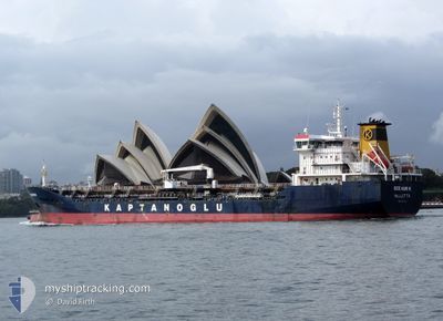
SILENDI
Oil/Chemical Tanker
Current Trip
| Time Travelled | 3 days |
|---|---|
| Remaining Time | --- |
| Distance Travelled | 321.94 nm |
| Remaining Distance | --- |
| AVG Speed | 12 Knots |
| MAX Speed | 13.5 Knots |
| AVG Wind | 8.5 knots |
| MAX Wind | 14.5 knots |
| MIN Temp | 21.9°C / 71.42°F |
| MAX Temp | 32.8°C / 91.04°F |
| Draught | 6.5 m |
| Position Received | 22 h, 9 m ago |
Current Position
| Longitude | 12.67797° |
|---|---|
| Latitude | 32.80494° |
| Status | Under way using engine |
| Speed | 1.2 Knots |
| Course | 116° |
| Area | Mediterranean Sea - Eastern Basin |
| Station | T-AIS |
| Position Received | 22 h, 9 m ago |
Info
Information
The current position of SILENDI is in Mediterranean Sea - Eastern Basin with coordinates 32.80494° / 12.67797° as reported on 2024-06-15 14:27 by AIS to our vessel tracker app. The vessel's current speed is 1.2 Knots
The vessel SILENDI (IMO: 9508720, MMSI: 248333000) is a Oil/Chemical Tanker that was built in 2009 ( 15 years old ). It's sailing under the flag of [MT] Malta.
In this page you can find informations about the vessels current position, last detected port calls, and current voyage information. If the vessels is not in coverage by AIS you will find the latest position.
The current position of SILENDI is detected by our AIS receivers and we are not responsible for the reliability of the data. The last position was recorded while the vessel was in Coverage by the Ais receivers of our vessel tracking app.
The current draught of SILENDI as reported by AIS is 6.5 meters
Weather
| Temperature | 29.7°C / 85.46°F |
|---|---|
| Wind Speed | 13 knots |
| Direction | 30° NNE |
| Pressure | 1012.7 hPa |
| Humidity | 42.5 % |
| Cloud Coverage | --- |
Featured Company
Last Port Calls
| Port | Arrival | Departure | Time In Port |
|---|---|---|---|
| 2024-06-12 08:29 | 2024-06-13 09:49 | 1 d | |
| 2024-06-11 05:57 | 2024-06-11 13:05 | 7 h | |
| 2024-05-31 20:26 | 2024-06-05 09:44 | 4 d | |
| 2024-05-18 22:20 | 2024-05-21 04:42 | 2 d | |
| 2024-05-16 04:20 | 2024-05-17 15:26 | 1 d | |
| 2024-04-15 21:05 | 2024-04-17 03:17 | 1 d | |
| 2024-04-10 08:04 | 2024-04-11 16:13 | 1 d |
Most Visited Ports (Last year)
| Port | Arrivals | |
|---|---|---|
| 3 | ||
| 2 | ||
| 2 | ||
| 2 | ||
| 2 | ||
| 2 |
Last Trips
| Origin | Departure | Destination | Arrival | Distance | |
|---|---|---|---|---|---|
| 2024-06-11 15:05 | 2024-06-12 10:29 | 2.90 nm | |||
| 2024-06-05 11:44 | 2024-06-11 07:57 | 11.38 nm | |||
| 2024-05-21 06:42 | 2024-05-31 22:26 | 828.60 nm | |||
| 2024-05-17 17:26 | 2024-05-19 00:20 | 239.27 nm | |||
| 2024-04-17 05:17 | 2024-05-16 06:20 | 2933.84 nm | |||
| 2024-04-11 18:13 | 2024-04-15 23:05 | 14.00 nm | |||
| 2024-02-28 19:26 | 2024-04-10 10:04 | 2285.71 nm |
Events
| Time | Event | Details | Position / Dest | Info |
|---|---|---|---|---|
| 2024-06-16 10:13 | STOP Moving | 0.88 nm, North West of AZ ZAWIYAH |
32.80538 / 12.66744
LYZAW
|
Speed: 0.3 kn Course: 48° |
| 2024-06-16 09:43 | START Moving | 0.71 nm, North of AZ ZAWIYAH |
32.80579 / 12.67885
LYZAW
|
Speed: 4.5 kn Course: 273° |
| 2024-06-15 14:49 | STOP Moving | 0.73 nm, North of AZ ZAWIYAH |
32.80524 / 12.68380
LYZAW
|
Speed: 0.1 kn Course: 61° |
| 2024-06-15 14:32 | Status Changed | Default Under way using engine |
32.80345 / 12.67817
LYZAW
|
Speed: 1.2 kn Course: 116° |
| 2024-06-15 14:30 | Destination Changed | LYZAW MT MLA |
32.80494 / 12.67797
LYZAW
|
Speed: 1.2 kn Course: 116° |
| 2024-06-15 14:30 | ETA Changed | 2024/06/14 21:59 2024/06/13 21:30 |
32.80494 / 12.67797
LYZAW
|
Speed: 1.2 kn Course: 116° |
| 2024-06-15 14:27 | OUT of Coverage |
32.80494 / 12.67797
Mediterranean Sea - Eastern Basin
|
Speed: 1.2 kn Course: 191.9° |
|
| 2024-06-15 14:26 | Change Sea Area | Libyan part of the Mediterranean Sea - Eastern Basin Italian part of the Mediterranean Sea - Eastern Basin |
32.80526 / 12.67814
Mediterranean Sea - Eastern Basin
|
Speed: 0.9 kn Course: 240° |
| 2024-06-15 14:25 | Status Changed | Under way using engine Default |
32.80535 / 12.67832
MT MLA
|
Speed: 1.7 kn Course: 128° |
| 2024-06-15 14:13 | IN Coverage |
32.80526 / 12.67814
Mediterranean Sea - Eastern Basin
|
Speed: 0.9 kn Course: 240° |