
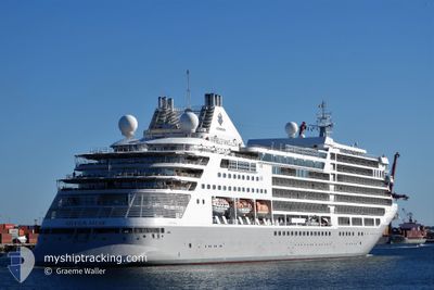
SILVER MUSE
Passenger
Current Trip
| Time Travelled | 7 h, 0 mins |
|---|---|
| Remaining Time | 1 day |
| Distance Travelled | 117.99 nm |
| Remaining Distance | 477.03 nm |
| AVG Speed | 17.8 Knots |
| MAX Speed | 18.7 Knots |
| AVG Wind | 13.4 knots |
| MAX Wind | 21.9 knots |
| MIN Temp | 8.4°C / 47.12°F |
| MAX Temp | 10.8°C / 51.44°F |
| Draught | 6.7 m |
| Position Received | 19 m ago |
Current Position
| Longitude | -131.01481° |
|---|---|
| Latitude | 53.59172° |
| Status | Under way using engine |
| Speed | 16.9 Knots |
| Course | 176.8° |
| Area | The Coastal Waters of Southeast Alaska and British Columbia |
| Station | T-AIS |
| Position Received | 19 m ago |
Info
Information
The current position of SILVER MUSE is in The Coastal Waters of Southeast Alaska and British Columbia with coordinates 53.59172° / -131.01481° as reported on 2024-05-25 06:59 by AIS to our vessel tracker app. The vessel's current speed is 16.9 Knots and is heading at the port of VICTORIA. The estimated time of arrival as calculated by vessel tracking app is 2024-05-26 09:53 LT
The vessel SILVER MUSE (IMO: 9784350, MMSI: 311000637) is a Passenger It's sailing under the flag of [BS] Bahamas.
In this page you can find informations about the vessels current position, last detected port calls, and current voyage information. If the vessels is not in coverage by AIS you will find the latest position.
The current position of SILVER MUSE is detected by our AIS receivers and we are not responsible for the reliability of the data. The last position was recorded while the vessel was in Coverage by the Ais receivers of our vessel tracking app.
The current draught of SILVER MUSE as reported by AIS is 6.7 meters
Weather
| Temperature | 8.6°C / 47.48°F |
|---|---|
| Wind Speed | 17 knots |
| Direction | 305° NW |
| Pressure | 1012.1 hPa |
| Humidity | 76.3 % |
| Cloud Coverage | 42 % |
Featured Company
Last Port Calls
| Port | Arrival | Departure | Time In Port |
|---|---|---|---|
| 2024-05-24 15:34 | 2024-05-25 00:18 | 8 h | |
| 2024-05-22 15:29 | 2024-05-23 07:06 | 15 h | |
| 2024-05-21 15:25 | 2024-05-22 00:13 | 8 h | |
| 2024-05-19 15:54 | 2024-05-20 02:02 | 10 h | |
| 2024-05-17 15:02 | 2024-05-18 01:06 | 10 h | |
| 2024-05-16 14:26 | 2024-05-17 03:22 | 12 h | |
| 2024-05-15 15:54 | 2024-05-16 01:46 | 9 h | |
| 2024-05-13 15:58 | 2024-05-13 22:30 | 6 h | |
| 2024-05-07 22:36 | 2024-05-08 08:20 | 9 h | |
| 2024-05-06 22:00 | 2024-05-07 09:28 | 11 h |
Last Trips
| Origin | Departure | Destination | Arrival | Distance | |
|---|---|---|---|---|---|
| 2024-05-22 23:06 | 2024-05-24 07:34 | 351.88 nm | |||
| 2024-05-21 16:13 | 2024-05-22 07:29 | 195.52 nm | |||
| 2024-05-19 18:02 | 2024-05-21 07:25 | 239.91 nm | |||
| 2024-05-17 17:06 | 2024-05-19 07:54 | 609.73 nm | |||
| 2024-05-16 19:22 | 2024-05-17 07:02 | 160.75 nm | |||
| 2024-05-15 17:46 | 2024-05-16 06:26 | 190.77 nm | |||
| 2024-05-13 14:30 | 2024-05-15 07:54 | 617.53 nm | |||
| 2024-05-08 17:20 | 2024-05-13 07:58 | 2086.40 nm | |||
| 2024-05-07 18:28 | 2024-05-08 07:36 | 201.39 nm | |||
| 2024-05-06 23:20 | 2024-05-07 07:00 | 75.17 nm |
Events
| Time | Event | Details | Position / Dest | Info |
|---|---|---|---|---|
| 2024-05-25 07:06 | Status Changed | Default Under way using engine |
53.55826 / -131.01167
CA VIC
|
Speed: 16.9 kn Course: 176.8° |
| 2024-05-25 06:47 | Status Changed | Under way using engine Default |
53.64469 / -131.01922
CA VIC
|
Speed: 17 kn Course: 177° |
| 2024-05-25 06:45 | Status Changed | Default Under way using engine |
53.65547 / -131.02037
CA VIC
|
Speed: 17.4 kn Course: 178.8° |
| 2024-05-25 06:29 | Status Changed | Under way using engine Default |
53.73392 / -131.02287
CA VIC
|
Speed: 18 kn Course: 179° |
| 2024-05-25 06:26 | Status Changed | Default Under way using engine |
53.74840 / -131.02289
CA VIC
|
Speed: 18.1 kn Course: 179.5° |
| 2024-05-25 03:16 | Status Changed | Under way using engine Default |
54.66112 / -131.20503
CA VIC
|
Speed: 17.9 kn Course: 210° |
| 2024-05-25 03:15 | Status Changed | Default Under way using engine |
54.66491 / -131.20129
CA VIC
|
Speed: 18 kn Course: 208.8° |
| 2024-05-25 02:55 | Change Sea Area | Canadian part of the The Coastal Waters of Southeast Alaska and British Columbia United States (Alaska) part of the The Coastal Waters of Southeast Alaska and British Columbia |
54.75080 / -131.11568
The Coastal Waters of Southeast Alaska and British Columbia
CA VIC
|
Speed: 18.4 kn Course: 209.7° |
| 2024-05-25 01:47 | Destination Changed | CA VIC JP MUR |
55.08359 / -131.13723
CA VIC
|
Speed: 18 kn Course: 166.6° |
| 2024-05-25 01:47 | ETA Changed | 2024/05/26 14:00 2024/05/06 21:45 |
55.08359 / -131.13723
CA VIC
|
Speed: 18 kn Course: 166.6° |