
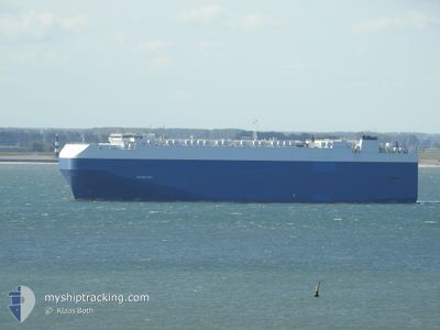
SILVER RAY
Vehicles Carrier
Current Trip
| Time Travelled | 8 days |
|---|---|
| Remaining Time | --- |
| Distance Travelled | 3392.38 nm |
| Remaining Distance | --- |
| AVG Speed | 15.7 Knots |
| MAX Speed | 17.3 Knots |
| AVG Wind | 12.6 knots |
| MAX Wind | 22.8 knots |
| MIN Temp | 14°C / 57.2°F |
| MAX Temp | 26.6°C / 79.88°F |
| Draught | 8.7 m |
| Position Received | 7 d ago |
Current Position
| Longitude | 17.40450° |
|---|---|
| Latitude | -33.60468° |
| Status | Under way using engine |
| Speed | 16.7 Knots |
| Course | 322.2° |
| Area | South Atlantic Ocean |
| Station | T-AIS |
| Position Received | 7 d ago |
Info
Information
The current position of SILVER RAY is in South Atlantic Ocean with coordinates -33.60468° / 17.40450° as reported on 2024-06-19 17:20 by AIS to our vessel tracker app. The vessel's current speed is 16.7 Knots and is heading at the port of BREMERHAVEN. The estimated time of arrival as calculated by vessel tracking app is 2024-07-07 03:00 LT
The vessel SILVER RAY (IMO: 9181376, MMSI: 355137000) is a Vehicles Carrier that was built in 1999 ( 25 years old ). It's sailing under the flag of [PA] Panama.
In this page you can find informations about the vessels current position, last detected port calls, and current voyage information. If the vessels is not in coverage by AIS you will find the latest position.
The current position of SILVER RAY is detected by our AIS receivers and we are not responsible for the reliability of the data. The last position was recorded while the vessel was in Coverage by the Ais receivers of our vessel tracking app.
The current draught of SILVER RAY as reported by AIS is 8.7 meters
Weather
| Temperature | 26.2°C / 79.16°F |
|---|---|
| Wind Speed | 10 knots |
| Direction | 201° SSW |
| Pressure | 1011.6 hPa |
| Humidity | 82.6 % |
| Cloud Coverage | 100 % |
Featured Company
Last Port Calls
| Port | Arrival | Departure | Time In Port |
|---|---|---|---|
| 2024-06-16 23:36 | 2024-06-18 07:04 | 1 d | |
| 2024-06-12 14:05 | 2024-06-14 05:38 | 1 d | |
| 2024-06-07 10:08 | 2024-06-08 03:56 | 17 h | |
| 2024-05-29 06:54 | 2024-05-31 01:29 | 1 d | |
| 2024-05-26 19:55 | 2024-05-27 20:54 | 1 d | |
| 2024-05-17 19:59 | 2024-05-19 16:55 | 1 d | |
| 2024-05-14 01:58 | 2024-05-16 23:29 | 2 d | |
| 2024-05-12 11:55 | 2024-05-13 00:19 | 12 h | |
| 2024-05-09 10:07 | 2024-05-10 14:14 | 1 d | |
| 2024-04-17 09:40 | 2024-04-19 08:53 | 1 d |
Most Visited Ports (Last year)
| Port | Arrivals | |
|---|---|---|
| 6 | ||
| 6 | ||
| 6 | ||
| 6 | ||
| 6 | ||
| 5 |
Last Trips
| Origin | Departure | Destination | Arrival | Distance | |
|---|---|---|---|---|---|
| 2024-06-14 07:38 | 2024-06-17 01:36 | 423.59 nm | |||
| 2024-06-08 05:56 | 2024-06-12 16:05 | 1540.91 nm | |||
| 2024-05-31 01:29 | 2024-06-07 12:08 | 2602.95 nm | |||
| 2024-05-27 20:54 | 2024-05-29 06:54 | 483.49 nm | |||
| 2024-05-19 18:55 | 2024-05-26 19:55 | 2617.27 nm | |||
| 2024-05-17 00:29 | 2024-05-17 21:59 | 265.59 nm | |||
| 2024-05-13 02:19 | 2024-05-14 02:58 | 210.40 nm | |||
| 2024-05-10 16:14 | 2024-05-12 13:55 | 422.77 nm | |||
| 2024-04-19 10:53 | 2024-05-09 12:07 | 7221.72 nm | |||
| 2024-04-16 11:52 | 2024-04-17 11:40 | 274.42 nm |
Events
| Time | Event | Details | Position / Dest | Info |
|---|---|---|---|---|
| 2024-06-19 17:22 | Status Changed | Default Under way using engine |
-33.59501 / 17.39559
ZA PLZ> DE BRV
|
Speed: 16.7 kn Course: 322.2° |
| 2024-06-19 17:20 | OUT of Coverage |
-33.60468 / 17.40450
South Atlantic Ocean
ZA PLZ> DE BRV
|
Speed: 16.7 kn Course: 322.2° |
|
| 2024-06-19 17:19 | Status Changed | Under way using engine Default |
-33.60860 / 17.40816
ZA PLZ> DE BRV
|
Speed: 16.9 kn Course: 324° |
| 2024-06-19 17:12 | Status Changed | Default Under way using engine |
-33.63307 / 17.42995
ZA PLZ> DE BRV
|
Speed: 16.8 kn Course: 323.8° |
| 2024-06-19 15:09 | Status Changed | Under way using engine Default |
-34.07253 / 17.83504
ZA PLZ> DE BRV
|
Speed: 15 kn Course: 332° |
| 2024-06-19 15:08 | Status Changed | Default Under way using engine |
-34.07611 / 17.83741
ZA PLZ> DE BRV
|
Speed: 15.2 kn Course: 330° |
| 2024-06-19 11:25 | Draught Changed | 8.7 8.1 |
-34.70952 / 18.55786
ZA PLZ> DE BRV
|
Speed: 13.1 kn Course: 291.8° |
| 2024-06-19 11:25 | Destination Changed | ZA PLZ> DE BRV ZA DUR>>ZA PLZ |
-34.70952 / 18.55786
ZA PLZ> DE BRV
|
Speed: 13.1 kn Course: 291.8° |
| 2024-06-19 11:25 | ETA Changed | 2024/07/07 03:00 2024/06/15 07:00 |
-34.70952 / 18.55786
ZA PLZ> DE BRV
|
Speed: 13.1 kn Course: 291.8° |
| 2024-06-19 11:17 | Status Changed | Under way using engine Default |
-34.72190 / 18.59372
ZA DUR>>ZA PLZ
|
Speed: 13.2 kn Course: 291° |