
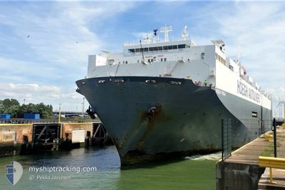
SILVER SOUL
Vehicles Carrier
Current Trip
| Time Travelled | 8 days |
|---|---|
| Remaining Time | 1 day |
| Distance Travelled | 3207.62 nm |
| Remaining Distance | 622.02 nm |
| AVG Speed | 14.7 Knots |
| MAX Speed | 18.5 Knots |
| AVG Wind | 11.5 knots |
| MAX Wind | 26.3 knots |
| MIN Temp | 11.1°C / 51.98°F |
| MAX Temp | 21.7°C / 71.06°F |
| Draught | 8.7 m |
| Position Received | 7 d ago |
Current Position
| Longitude | -9.78823° |
|---|---|
| Latitude | 48.10195° |
| Status | Under way using engine |
| Speed | 16.3 Knots |
| Course | 246.4° |
| Area | North Atlantic Ocean |
| Station | T-AIS |
| Position Received | 7 d ago |
Info
Information
The current position of SILVER SOUL is in North Atlantic Ocean with coordinates 48.10195° / -9.78823° as reported on 2024-05-10 04:01 by AIS to our vessel tracker app. The vessel's current speed is 16.3 Knots and is heading at the port of BALTIMORE. The estimated time of arrival as calculated by vessel tracking app is 2024-05-19 02:03 LT
The vessel SILVER SOUL (IMO: 9153783, MMSI: 370694000) is a Vehicles Carrier that was built in 1997 ( 27 years old ). It's sailing under the flag of [PA] Panama.
In this page you can find informations about the vessels current position, last detected port calls, and current voyage information. If the vessels is not in coverage by AIS you will find the latest position.
The current position of SILVER SOUL is detected by our AIS receivers and we are not responsible for the reliability of the data. The last position was recorded while the vessel was in Coverage by the Ais receivers of our vessel tracking app.
The current draught of SILVER SOUL as reported by AIS is 8.7 meters
Weather
| Temperature | 21.4°C / 70.52°F |
|---|---|
| Wind Speed | 18 knots |
| Direction | 212° SSW |
| Pressure | 1002.9 hPa |
| Humidity | 84.9 % |
| Cloud Coverage | 100 % |
Featured Company
Last Port Calls
| Port | Arrival | Departure | Time In Port |
|---|---|---|---|
| 2024-05-07 00:33 | 2024-05-08 13:13 | 1 d | |
| 2024-05-02 17:30 | 2024-05-06 00:20 | 3 d | |
| 2024-04-23 02:50 | 2024-04-25 00:00 | 1 d | |
| 2024-04-04 19:48 | 2024-04-05 23:46 | 1 d | |
| 2024-04-01 12:39 | 2024-04-02 21:23 | 1 d | |
| 2024-03-21 07:32 | 2024-03-23 21:21 | 2 d | |
| 2024-03-20 10:00 | 2024-03-20 18:12 | 8 h | |
| 2024-03-18 11:52 | 2024-03-19 23:52 | 1 d | |
| 2024-03-01 14:00 |
Most Visited Ports (Last year)
| Port | Arrivals | |
|---|---|---|
| 6 | ||
| 5 | ||
| 4 | ||
| 4 | ||
| 3 | ||
| 3 |
Last Trips
| Origin | Departure | Destination | Arrival | Distance | |
|---|---|---|---|---|---|
| 2024-05-06 02:20 | 2024-05-07 02:33 | 352.36 nm | |||
| 2024-04-25 01:00 | 2024-05-02 19:30 | 649.65 nm | |||
| 2024-04-06 01:46 | 2024-04-23 03:50 | 6876.76 nm | |||
| 2024-04-02 23:23 | 2024-04-04 21:48 | 434.04 nm | |||
| 2024-03-23 22:21 | 2024-04-01 14:39 | 3057.80 nm | |||
| 2024-03-20 18:12 | 2024-03-21 08:32 | 165.40 nm | |||
| 2024-03-20 00:52 | 2024-03-20 10:00 | 91.54 nm | |||
| 2024-03-01 08:00 | 2024-03-18 12:52 | 5978.71 nm |
Events
| Time | Event | Details | Position / Dest | Info |
|---|---|---|---|---|
| 2024-05-10 04:06 | Status Changed | Default Under way using engine |
48.09417 / -9.81481
BE ANR >> US BAL
|
Speed: 16.3 kn Course: 246.4° |
| 2024-05-10 04:01 | OUT of Coverage |
48.10195 / -9.78823
North Atlantic Ocean
BE ANR >> US BAL
|
Speed: 16.3 kn Course: 246.4° |
|
| 2024-05-10 03:41 | Change Sea Area | United Kingdom part of the North Atlantic Ocean United Kingdom part of the Celtic Sea |
48.13934 / -9.66296
North Atlantic Ocean
BE ANR >> US BAL
|
Speed: 16.3 kn Course: 245.8° |
| 2024-05-10 03:41 | Status Changed | Under way using engine Default |
48.14025 / -9.65998
BE ANR >> US BAL
|
Speed: 16.5 kn Course: 246° |
| 2024-05-10 03:26 | Status Changed | Default Under way using engine |
48.16723 / -9.57008
BE ANR >> US BAL
|
Speed: 16.6 kn Course: 247.4° |
| 2024-05-10 02:03 | Status Changed | Under way using engine Default |
48.33492 / -9.06714
BE ANR >> US BAL
|
Speed: 16.6 kn Course: 244° |
| 2024-05-10 02:02 | Status Changed | Default Under way using engine |
48.33693 / -9.06109
BE ANR >> US BAL
|
Speed: 16.7 kn Course: 243.6° |
| 2024-05-10 01:55 | Status Changed | Under way using engine Default |
48.35135 / -9.01748
BE ANR >> US BAL
|
Speed: 16.5 kn Course: 243° |
| 2024-05-10 01:54 | Status Changed | Default Under way using engine |
48.35353 / -9.01097
BE ANR >> US BAL
|
Speed: 16.5 kn Course: 243.1° |
| 2024-05-10 01:49 | Status Changed | Under way using engine Default |
48.36433 / -8.97952
BE ANR >> US BAL
|
Speed: 16.4 kn Course: 244° |