
SILVERSTONE
Tanker
Current Trip
| Time Travelled | --- |
|---|---|
| Remaining Time | 1 day |
| Distance Travelled | 12560.17 nm |
| Remaining Distance | 725.23 nm |
| AVG Speed | 10.9 Knots |
| MAX Speed | 15.2 Knots |
| AVG Wind | 10.5 knots |
| MAX Wind | 25.3 knots |
| MIN Temp | 25.7°C / 78.26°F |
| MAX Temp | 34.2°C / 93.56°F |
| Draught | 10.8 m |
| Position Received | 1 d ago |
Current Position
| Longitude | 9.46153° |
|---|---|
| Latitude | 37.89408° |
| Status | Under way using engine |
| Speed | 11.6 Knots |
| Course | 276.4° |
| Area | Mediterranean Sea - Western Basin |
| Station | T-AIS |
| Position Received | 1 d ago |
Info
Information
The current position of SILVERSTONE is in Mediterranean Sea - Western Basin with coordinates 37.89408° / 9.46153° as reported on 2024-06-01 03:47 by AIS to our vessel tracker app. The vessel's current speed is 11.6 Knots and is heading at the port of GIBRALTAR. The estimated time of arrival as calculated by vessel tracking app is 2024-06-03 18:52 LT
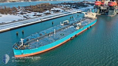
The vessel SILVERSTONE (IMO: 9878838, MMSI: 636019545) is a Tanker It's sailing under the flag of [LR] Liberia.
In this page you can find informations about the vessels current position, last detected port calls, and current voyage information. If the vessels is not in coverage by AIS you will find the latest position.
The current position of SILVERSTONE is detected by our AIS receivers and we are not responsible for the reliability of the data. The last position was recorded while the vessel was in Coverage by the Ais receivers of our vessel tracking app.
The current draught of SILVERSTONE as reported by AIS is 10.8 meters
Weather
| Temperature | 19.9°C / 67.82°F |
|---|---|
| Wind Speed | 15 knots |
| Direction | 79° E |
| Pressure | 1017.9 hPa |
| Humidity | 77 % |
| Cloud Coverage | 6 % |
Featured Company
Last Port Calls
Most Visited Ports (Last year)
| Port | Arrivals |
|---|
Last Trips
| Origin | Departure | Destination | Arrival | Distance |
|---|
Events
| Time | Event | Details | Position / Dest | Info |
|---|---|---|---|---|
| 2024-06-01 03:54 | Status Changed | Default Under way using engine |
37.89655 / 9.43441
GIBRALTAR
|
Speed: 11.6 kn Course: 276.4° |
| 2024-06-01 03:47 | OUT of Coverage |
37.89408 / 9.46153
Mediterranean Sea - Western Basin
GIBRALTAR
|
Speed: 11.6 kn Course: 276.4° |
|
| 2024-06-01 03:35 | Status Changed | Under way using engine Default |
37.88983 / 9.50875
GIBRALTAR
|
Speed: 11.4 kn Course: 276° |
| 2024-06-01 03:24 | IN Coverage |
37.89060 / 9.49998
Mediterranean Sea - Western Basin
GIBRALTAR
|
Speed: 11.5 kn Course: 276° |
|
| 2024-05-31 23:08 | Status Changed | Default Under way using engine |
37.72178 / 10.56100
GIBRALTAR
|
Speed: 11.6 kn Course: 279.2° |
| 2024-05-31 23:06 | OUT of Coverage |
37.72054 / 10.57029
Mediterranean Sea - Western Basin
GIBRALTAR
|
Speed: 11.6 kn Course: 279.2° |
|
| 2024-05-31 22:56 | Status Changed | Under way using engine Default |
37.71482 / 10.60999
GIBRALTAR
|
Speed: 11.7 kn Course: 288° |
| 2024-05-31 22:52 | Status Changed | Default Under way using engine |
37.71075 / 10.62790
GIBRALTAR
|
Speed: 11.8 kn Course: 288.6° |
| 2024-05-31 22:34 | Status Changed | Under way using engine Default |
37.69158 / 10.69901
GIBRALTAR
|
Speed: 11.9 kn Course: 292° |
| 2024-05-31 22:19 | Status Changed | Default Under way using engine |
37.67519 / 10.75695
GIBRALTAR
|
Speed: 12 kn Course: 292.4° |