
SINE A
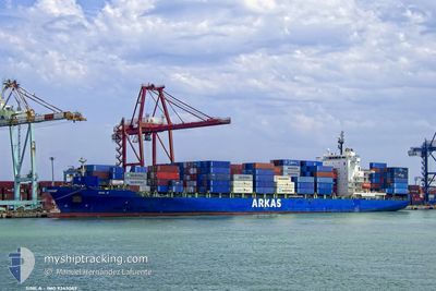
Container Ship
Current Trip
| Time Travelled | 5 days |
|---|---|
| Remaining Time | --- |
| Distance Travelled | 1997.47 nm |
| Remaining Distance | --- |
| AVG Speed | 14.3 Knots |
| MAX Speed | 22 Knots |
| AVG Wind | 14.6 knots |
| MAX Wind | 23 knots |
| MIN Temp | 19°C / 66.2°F |
| MAX Temp | 28°C / 82.4°F |
| Draught | 9.3 m |
| Position Received | 5 d ago |
Current Position
| Longitude | -79.58403° |
|---|---|
| Latitude | 31.96562° |
| Status | Under way using engine |
| Speed | 11.7 Knots |
| Course | 86.6° |
| Area | North Atlantic Ocean |
| Station | T-AIS |
| Position Received | 5 d ago |
Info
Information
The current position of SINE A is in North Atlantic Ocean with coordinates 31.96562° / -79.58403° as reported on 2024-05-28 10:25 by AIS to our vessel tracker app. The vessel's current speed is 11.7 Knots and is heading at the port of TANGER MED. The estimated time of arrival as calculated by vessel tracking app is 2024-06-07 23:00 LT
The vessel SINE A (IMO: 9343089, MMSI: 256318000) is a Container Ship that was built in 2008 ( 16 years old ). It's sailing under the flag of [MT] Malta.
In this page you can find informations about the vessels current position, last detected port calls, and current voyage information. If the vessels is not in coverage by AIS you will find the latest position.
The current position of SINE A is detected by our AIS receivers and we are not responsible for the reliability of the data. The last position was recorded while the vessel was in Coverage by the Ais receivers of our vessel tracking app.
The current draught of SINE A as reported by AIS is 9.3 meters
Weather
| Temperature | 19°C / 66.2°F |
|---|---|
| Wind Speed | 4 knots |
| Direction | 45° NE |
| Pressure | 1017.9 hPa |
| Humidity | 76.6 % |
| Cloud Coverage | 81 % |
Featured Company
Last Port Calls
| Port | Arrival | Departure | Time In Port |
|---|---|---|---|
| 2024-05-27 14:10 | 2024-05-28 04:21 | 14 h | |
| 2024-05-24 17:02 | 2024-05-25 09:25 | 16 h | |
| 2024-05-22 07:02 | 2024-05-23 17:28 | 1 d | |
| 2024-05-11 22:46 | 2024-05-12 03:21 | 4 h | |
| 2024-05-05 05:53 | 2024-05-05 23:30 | 17 h | |
| 2024-05-04 00:05 | 2024-05-04 09:45 | 9 h | |
| 2024-05-03 05:34 | 2024-05-03 16:28 | 10 h | |
| 2024-05-02 11:23 | 2024-05-03 01:23 | 14 h | |
| 2024-04-28 06:28 | 2024-04-29 15:20 | 1 d | |
| 2024-04-07 09:24 | 2024-04-08 04:50 | 19 h |
Last Trips
| Origin | Departure | Destination | Arrival | Distance | |
|---|---|---|---|---|---|
| 2024-05-25 05:25 | 2024-05-27 10:10 | 529.59 nm | |||
| 2024-05-23 13:28 | 2024-05-24 13:02 | 284.73 nm | |||
| 2024-05-12 05:21 | 2024-05-22 03:02 | 3237.53 nm | |||
| 2024-05-06 02:30 | 2024-05-12 00:46 | 1678.57 nm | |||
| 2024-05-04 12:45 | 2024-05-05 08:53 | 281.43 nm | |||
| 2024-05-03 19:28 | 2024-05-04 03:05 | 75.49 nm | |||
| 2024-05-03 04:23 | 2024-05-03 08:34 | 56.23 nm | |||
| 2024-04-29 18:20 | 2024-05-02 14:23 | 794.40 nm | |||
| 2024-04-08 00:50 | 2024-04-28 09:28 | 5858.95 nm | |||
| 2024-04-05 20:21 | 2024-04-07 05:24 | 508.76 nm |
Events
| Time | Event | Details | Position / Dest | Info |
|---|---|---|---|---|
| 2024-05-28 10:31 | Status Changed | Default Under way using engine |
31.96679 / -79.55924
MAPTM
|
Speed: 11.7 kn Course: 86.6° |
| 2024-05-28 10:25 | Status Changed | Under way using engine Default |
31.96562 / -79.58403
MAPTM
|
Speed: 11.7 kn Course: 87° |
| 2024-05-28 10:25 | OUT of Coverage |
31.96562 / -79.58403
North Atlantic Ocean
MAPTM
|
Speed: 11.7 kn Course: 86.6° |
|
| 2024-05-28 09:39 | Status Changed | Default Under way using engine |
31.95167 / -79.76166
MAPTM
|
Speed: 12.2 kn Course: 85.6° |
| 2024-05-28 09:23 | Status Changed | Under way using engine Default |
31.94729 / -79.82609
MAPTM
|
Speed: 12 kn Course: 86° |
| 2024-05-28 09:11 | Status Changed | Default Under way using engine |
31.94440 / -79.87369
MAPTM
|
Speed: 12.3 kn Course: 86.6° |
| 2024-05-28 09:00 | Status Changed | Under way using engine Default |
31.94209 / -79.91790
MAPTM
|
Speed: 12.3 kn Course: 86° |
| 2024-05-28 08:55 | Status Changed | Default Under way using engine |
31.94104 / -79.93753
MAPTM
|
Speed: 12.3 kn Course: 86.4° |
| 2024-05-28 08:50 | Status Changed | Under way using engine Default |
31.93978 / -79.95990
MAPTM
|
Speed: 12.5 kn Course: 86° |
| 2024-05-28 08:23 | Status Changed | Default Under way using engine |
31.93414 / -80.07179
MAPTM
|
Speed: 12.9 kn Course: 87.3° |