
SIRIUS
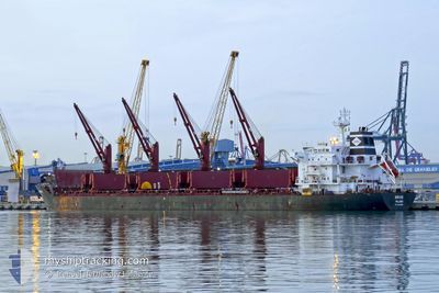
Bulk Carrier
Current Trip
| Time Travelled | 7 days |
|---|---|
| Remaining Time | 1 day |
| Distance Travelled | 1453.00 nm |
| Remaining Distance | 513.99 nm |
| AVG Speed | 10.9 Knots |
| MAX Speed | 13.5 Knots |
| AVG Wind | 6.4 knots |
| MAX Wind | 12.8 knots |
| MIN Temp | 16.9°C / 62.42°F |
| MAX Temp | 21.8°C / 71.24°F |
| Draught | 6.2 m |
| Position Received | Now |
Current Position
| Longitude | 26.35998° |
|---|---|
| Latitude | 36.82950° |
| Status | Under way using engine |
| Speed | 12.6 Knots |
| Course | 133.2° |
| Area | Aegean Sea |
| Station | T-AIS |
| Position Received | Now |
Info
Information
The current position of SIRIUS is in Aegean Sea with coordinates 36.82950° / 26.35998° as reported on 2024-05-17 01:36 by AIS to our vessel tracker app. The vessel's current speed is 12.6 Knots and is heading at the port of ASHDOD. The estimated time of arrival as calculated by vessel tracking app is 2024-05-18 18:04 LT
The vessel SIRIUS (IMO: 9541887, MMSI: 538008996) is a Bulk Carrier that was built in 2011 ( 13 years old ). It's sailing under the flag of [MH] Marshall Is.
In this page you can find informations about the vessels current position, last detected port calls, and current voyage information. If the vessels is not in coverage by AIS you will find the latest position.
The current position of SIRIUS is detected by our AIS receivers and we are not responsible for the reliability of the data. The last position was recorded while the vessel was in Coverage by the Ais receivers of our vessel tracking app.
The current draught of SIRIUS as reported by AIS is 6.2 meters
Weather
| Temperature | 19.8°C / 67.64°F |
|---|---|
| Wind Speed | 6 knots |
| Direction | 97° E |
| Pressure | 1016.3 hPa |
| Humidity | 68 % |
| Cloud Coverage | 100 % |
Featured Company
Last Port Calls
| Port | Arrival | Departure | Time In Port |
|---|---|---|---|
| 2024-05-08 03:36 | 2024-05-09 18:08 | 1 d | |
| 2024-05-02 07:53 | 2024-05-04 22:23 | 2 d | |
| 2024-04-26 02:41 | 2024-05-01 01:01 | 4 d | |
| 2024-03-04 13:15 |
Most Visited Ports (Last year)
| Port | Arrivals | |
|---|---|---|
| 2 | ||
| 2 | ||
| 1 | ||
| 1 | ||
| 1 | ||
| 1 |
Last Trips
| Origin | Departure | Destination | Arrival | Distance | |
|---|---|---|---|---|---|
| 2024-05-04 23:23 | 2024-05-08 05:36 | 873.51 nm | |||
| 2024-05-01 02:01 | 2024-05-02 08:53 | 294.25 nm | |||
| 2024-02-19 08:37 | 2024-03-04 10:15 | 228.63 nm |
Events
| Time | Event | Details | Position / Dest | Info |
|---|---|---|---|---|
| 2024-05-16 23:49 | ETA Changed | 2024/05/18 19:00 2024/05/18 12:00 |
37.13882 / 26.10030
IL ASH
|
Speed: 12.7 kn Course: 154.7° |
| 2024-05-16 16:31 | START Moving | 1.84 nm, North of CHIOS |
38.39876 / 26.15259
IL ASH
|
Speed: 3.1 kn Course: 10° |
| 2024-05-16 16:05 | Status Changed | Under way using engine At anchor |
38.39334 / 26.15025
IL ASH
|
Speed: Course: 15° |
| 2024-05-16 16:04 | ETA Changed | 2024/05/18 12:00 2024/05/15 10:00 |
38.39321 / 26.15028
IL ASH
|
Speed: 0.1 kn Course: 9° |
| 2024-05-16 15:59 | Destination Changed | IL ASH GR JKH |
38.39313 / 26.15045
IL ASH
|
Speed: 0.2 kn Course: 356° |
| 2024-05-16 05:52 | Status Changed | At anchor Default |
38.39308 / 26.15005
GR JKH
|
Speed: Course: 12° |
| 2024-05-16 05:48 | Status Changed | Default At anchor |
38.39317 / 26.15016
GR JKH
|
Speed: Course: 16° |
| 2024-05-16 05:13 | Status Changed | At anchor Default |
38.39355 / 26.14915
GR JKH
|
Speed: 0.4 kn Course: 56° |
| 2024-05-16 05:12 | Status Changed | Default At anchor |
38.39383 / 26.14890
GR JKH
|
Speed: 0.6 kn Course: 84° |
| 2024-05-16 04:52 | Status Changed | At anchor Default |
38.39603 / 26.15043
GR JKH
|
Speed: 0.2 kn Course: 168° |