
SJOVIK
Fishing
Current Trip
CH16 FOR INFO
Unknown Port
ETA*
2025-01-01 00:00 UTC
| Time Travelled | 3 days |
|---|---|
| Remaining Time | --- |
| Distance Travelled | 299.75 nm |
| Remaining Distance | --- |
| AVG Speed | 7.2 Knots |
| MAX Speed | 9.8 Knots |
| AVG Wind | 19.6 knots |
| MAX Wind | 31 knots |
| MIN Temp | 11.1°C / 51.98°F |
| MAX Temp | 18°C / 64.4°F |
| Draught | 0 m |
| Position Received | 1 m ago |
Current Position
| Longitude | 5.17416° |
|---|---|
| Latitude | 58.07750° |
| Status | Engaged in Fishing |
| Speed | 2.8 Knots |
| Course | 111° |
| Area | North Sea |
| Station | T-AIS |
| Position Received | 1 m ago |
Info
info
Information
The current position of SJOVIK is in North Sea with coordinates 58.07750° / 5.17416° as reported on 2024-06-03 16:13 by AIS to our vessel tracker app. The vessel's current speed is 2.8 Knots
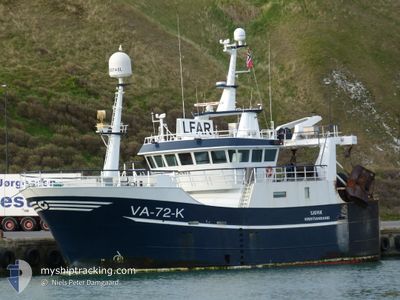
The vessel SJOVIK (IMO: 9826782, MMSI: 257058070) is a Fishing It's sailing under the flag of [NO] Norway.
In this page you can find informations about the vessels current position, last detected port calls, and current voyage information. If the vessels is not in coverage by AIS you will find the latest position.
The current position of SJOVIK is detected by our AIS receivers and we are not responsible for the reliability of the data. The last position was recorded while the vessel was in Coverage by the Ais receivers of our vessel tracking app.
Weather
| Temperature | 11.5°C / 52.7°F |
|---|---|
| Wind Speed | 17 knots |
| Direction | 282° WNW |
| Pressure | 1013.9 hPa |
| Humidity | 84.9 % |
| Cloud Coverage | 34 % |
Featured Company
Limited time offer - Install a base station receiver to your area and list your company on Free forever!
Last Port Calls
| Port | Arrival | Departure | Time In Port |
|---|---|---|---|
| 2024-05-30 22:14 | 2024-05-31 03:00 | 4 h | |
| 2024-05-24 12:24 | 2024-05-24 12:47 | 23 m | |
| 2024-05-23 18:33 | 2024-05-24 06:42 | 12 h | |
| 2024-05-23 01:00 | 2024-05-23 07:01 | 6 h | |
| 2024-05-22 11:48 | 2024-05-22 19:02 | 7 h | |
| 2024-05-22 05:44 | 2024-05-22 11:27 | 5 h | |
| 2024-05-17 06:43 | 2024-05-17 11:24 | 4 h | |
| 2024-05-15 01:02 | 2024-05-15 01:35 | 32 m | |
| 2024-05-14 05:47 | 2024-05-14 10:30 | 4 h | |
| 2024-05-07 12:48 | 2024-05-07 12:57 | 9 m |
Last Trips
| Origin | Departure | Destination | Arrival | Distance | |
|---|---|---|---|---|---|
| 2024-05-24 14:47 | 2024-05-31 00:14 | 586.72 nm | |||
| 2024-05-24 08:42 | 2024-05-24 14:24 | 25.58 nm | |||
| 2024-05-23 09:01 | 2024-05-23 20:33 | 47.46 nm | |||
| 2024-05-22 21:02 | 2024-05-23 03:00 | 55.52 nm | |||
| 2024-05-22 13:27 | 2024-05-22 13:48 | 0.28 nm | |||
| 2024-05-17 13:24 | 2024-05-22 07:44 | 421.76 nm | |||
| 2024-05-15 03:35 | 2024-05-17 08:43 | 300.66 nm | |||
| 2024-05-14 12:30 | 2024-05-15 03:02 | 116.63 nm | |||
| 2024-05-07 14:57 | 2024-05-14 07:47 | 553.49 nm | |||
| 2024-05-07 14:40 | 2024-05-07 14:48 | 0.81 nm |
Events
| Time | Event | Details | Position / Dest | Info |
|---|---|---|---|---|
| 2024-06-03 10:28 | START Moving |
58.17571 / 4.69019
CH16 FOR INFO
|
Speed: 4.9 kn Course: 120° |
|
| 2024-06-03 10:24 | STOP Moving |
58.17892 / 4.68992
CH16 FOR INFO
|
Speed: 0.3 kn Course: 166° |
|
| 2024-06-02 14:10 | START Moving |
57.77573 / 5.89542
CH16 FOR INFO
|
Speed: 4.4 kn Course: 159° |
|
| 2024-06-02 14:04 | STOP Moving |
57.77882 / 5.89614
CH16 FOR INFO
|
Speed: 0.3 kn Course: 181° |
|
| 2024-06-02 00:53 | START Moving |
58.12318 / 4.91146
CH16 FOR INFO
|
Speed: 6.8 kn Course: 72.2° |
|
| 2024-06-02 00:39 | STOP Moving |
58.12167 / 4.90871
CH16 FOR INFO
|
Speed: 0.1 kn Course: 235° |
|
| 2024-06-01 02:19 | START Moving |
57.60106 / 6.71950
CH16 FOR INFO
|
Speed: 3.4 kn Course: 287° |
|
| 2024-06-01 02:02 | STOP Moving |
57.60023 / 6.73248
CH16 FOR INFO
|
Speed: 0.2 kn Course: 285° |
|
| 2024-05-31 17:58 | Detected in Sea | Norwegian part of the North Sea |
57.71112 / 7.51433
North Sea
|
Speed: 8.9 kn Course: 216° |
| 2024-05-31 14:59 | START Moving | 3.71 nm, South of KRISTIANSAND |
58.07567 / 8.01483
CH16 FOR INFO
|
Speed: 5.5 kn Course: 117.3° |