
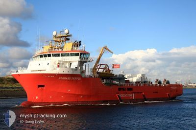
SKIPPER TIDE
Multi Purpose Offshore Vessel
Current Trip
| Time Travelled | 5 days |
|---|---|
| Remaining Time | --- |
| Distance Travelled | 246.32 nm |
| Remaining Distance | --- |
| AVG Speed | 9.7 Knots |
| MAX Speed | 14.6 Knots |
| AVG Wind | 7.1 knots |
| MAX Wind | 17.3 knots |
| MIN Temp | 14.1°C / 57.38°F |
| MAX Temp | 19.1°C / 66.38°F |
| Draught | 5.9 m |
| Position Received | 6 h, 27 m ago |
Current Position
| Longitude | -1.68615° |
|---|---|
| Latitude | 49.72744° |
| Status | Under way using engine |
| Speed | 7.4 Knots |
| Course | 202.3° |
| Area | English Channel |
| Station | T-AIS |
| Position Received | 6 h, 27 m ago |
Info
Information
The current position of SKIPPER TIDE is in English Channel with coordinates 49.72744° / -1.68615° as reported on 2024-06-28 19:58 by AIS to our vessel tracker app. The vessel's current speed is 7.4 Knots
The vessel SKIPPER TIDE (IMO: 9331268, MMSI: 259231000) is a Multi Purpose Offshore Vessel that was built in 2005 ( 19 years old ). It's sailing under the flag of [NO] Norway.
In this page you can find informations about the vessels current position, last detected port calls, and current voyage information. If the vessels is not in coverage by AIS you will find the latest position.
The current position of SKIPPER TIDE is detected by our AIS receivers and we are not responsible for the reliability of the data. The last position was recorded while the vessel was in Coverage by the Ais receivers of our vessel tracking app.
The current draught of SKIPPER TIDE as reported by AIS is 5.9 meters
Weather
| Temperature | 14.6°C / 58.28°F |
|---|---|
| Wind Speed | 6 knots |
| Direction | 267° W |
| Pressure | 1018.6 hPa |
| Humidity | 72.4 % |
| Cloud Coverage | 100 % |
Featured Company
Last Port Calls
| Port | Arrival | Departure | Time In Port |
|---|---|---|---|
| 2024-06-23 07:40 | |||
| 2024-06-06 04:33 | 2024-06-12 20:38 | 6 d | |
| 2024-06-03 13:41 | 2024-06-04 08:12 | 18 h | |
| 2024-06-02 15:11 | 2024-06-03 07:21 | 16 h | |
| 2024-06-02 07:51 | 2024-06-02 08:05 | 14 m | |
| 2024-06-01 16:54 | 2024-06-02 07:44 | 14 h | |
| 2024-05-31 04:40 | 2024-06-01 16:31 | 1 d | |
| 2024-05-30 20:51 | 2024-05-31 04:05 | 7 h | |
| 2024-05-20 06:47 | 2024-05-24 09:39 | 4 d | |
| 2024-05-18 08:34 | 2024-05-20 05:48 | 1 d |
Most Visited Ports (Last year)
| Port | Arrivals | |
|---|---|---|
| 34 | ||
| 30 | ||
| 15 | ||
| 5 | ||
| 1 | ||
| 1 |
Last Trips
| Origin | Departure | Destination | Arrival | Distance | |
|---|---|---|---|---|---|
| 2024-06-01 17:31 | 2024-06-06 06:33 | 427.15 nm | |||
| 2024-06-01 17:31 | 2024-06-03 14:41 | 21.36 nm | |||
| 2024-06-01 17:31 | 2024-06-02 16:11 | 13.07 nm | |||
| 2024-06-01 17:31 | 2024-06-02 08:51 | 2.93 nm | |||
| 2024-06-01 17:31 | 2024-06-01 17:54 | 2.11 nm | |||
| 2024-05-24 10:39 | 2024-05-31 05:40 | 546.88 nm | |||
| 2024-05-24 10:39 | 2024-05-30 21:51 | 543.62 nm | |||
| 2024-05-18 02:23 | 2024-05-20 07:47 | 27.35 nm | |||
| 2024-05-18 02:23 | 2024-05-18 09:34 | 22.70 nm | |||
| 2024-05-13 23:25 | 2024-05-17 20:13 | 279.83 nm |
Events
| Time | Event | Details | Position / Dest | Info |
|---|---|---|---|---|
| 2024-06-28 19:58 | OUT of Coverage |
49.72744 / -1.68615
English Channel
CHERBOURG
|
Speed: 7.4 kn Course: 202.3° |
|
| 2024-06-28 19:28 | IN Coverage |
49.77283 / -1.62473
English Channel
CHERBOURG
|
Speed: 7.1 kn Course: 219.2° |
|
| 2024-06-28 16:08 | OUT of Coverage |
49.98630 / -.58759
English Channel
CHERBOURG
|
Speed: 13.4 kn Course: 256.7° |
|
| 2024-06-28 14:34 | Destination Changed | CHERBOURG TRE OWF |
50.06232 / -.08976
CHERBOURG
|
Speed: 11.3 kn Course: 256.5° |
| 2024-06-28 14:34 | ETA Changed | 2024/06/28 22:00 2024/06/23 21:00 |
50.06232 / -.08976
CHERBOURG
|
Speed: 11.3 kn Course: 256.5° |
| 2024-06-28 11:46 | IN Coverage |
50.12631 / .63204
English Channel
|
Speed: 11 kn Course: 262.5° |
|
| 2024-06-27 17:22 | OUT of Coverage |
50.16895 / 1.14985
English Channel
|
Speed: 1.3 kn Course: 76.4° |
|
| 2024-06-27 17:22 | IN Coverage |
50.16895 / 1.14985
English Channel
|
Speed: 1.3 kn Course: 76.4° |
|
| 2024-06-27 15:38 | OUT of Coverage |
50.16662 / 1.12775
English Channel
|
Speed: Course: 67.8° |
|
| 2024-06-27 11:59 | STOP Moving | 13.27 nm, North West of TREPORT |
50.18921 / 1.08807
TRE OWF
|
Speed: 0.2 kn Course: 262° |