
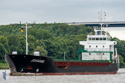
SKY MARINE
General Cargo
Current Trip
| Time Travelled | 15 h, 9 mins |
|---|---|
| Remaining Time | --- |
| Distance Travelled | 120.71 nm |
| Remaining Distance | --- |
| AVG Speed | 8.1 Knots |
| MAX Speed | 11.5 Knots |
| AVG Wind | 12.4 knots |
| MAX Wind | 14 knots |
| MIN Temp | 14.5°C / 58.1°F |
| MAX Temp | 15.7°C / 60.26°F |
| Draught | 5.9 m |
| Position Received | Now |
Current Position
| Longitude | 26.26294° |
|---|---|
| Latitude | 59.98750° |
| Status | Under way using engine |
| Speed | 8.3 Knots |
| Course | 255.9° |
| Area | Gulf of Finland |
| Station | T-AIS |
| Position Received | Now |
Info
Information
The current position of SKY MARINE is in Gulf of Finland with coordinates 59.98750° / 26.26294° as reported on 2024-06-26 10:05 by AIS to our vessel tracker app. The vessel's current speed is 8.3 Knots and is heading at the port of BRAKE. The estimated time of arrival as calculated by vessel tracking app is 2024-06-30 23:00 LT
The vessel SKY MARINE (IMO: 9143269, MMSI: 352002352) is a General Cargo that was built in 1998 ( 26 years old ). It's sailing under the flag of [PA] Panama.
In this page you can find informations about the vessels current position, last detected port calls, and current voyage information. If the vessels is not in coverage by AIS you will find the latest position.
The current position of SKY MARINE is detected by our AIS receivers and we are not responsible for the reliability of the data. The last position was recorded while the vessel was in Coverage by the Ais receivers of our vessel tracking app.
The current draught of SKY MARINE as reported by AIS is 5.9 meters
Weather
| Temperature | 15.6°C / 60.08°F |
|---|---|
| Wind Speed | 14 knots |
| Direction | 252° WSW |
| Pressure | 1017.6 hPa |
| Humidity | 80 % |
| Cloud Coverage | 4 % |
Featured Company
Last Port Calls
| Port | Arrival | Departure | Time In Port |
|---|---|---|---|
| 2024-06-25 01:21 | 2024-06-25 18:57 | 17 h | |
| 2024-06-23 16:25 | 2024-06-24 20:13 | 1 d | |
| 2024-06-09 20:52 | 2024-06-11 21:44 | 2 d | |
| 2024-06-04 16:50 | 2024-06-07 18:25 | 3 d | |
| 2024-05-22 01:14 | 2024-05-22 05:22 | 4 h | |
| 2024-05-13 15:30 | 2024-05-18 17:45 | 5 d | |
| 2024-05-09 10:50 | 2024-05-10 10:42 | 23 h | |
| 2024-05-01 05:12 | 2024-05-05 05:42 | 4 d | |
| 2024-04-16 19:02 | 2024-04-19 07:55 | 2 d | |
| 2024-04-11 20:09 | 2024-04-14 09:02 | 2 d |
Most Visited Ports (Last year)
| Port | Arrivals | |
|---|---|---|
| 3 | ||
| 2 | ||
| 2 | ||
| 2 | ||
| 2 | ||
| 2 |
Last Trips
| Origin | Departure | Destination | Arrival | Distance | |
|---|---|---|---|---|---|
| 2024-06-24 23:13 | 2024-06-25 04:21 | 34.75 nm | |||
| 2024-06-11 22:44 | 2024-06-23 19:25 | 1378.58 nm | |||
| 2024-06-07 19:25 | 2024-06-09 21:52 | 5.13 nm | |||
| 2024-05-22 07:22 | 2024-06-04 17:50 | 1551.70 nm | |||
| 2024-05-18 18:45 | 2024-05-22 03:14 | 617.44 nm | |||
| 2024-05-10 12:42 | 2024-05-13 16:30 | 776.71 nm | |||
| 2024-05-05 07:42 | 2024-05-09 12:50 | 10.03 nm | |||
| 2024-04-19 11:55 | 2024-05-01 07:12 | 1504.13 nm | |||
| 2024-04-14 12:02 | 2024-04-16 23:02 | 598.53 nm | |||
| 2024-04-10 13:17 | 2024-04-11 23:09 | 132.24 nm |
Events
| Time | Event | Details | Position / Dest | Info |
|---|---|---|---|---|
| 2024-06-26 09:59 | Detected in Sea | Estonian part of the Gulf of Finland |
59.99116 / 26.29264
Gulf of Finland
BRAKE GERMANY
|
Speed: 8.3 kn Course: 256.1° |
| 2024-06-26 09:50 | Detected in Sea | Finnish part of the Gulf of Finland |
59.99621 / 26.33306
Gulf of Finland
BRAKE GERMANY
|
Speed: 8.3 kn Course: 255.9° |
| 2024-06-25 22:13 | Draught Changed | 5.9 3.6 |
60.03472 / 29.22783
BRAKE GERMANY
|
Speed: 8 kn Course: 272° |
| 2024-06-25 22:13 | Destination Changed | BRAKE GERMANY RU LED |
60.03472 / 29.22783
BRAKE GERMANY
|
Speed: 8 kn Course: 272° |
| 2024-06-25 22:13 | ETA Changed | 2024/06/30 23:00 2024/06/23 07:30 |
60.03472 / 29.22783
BRAKE GERMANY
|
Speed: 8 kn Course: 272° |
| 2024-06-25 21:46 | Status Changed | Under way using engine Default |
60.03214 / 29.34484
RU LED
|
Speed: 8.5 kn Course: 272° |
| 2024-06-25 21:39 | Status Changed | Default Under way using engine |
60.03046 / 29.37795
RU LED
|
Speed: 9 kn Course: 266.3° |
| 2024-06-25 21:34 | Status Changed | Under way using engine Default |
60.03057 / 29.39729
RU LED
|
Speed: 9.4 kn Course: 270° |
| 2024-06-25 21:24 | IN Coverage |
60.03057 / 29.39729
Gulf of Finland
|
Speed: 8.4 kn Course: 269.6° |
|
| 2024-06-25 18:57 | PORT DEPARTURE |
|
59.89552 / 30.12937
RU LED
|
Speed: 7.1 kn Course: 293° |