
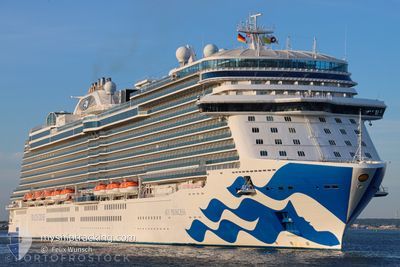
SKY PRINCESS
Passenger
Current Trip
| Time Travelled | 1 day |
|---|---|
| Remaining Time | 46 mins |
| Distance Travelled | 681.05 nm |
| Remaining Distance | 16.55 nm |
| AVG Speed | 16.6 Knots |
| MAX Speed | 20.8 Knots |
| AVG Wind | 16.4 knots |
| MAX Wind | 22.3 knots |
| MIN Temp | 11.9°C / 53.42°F |
| MAX Temp | 14.8°C / 58.64°F |
| Draught | 8.6 m |
| Position Received | Now |
Current Position
| Longitude | 5.10774° |
|---|---|
| Latitude | 59.27820° |
| Status | Under way using engine |
| Speed | 17.7 Knots |
| Course | 355.2° |
| Area | North Sea |
| Station | T-AIS |
| Position Received | Now |
Info
Information
The current position of SKY PRINCESS is in North Sea with coordinates 59.27820° / 5.10774° as reported on 2024-06-17 05:04 by AIS to our vessel tracker app. The vessel's current speed is 17.7 Knots and is heading at the port of HAUGESUND. The estimated time of arrival as calculated by vessel tracking app is 2024-06-17 05:51 LT
The vessel SKY PRINCESS (IMO: 9802396, MMSI: 310780000) is a Passenger It's sailing under the flag of [BM] Bermuda.
In this page you can find informations about the vessels current position, last detected port calls, and current voyage information. If the vessels is not in coverage by AIS you will find the latest position.
The current position of SKY PRINCESS is detected by our AIS receivers and we are not responsible for the reliability of the data. The last position was recorded while the vessel was in Coverage by the Ais receivers of our vessel tracking app.
The current draught of SKY PRINCESS as reported by AIS is 8.6 meters
Weather
| Temperature | 11.4°C / 52.52°F |
|---|---|
| Wind Speed | 12 knots |
| Direction | 105° ESE |
| Pressure | 1004.4 hPa |
| Humidity | 89 % |
| Cloud Coverage | 100 % |
Featured Company
Last Port Calls
| Port | Arrival | Departure | Time In Port |
|---|---|---|---|
| 2024-06-15 04:58 | 2024-06-15 16:22 | 11 h | |
| 2024-06-13 05:00 | 2024-06-13 16:24 | 11 h | |
| 2024-06-09 19:45 | 2024-06-10 14:20 | 18 h | |
| 2024-06-09 04:32 | 2024-06-09 15:13 | 10 h | |
| 2024-06-07 04:57 | 2024-06-08 12:34 | 1 d | |
| 2024-06-05 04:44 | 2024-06-05 20:44 | 16 h | |
| 2024-06-03 06:20 | 2024-06-03 16:39 | 10 h | |
| 2024-06-01 05:28 | 2024-06-01 15:36 | 10 h | |
| 2024-05-30 05:53 | 2024-05-30 15:28 | 9 h | |
| 2024-05-29 04:03 | 2024-05-29 14:11 | 10 h |
Most Visited Ports (Last year)
| Port | Arrivals | |
|---|---|---|
| 21 | ||
| 16 | ||
| 9 | ||
| 8 | ||
| 6 | ||
| 6 |
Last Trips
| Origin | Departure | Destination | Arrival | Distance | |
|---|---|---|---|---|---|
| 2024-06-13 18:24 | 2024-06-15 05:58 | 624.54 nm | |||
| 2024-06-10 17:20 | 2024-06-13 07:00 | 943.13 nm | |||
| 2024-06-09 18:13 | 2024-06-09 22:45 | 45.79 nm | |||
| 2024-06-08 14:34 | 2024-06-09 07:32 | 234.77 nm | |||
| 2024-06-05 22:44 | 2024-06-07 06:57 | 529.33 nm | |||
| 2024-06-03 18:39 | 2024-06-05 06:44 | 378.80 nm | |||
| 2024-06-01 16:36 | 2024-06-03 08:20 | 698.64 nm | |||
| 2024-05-30 17:28 | 2024-06-01 06:28 | 649.79 nm | |||
| 2024-05-29 16:11 | 2024-05-30 07:53 | 284.08 nm | |||
| 2024-05-28 19:15 | 2024-05-29 06:03 | 190.80 nm |
Events
| Time | Event | Details | Position / Dest | Info |
|---|---|---|---|---|
| 2024-06-16 20:41 | Detected in Sea | Norwegian part of the North Sea |
57.22800 / 4.55216
North Sea
NO HAU
|
Speed: 16.9 kn Course: 5.8° |
| 2024-06-16 20:41 | IN Coverage |
57.22800 / 4.55216
North Sea
NO HAU
|
Speed: 16.9 kn Course: 5.8° |
|
| 2024-06-16 16:33 | Status Changed | Default Under way using engine |
56.06118 / 4.33879
NO HAU
|
Speed: 17.7 kn Course: 5.7° |
| 2024-06-16 16:29 | OUT of Coverage |
56.04062 / 4.33505
North Sea
NO HAU
|
Speed: 17.7 kn Course: 5.7° |
|
| 2024-06-16 15:40 | Status Changed | Under way using engine Default |
55.80060 / 4.29204
NO HAU
|
Speed: 17.8 kn Course: 6° |
| 2024-06-16 15:33 | Status Changed | Default Under way using engine |
55.76678 / 4.28597
NO HAU
|
Speed: 17.7 kn Course: 6° |
| 2024-06-16 15:31 | Change Sea Area | Danish part of the North Sea German part of the North Sea |
55.75550 / 4.28394
North Sea
NO HAU
|
Speed: 17.7 kn Course: 6° |
| 2024-06-16 14:46 | Status Changed | Under way using engine Default |
55.51125 / 4.24049
NO HAU
|
Speed: 20.2 kn Course: 6° |
| 2024-06-16 14:39 | Status Changed | Default Under way using engine |
55.47098 / 4.23323
NO HAU
|
Speed: 20.3 kn Course: 5.7° |
| 2024-06-16 14:26 | Change Sea Area | German part of the North Sea Dutch part of the North Sea |
55.39986 / 4.22067
North Sea
NO HAU
|
Speed: 20.4 kn Course: 5.6° |