
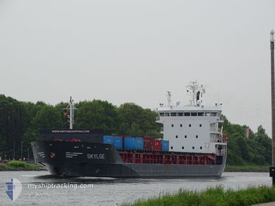
SKYLGE
General Cargo
Current Trip
| Time Travelled | 1 day |
|---|---|
| Remaining Time | 3 days |
| Distance Travelled | 406.53 nm |
| Remaining Distance | 1070.49 nm |
| AVG Speed | 12.9 Knots |
| MAX Speed | 16.7 Knots |
| AVG Wind | 10.5 knots |
| MAX Wind | 17 knots |
| MIN Temp | 11.2°C / 52.16°F |
| MAX Temp | 14.6°C / 58.28°F |
| Draught | 6.6 m |
| Position Received | 1 m ago |
Current Position
| Longitude | 8.36683° |
|---|---|
| Latitude | 57.07367° |
| Status | Under way using engine |
| Speed | 12.7 Knots |
| Course | 35° |
| Area | North Sea |
| Station | T-AIS |
| Position Received | 1 m ago |
Info
Information
The current position of SKYLGE is in North Sea with coordinates 57.07367° / 8.36683° as reported on 2024-05-18 08:04 by AIS to our vessel tracker app. The vessel's current speed is 12.7 Knots and is heading at the port of ROYTTA. The estimated time of arrival as calculated by vessel tracking app is 2024-05-21 18:14 LT
The vessel SKYLGE (IMO: 9508809, MMSI: 246630000) is a General Cargo that was built in 2010 ( 14 years old ). It's sailing under the flag of [NL] Netherlands.
In this page you can find informations about the vessels current position, last detected port calls, and current voyage information. If the vessels is not in coverage by AIS you will find the latest position.
The current position of SKYLGE is detected by our AIS receivers and we are not responsible for the reliability of the data. The last position was recorded while the vessel was in Coverage by the Ais receivers of our vessel tracking app.
The current draught of SKYLGE as reported by AIS is 6.6 meters
Weather
| Temperature | 12.9°C / 55.22°F |
|---|---|
| Wind Speed | 10 knots |
| Direction | 71° ENE |
| Pressure | 1016.3 hPa |
| Humidity | 73.8 % |
| Cloud Coverage | --- |
Featured Company
Last Port Calls
| Port | Arrival | Departure | Time In Port |
|---|---|---|---|
| 2024-05-15 18:55 | 2024-05-16 23:53 | 1 d | |
| 2024-05-15 18:14 | 2024-05-15 18:34 | 19 m | |
| 2024-05-08 00:44 | 2024-05-11 07:12 | 3 d | |
| 2024-05-02 06:31 | 2024-05-03 16:05 | 1 d | |
| 2024-05-01 08:31 | 2024-05-01 21:46 | 13 h | |
| 2024-05-01 08:01 | 2024-05-01 08:14 | 12 m | |
| 2024-04-29 03:06 | 2024-04-29 06:50 | 3 h | |
| 2024-04-24 08:12 | 2024-04-26 08:04 | 1 d | |
| 2024-04-17 18:30 | 2024-04-19 15:47 | 1 d | |
| 2024-04-16 18:37 | 2024-04-17 09:06 | 14 h |
Last Trips
| Origin | Departure | Destination | Arrival | Distance | |
|---|---|---|---|---|---|
| 2024-05-15 20:34 | 2024-05-15 20:55 | 1.53 nm | |||
| 2024-05-11 10:12 | 2024-05-15 20:14 | 1314.97 nm | |||
| 2024-05-03 18:05 | 2024-05-08 03:44 | 1279.60 nm | |||
| 2024-05-01 23:46 | 2024-05-02 08:31 | 101.16 nm | |||
| 2024-05-01 10:14 | 2024-05-01 10:31 | 1.46 nm | |||
| 2024-04-29 08:50 | 2024-05-01 10:01 | 630.87 nm | |||
| 2024-04-26 11:04 | 2024-04-29 05:06 | 862.08 nm | |||
| 2024-04-19 17:47 | 2024-04-24 11:12 | 1280.41 nm | |||
| 2024-04-17 11:06 | 2024-04-17 20:30 | 101.22 nm | |||
| 2024-04-16 18:18 | 2024-04-16 20:37 | 5.17 nm |
Events
| Time | Event | Details | Position / Dest | Info |
|---|---|---|---|---|
| 2024-05-17 22:50 | Status Changed | Under way using engine Default |
55.43500 / 6.52783
FITOR
|
Speed: 12.9 kn Course: 33° |
| 2024-05-17 22:47 | Status Changed | Default Under way using engine |
55.42517 / 6.51683
FITOR
|
Speed: 13 kn Course: 32° |
| 2024-05-17 22:38 | Detected in Sea | Danish part of the North Sea |
55.39950 / 6.48817
North Sea
FITOR
|
Speed: 13 kn Course: 32° |
| 2024-05-17 21:07 | Status Changed | Under way using engine Default |
55.12367 / 6.20067
FITOR
|
Speed: 12.6 kn Course: 31° |
| 2024-05-17 20:54 | Status Changed | Default Under way using engine |
55.08483 / 6.15983
FITOR
|
Speed: 12.5 kn Course: 32° |
| 2024-05-17 18:10 | Detected in Sea | German part of the North Sea |
54.59166 / 5.66533
North Sea
FITOR
|
Speed: 12.7 kn Course: 31° |
| 2024-05-17 18:10 | Status Changed | Under way using engine Default |
54.59166 / 5.66533
FITOR
|
Speed: 12.7 kn Course: 32° |
| 2024-05-17 17:59 | IN Coverage |
54.59166 / 5.66533
North Sea
FITOR
|
Speed: 12.7 kn Course: 31° |
|
| 2024-05-17 14:17 | Status Changed | Default Under way using engine |
53.85133 / 4.98950
FITOR
|
Speed: 13.4 kn Course: 23° |
| 2024-05-17 14:15 | OUT of Coverage |
53.84283 / 4.98333
North Sea
FITOR
|
Speed: 13.4 kn Course: 23° |