
SKYVIEW
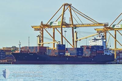
Container Ship
Current Trip
| Time Travelled | 1 day |
|---|---|
| Remaining Time | 2 h, 36 mins |
| Distance Travelled | 468.82 nm |
| Remaining Distance | 32.49 nm |
| AVG Speed | 11.3 Knots |
| MAX Speed | 12.5 Knots |
| AVG Wind | 7.9 knots |
| MAX Wind | 16.6 knots |
| MIN Temp | 20.8°C / 69.44°F |
| MAX Temp | 22.3°C / 72.14°F |
| Draught | 8.4 m |
| Position Received | 2 m ago |
Current Position
| Longitude | 14.36188° |
|---|---|
| Latitude | 36.10547° |
| Status | Under way using engine |
| Speed | 10.5 Knots |
| Course | 117.2° |
| Area | Mediterranean Sea - Eastern Basin |
| Station | T-AIS |
| Position Received | 2 m ago |
Info
Information
The current position of SKYVIEW is in Mediterranean Sea - Eastern Basin with coordinates 36.10547° / 14.36188° as reported on 2024-06-01 12:52 by AIS to our vessel tracker app. The vessel's current speed is 10.5 Knots and is heading at the port of MARSAXLOKK. The estimated time of arrival as calculated by vessel tracking app is 2024-06-01 15:30 LT
The vessel SKYVIEW (IMO: 9358890, MMSI: 636020959) is a Container Ship that was built in 2007 ( 17 years old ). It's sailing under the flag of [LR] Liberia.
In this page you can find informations about the vessels current position, last detected port calls, and current voyage information. If the vessels is not in coverage by AIS you will find the latest position.
The current position of SKYVIEW is detected by our AIS receivers and we are not responsible for the reliability of the data. The last position was recorded while the vessel was in Coverage by the Ais receivers of our vessel tracking app.
The current draught of SKYVIEW as reported by AIS is 8.4 meters
Weather
| Temperature | 23.7°C / 74.66°F |
|---|---|
| Wind Speed | 13 knots |
| Direction | 112° ESE |
| Pressure | 1014.2 hPa |
| Humidity | 69.5 % |
| Cloud Coverage | 6 % |
Featured Company
Last Port Calls
| Port | Arrival | Departure | Time In Port |
|---|---|---|---|
| 2024-05-27 10:23 | 2024-05-30 18:38 | 3 d | |
| 2024-05-21 18:18 | 2024-05-22 16:03 | 21 h | |
| 2024-05-19 13:21 | 2024-05-20 11:46 | 22 h | |
| 2024-05-17 21:24 | 2024-05-19 13:16 | 1 d | |
| 2024-05-12 14:19 | 2024-05-16 21:15 | 4 d | |
| 2024-05-08 13:45 | 2024-05-09 11:35 | 21 h | |
| 2024-05-06 06:39 | 2024-05-07 09:58 | 1 d | |
| 2024-04-30 12:28 | 2024-05-04 05:08 | 3 d | |
| 2024-04-24 02:58 | 2024-04-25 11:08 | 1 d | |
| 2024-04-19 23:10 | 2024-04-20 23:16 | 1 d |
Most Visited Ports (Last year)
| Port | Arrivals | |
|---|---|---|
| 13 | ||
| 9 | ||
| 8 | ||
| 8 | ||
| 8 | ||
| 5 |
Last Trips
| Origin | Departure | Destination | Arrival | Distance | |
|---|---|---|---|---|---|
| 2024-05-22 18:03 | 2024-05-27 11:23 | 458.17 nm | |||
| 2024-05-20 13:46 | 2024-05-21 20:18 | 352.60 nm | |||
| 2024-05-19 15:16 | 2024-05-19 15:21 | 0.79 nm | |||
| 2024-05-16 22:15 | 2024-05-17 23:24 | 324.71 nm | |||
| 2024-05-09 13:35 | 2024-05-12 15:19 | 445.14 nm | |||
| 2024-05-07 11:58 | 2024-05-08 15:45 | 358.42 nm | |||
| 2024-05-04 06:08 | 2024-05-06 08:39 | 327.17 nm | |||
| 2024-04-25 13:08 | 2024-04-30 13:28 | 534.49 nm | |||
| 2024-04-21 01:16 | 2024-04-24 04:58 | 421.78 nm | |||
| 2024-04-18 11:12 | 2024-04-20 01:10 | 333.22 nm |
Events
| Time | Event | Details | Position / Dest | Info |
|---|---|---|---|---|
| 2024-06-01 09:34 | Status Changed | Under way using engine Default |
36.37038 / 13.72482
MTMAR
|
Speed: 10.4 kn Course: 115° |
| 2024-06-01 09:30 | Status Changed | Default Under way using engine |
36.37550 / 13.71169
MTMAR
|
Speed: 10.6 kn Course: 115.4° |
| 2024-06-01 08:17 | Change Sea Area | Maltese part of the Mediterranean Sea - Eastern Basin Italian part of the Mediterranean Sea - Eastern Basin |
36.46889 / 13.46555
Mediterranean Sea - Eastern Basin
MTMAR
|
Speed: 11 kn Course: 116.2° |
| 2024-06-01 08:17 | Status Changed | Under way using engine Default |
36.46889 / 13.46555
MTMAR
|
Speed: 11 kn Course: 117° |
| 2024-06-01 08:14 | Status Changed | Default Under way using engine |
36.47300 / 13.45531
MTMAR
|
Speed: 11.1 kn Course: 117.1° |
| 2024-06-01 07:05 | Status Changed | Under way using engine Default |
36.56254 / 13.21892
MTMAR
|
Speed: 11 kn Course: 117° |
| 2024-06-01 07:01 | Status Changed | Default Under way using engine |
36.56820 / 13.20536
MTMAR
|
Speed: 11 kn Course: 117.3° |
| 2024-06-01 01:10 | Detected in Sea | Italian part of the Mediterranean Sea - Eastern Basin |
37.04210 / 12.01660
Mediterranean Sea - Eastern Basin
MTMAR
|
Speed: 10.9 kn Course: 115.4° |
| 2024-05-31 23:09 | Status Changed | Under way using engine Default |
37.21149 / 11.58019
MTMAR
|
Speed: 11.7 kn Course: 116° |
| 2024-05-31 23:06 | Status Changed | Default Under way using engine |
37.21581 / 11.56917
MTMAR
|
Speed: 11.7 kn Course: 116.4° |