
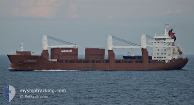
SLOTERGRACHT
General Cargo
Current Trip
| Time Travelled | 8 days |
|---|---|
| Remaining Time | 1 day |
| Distance Travelled | 3001.64 nm |
| Remaining Distance | 434.93 nm |
| AVG Speed | 14.3 Knots |
| MAX Speed | 21.1 Knots |
| AVG Wind | 13 knots |
| MAX Wind | 23 knots |
| MIN Temp | 12.4°C / 54.32°F |
| MAX Temp | 21.6°C / 70.88°F |
| Draught | 6.7 m |
| Position Received | Now |
Current Position
| Longitude | 16.60379° |
|---|---|
| Latitude | 56.00172° |
| Status | Under way using engine |
| Speed | 13.2 Knots |
| Course | 60° |
| Area | Baltic Sea |
| Station | T-AIS |
| Position Received | Now |
Info
Information
The current position of SLOTERGRACHT is in Baltic Sea with coordinates 56.00172° / 16.60379° as reported on 2024-06-01 05:08 by AIS to our vessel tracker app. The vessel's current speed is 13.2 Knots and is heading at the port of KOTKA. The estimated time of arrival as calculated by vessel tracking app is 2024-06-02 13:48 LT
The vessel SLOTERGRACHT (IMO: 9197947, MMSI: 246456000) is a General Cargo that was built in 2000 ( 24 years old ). It's sailing under the flag of [NL] Netherlands.
In this page you can find informations about the vessels current position, last detected port calls, and current voyage information. If the vessels is not in coverage by AIS you will find the latest position.
The current position of SLOTERGRACHT is detected by our AIS receivers and we are not responsible for the reliability of the data. The last position was recorded while the vessel was in Coverage by the Ais receivers of our vessel tracking app.
The current draught of SLOTERGRACHT as reported by AIS is 6.7 meters
Weather
| Temperature | 12.6°C / 54.68°F |
|---|---|
| Wind Speed | 13 knots |
| Direction | 17° NNE |
| Pressure | 1012.4 hPa |
| Humidity | 92.4 % |
| Cloud Coverage | 12 % |
Featured Company
Last Port Calls
| Port | Arrival | Departure | Time In Port |
|---|---|---|---|
| 2024-05-22 20:04 | 2024-05-23 18:16 | 22 h | |
| 2024-05-21 05:38 | 2024-05-21 15:29 | 9 h | |
| 2024-05-16 16:22 | 2024-05-20 16:16 | 3 d | |
| 2024-05-13 06:53 | 2024-05-14 14:27 | 1 d | |
| 2024-05-11 09:22 | 2024-05-11 18:59 | 9 h | |
| 2024-05-10 05:27 | 2024-05-11 05:33 | 1 d | |
| 2024-04-27 23:34 | 2024-05-01 21:37 | 3 d | |
| 2024-04-23 15:04 | 2024-04-25 13:58 | 1 d | |
| 2024-04-19 19:49 | 2024-04-21 05:27 | 1 d | |
| 2024-04-15 14:22 | 2024-04-16 21:40 | 1 d |
Most Visited Ports (Last year)
| Port | Arrivals | |
|---|---|---|
| 4 | ||
| 3 | ||
| 3 | ||
| 2 | ||
| 2 | ||
| 2 |
Last Trips
| Origin | Departure | Destination | Arrival | Distance | |
|---|---|---|---|---|---|
| 2024-05-21 17:29 | 2024-05-22 22:04 | 455.43 nm | |||
| 2024-05-20 18:16 | 2024-05-21 07:38 | 138.25 nm | |||
| 2024-05-14 15:27 | 2024-05-16 18:22 | 829.98 nm | |||
| 2024-05-11 19:59 | 2024-05-13 07:53 | 377.13 nm | |||
| 2024-05-11 06:33 | 2024-05-11 10:22 | 54.48 nm | |||
| 2024-05-01 17:37 | 2024-05-10 06:27 | 3443.63 nm | |||
| 2024-04-25 09:58 | 2024-04-27 19:34 | 362.32 nm | |||
| 2024-04-21 00:27 | 2024-04-23 11:04 | 988.32 nm | |||
| 2024-04-16 16:40 | 2024-04-19 14:49 | 436.50 nm | |||
| 2024-04-02 23:01 | 2024-04-15 09:22 | 4941.96 nm |
Events
| Time | Event | Details | Position / Dest | Info |
|---|---|---|---|---|
| 2024-06-01 05:00 | ETA Changed | 2024/06/02 12:00 2024/06/02 13:00 |
55.98733 / 16.55925
FI KTK
|
Speed: 13.2 kn Course: 60.6° |
| 2024-06-01 01:32 | Detected in Sea | Swedish part of the Baltic Sea |
55.62123 / 15.35605
Baltic Sea
FI KTK
|
Speed: 13.6 kn Course: 59.4° |
| 2024-05-31 22:01 | Change Sea Area | Danish part of the Kattegat Swedish part of the Baltic Sea |
55.15616 / 14.25984
Kattegat
FI KTK
|
Speed: 12.9 kn Course: 97.1° |
| 2024-05-31 17:46 | Change Sea Area | Swedish part of the Baltic Sea Danish part of the Baltic Sea |
55.28779 / 12.65839
Baltic Sea
FI KTK
|
Speed: 13.3 kn Course: 112.4° |
| 2024-05-31 17:34 | Change Sea Area | Danish part of the Baltic Sea Danish part of the Kattegat |
55.31572 / 12.61320
Baltic Sea
FI KTK
|
Speed: 13 kn Course: 182.3° |
| 2024-05-31 17:19 | Change Sea Area | Danish part of the Kattegat Swedish part of the Kattegat |
55.36957 / 12.62580
Kattegat
FI KTK
|
Speed: 13.2 kn Course: 191.1° |
| 2024-05-31 16:49 | Change Sea Area | Swedish part of the Kattegat Danish part of the Kattegat |
55.47295 / 12.69010
Kattegat
FI KTK
|
Speed: 13.3 kn Course: 203.6° |
| 2024-05-31 13:55 | Change Sea Area | Danish part of the Kattegat Swedish part of the Kattegat |
55.94081 / 12.65018
Kattegat
FI KTK
|
Speed: 14 kn Course: 198° |
| 2024-05-31 13:37 | Change Sea Area | Swedish part of the Kattegat Danish part of the Kattegat |
56.01557 / 12.66158
Kattegat
FI KTK
|
Speed: 16.3 kn Course: 164.7° |
| 2024-05-31 12:11 | Change Sea Area | Danish part of the Kattegat Swedish part of the Kattegat |
56.23102 / 12.30880
Kattegat
FI KTK
|
Speed: 13.3 kn Course: 139.7° |