
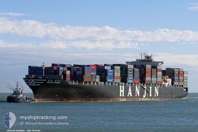
SM KWANGYANG
Container Ship
Current Trip
| Time Travelled | 10 days |
|---|---|
| Remaining Time | 13 h, 17 mins |
| Distance Travelled | 4447.91 nm |
| Remaining Distance | 475.85 nm |
| AVG Speed | 16.5 Knots |
| MAX Speed | 20.4 Knots |
| AVG Wind | 11.2 knots |
| MAX Wind | 26.9 knots |
| MIN Temp | 3.5°C / 38.3°F |
| MAX Temp | 17.5°C / 63.5°F |
| Draught | 10.5 m |
| Position Received | 20 h, 38 m ago |
Current Position
| Longitude | 140.33502° |
|---|---|
| Latitude | 41.38210° |
| Status | Under way using engine |
| Speed | 17 Knots |
| Course | 232° |
| Area | Japan Sea |
| Station | T-AIS |
| Position Received | 20 h, 38 m ago |
Info
Information
The current position of SM KWANGYANG is in Japan Sea with coordinates 41.38210° / 140.33502° as reported on 2024-05-19 23:32 by AIS to our vessel tracker app. The vessel's current speed is 17 Knots and is heading at the port of BUSAN. The estimated time of arrival as calculated by vessel tracking app is 2024-05-21 09:27 LT
The vessel SM KWANGYANG (IMO: 9347425, MMSI: 440086000) is a Container Ship that was built in 2007 ( 17 years old ). It's sailing under the flag of [KR] Korea.
In this page you can find informations about the vessels current position, last detected port calls, and current voyage information. If the vessels is not in coverage by AIS you will find the latest position.
The current position of SM KWANGYANG is detected by our AIS receivers and we are not responsible for the reliability of the data. The last position was recorded while the vessel was in Coverage by the Ais receivers of our vessel tracking app.
The current draught of SM KWANGYANG as reported by AIS is 10.5 meters
Weather
| Temperature | 12.7°C / 54.86°F |
|---|---|
| Wind Speed | 16 knots |
| Direction | 345° NNW |
| Pressure | 1017.2 hPa |
| Humidity | 77.4 % |
| Cloud Coverage | 99 % |
Featured Company
Last Port Calls
| Port | Arrival | Departure | Time In Port |
|---|---|---|---|
| 2024-05-09 12:22 | 2024-05-10 09:26 | 21 h | |
| 2024-05-03 14:12 | 2024-05-06 11:16 | 2 d | |
| 2024-04-20 15:56 | 2024-04-21 15:28 | 23 h | |
| 2024-04-18 08:38 | |||
| 2024-04-16 11:29 | 2024-04-16 23:35 | 12 h | |
| 2024-04-14 05:18 | 2024-04-15 09:10 | 1 d | |
| 2024-04-10 05:06 | 2024-04-11 02:30 | 21 h | |
| 2024-04-09 01:45 | 2024-04-09 21:34 | 19 h | |
| 2024-03-24 11:12 | 2024-03-25 12:11 | 1 d | |
| 2024-03-18 12:23 | 2024-03-21 11:08 | 2 d |
Most Visited Ports (Last year)
| Port | Arrivals | |
|---|---|---|
| 14 | ||
| 8 | ||
| 8 | ||
| 8 | ||
| 7 | ||
| 7 |
Last Trips
| Origin | Departure | Destination | Arrival | Distance | |
|---|---|---|---|---|---|
| 2024-05-06 04:16 | 2024-05-09 05:22 | 995.47 nm | |||
| 2024-04-22 00:28 | 2024-05-03 07:12 | 5288.70 nm | |||
| 2024-04-17 07:35 | 2024-04-18 16:38 | 267.80 nm | |||
| 2024-04-15 17:10 | 2024-04-16 19:29 | 398.89 nm | |||
| 2024-04-11 11:30 | 2024-04-14 13:18 | 480.19 nm | |||
| 2024-04-10 06:34 | 2024-04-10 14:06 | 92.26 nm | |||
| 2024-03-25 05:11 | 2024-04-09 10:45 | 4796.25 nm | |||
| 2024-03-21 04:08 | 2024-03-24 04:12 | 993.98 nm | |||
| 2024-03-03 22:33 | 2024-03-18 05:23 | 5613.71 nm | |||
| 2024-02-29 07:45 | 2024-03-02 20:38 | 597.37 nm |
Events
| Time | Event | Details | Position / Dest | Info |
|---|---|---|---|---|
| 2024-05-19 23:37 | Status Changed | Default Under way using engine |
41.36765 / 140.31067
KRPUS
|
Speed: 17 kn Course: 232° |
| 2024-05-19 23:32 | OUT of Coverage |
41.38210 / 140.33502
Japan Sea
KRPUS
|
Speed: 17 kn Course: 232° |
|
| 2024-05-19 22:12 | Status Changed | Under way using engine Default |
41.62633 / 140.73668
KRPUS
|
Speed: 17.6 kn Course: 233° |
| 2024-05-19 22:09 | Status Changed | Default Under way using engine |
41.63660 / 140.75513
KRPUS
|
Speed: 16.4 kn Course: 241° |
| 2024-05-19 20:47 | Change Sea Area | Japanese part of the Japan Sea Japanese part of the North Pacific Ocean |
41.65772 / 141.26397
Japan Sea
KRPUS
|
Speed: 19.4 kn Course: 269° |
| 2024-05-19 17:37 | Change Sea Area | Japanese part of the North Pacific Ocean High seas of the North Pacific Ocean |
41.75580 / 142.61468
North Pacific Ocean
KRPUS
|
Speed: 19.5 kn Course: 263° |
| 2024-05-19 17:37 | IN Coverage |
41.75580 / 142.61468
North Pacific Ocean
KRPUS
|
Speed: 19.5 kn Course: 263° |
|
| 2024-05-19 17:36 | Status Changed | Under way using engine Default |
41.75615 / 142.61903
KRPUS
|
Speed: 19.3 kn Course: 263° |
| 2024-05-11 08:58 | Status Changed | Default Under way using engine |
47.11183 / -131.04246
KRPUS
|
Speed: 19.1 kn Course: 300° |
| 2024-05-11 08:53 | OUT of Coverage |
47.10112 / -131.01527
North Pacific Ocean
KRPUS
|
Speed: 19.1 kn Course: 300° |