
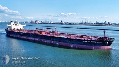
SONANGOL PORTOAMBOI
Crude Oil Tanker
Current Trip
SIN SG
| Time Travelled | 5 days |
|---|---|
| Remaining Time | --- |
| Distance Travelled | 1661.64 nm |
| Remaining Distance | --- |
| AVG Speed | 11.6 Knots |
| MAX Speed | 13.2 Knots |
| AVG Wind | 9.3 knots |
| MAX Wind | 22 knots |
| MIN Temp | 12.9°C / 55.22°F |
| MAX Temp | 20.3°C / 68.54°F |
| Draught | 17 m |
| Position Received | 5 d ago |
Current Position
| Longitude | -118.76661° |
|---|---|
| Latitude | 33.66708° |
| Status | Under way using engine |
| Speed | 10 Knots |
| Course | 266.5° |
| Area | North Pacific Ocean |
| Station | T-AIS |
| Position Received | 5 d ago |
Info
Information
The current position of SONANGOL PORTOAMBOI is in North Pacific Ocean with coordinates 33.66708° / -118.76661° as reported on 2024-05-23 13:04 by AIS to our vessel tracker app. The vessel's current speed is 10 Knots
The vessel SONANGOL PORTOAMBOI (IMO: 9575577, MMSI: 311066300) is a Crude Oil Tanker that was built in 2012 ( 12 years old ). It's sailing under the flag of [BS] Bahamas.
In this page you can find informations about the vessels current position, last detected port calls, and current voyage information. If the vessels is not in coverage by AIS you will find the latest position.
The current position of SONANGOL PORTOAMBOI is detected by our AIS receivers and we are not responsible for the reliability of the data. The last position was recorded while the vessel was in Coverage by the Ais receivers of our vessel tracking app.
The current draught of SONANGOL PORTOAMBOI as reported by AIS is 17 meters
Weather
| Temperature | 20.3°C / 68.54°F |
|---|---|
| Wind Speed | 13 knots |
| Direction | 112° ESE |
| Pressure | 1027.6 hPa |
| Humidity | 72.3 % |
| Cloud Coverage | 100 % |
Featured Company
Last Port Calls
| Port | Arrival | Departure | Time In Port |
|---|---|---|---|
| 2024-05-22 23:35 | 2024-05-23 09:30 | 9 h | |
| 2024-03-27 12:17 | 2024-03-28 09:34 | 21 h | |
| 2024-03-21 14:26 | 2024-03-22 21:39 | 1 d |
Most Visited Ports (Last year)
| Port | Arrivals | |
|---|---|---|
| 2 | ||
| 1 | ||
| 1 | ||
| 1 | ||
| 1 | ||
| 1 |
Last Trips
| Origin | Departure | Destination | Arrival | Distance | |
|---|---|---|---|---|---|
| 2024-03-28 02:34 | 2024-05-22 16:35 | 8429.87 nm | |||
| 2024-03-22 14:39 | 2024-03-27 05:17 | 44.03 nm | |||
| 2024-02-23 05:37 | 2024-03-21 07:26 | 1898.53 nm |
Events
| Time | Event | Details | Position / Dest | Info |
|---|---|---|---|---|
| 2024-05-23 13:08 | Status Changed | Default Under way using engine |
33.66646 / -118.78051
SIN SG
|
Speed: 10 kn Course: 266.5° |
| 2024-05-23 13:04 | Status Changed | Under way using engine Default |
33.66708 / -118.76661
SIN SG
|
Speed: 10 kn Course: 266° |
| 2024-05-23 13:04 | OUT of Coverage |
33.66708 / -118.76661
North Pacific Ocean
SIN SG
|
Speed: 10 kn Course: 266.5° |
|
| 2024-05-23 12:55 | Status Changed | Default Under way using engine |
33.66872 / -118.73656
SIN SG
|
Speed: 10.1 kn Course: 266.3° |
| 2024-05-23 12:39 | Status Changed | Under way using engine Default |
33.67227 / -118.68464
SIN SG
|
Speed: 10 kn Course: 264° |
| 2024-05-23 12:35 | Status Changed | Default Under way using engine |
33.67353 / -118.66975
SIN SG
|
Speed: 9.8 kn Course: 264.1° |
| 2024-05-23 12:23 | Status Changed | Under way using engine Default |
33.67693 / -118.63265
SIN SG
|
Speed: 9.7 kn Course: 263° |
| 2024-05-23 12:23 | Status Changed | Default Under way using engine |
33.67708 / -118.63110
SIN SG
|
Speed: 9.8 kn Course: 263.2° |
| 2024-05-23 11:49 | Status Changed | Under way using engine Default |
33.68482 / -118.52001
SIN SG
|
Speed: 9.9 kn Course: 267° |
| 2024-05-23 11:47 | Status Changed | Default Under way using engine |
33.68523 / -118.51224
SIN SG
|
Speed: 9.8 kn Course: 265.9° |