
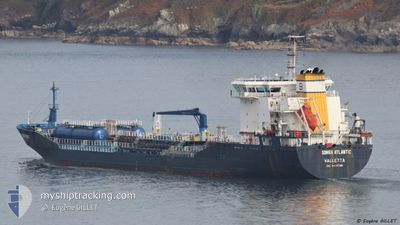
SONGA ATLANTIC
Oil/Chemical Tanker
Current Trip
| Time Travelled | 1 day |
|---|---|
| Remaining Time | --- |
| Distance Travelled | 255.72 nm |
| Remaining Distance | --- |
| AVG Speed | 8.5 Knots |
| MAX Speed | 11 Knots |
| AVG Wind | 16.4 knots |
| MAX Wind | 22 knots |
| MIN Temp | 11.4°C / 52.52°F |
| MAX Temp | 14.7°C / 58.46°F |
| Draught | 9.6 m |
| Position Received | Now |
Current Position
| Longitude | 7.36907° |
|---|---|
| Latitude | 54.15350° |
| Status | Under way using engine |
| Speed | 9.7 Knots |
| Course | 89° |
| Area | North Sea |
| Station | T-AIS |
| Position Received | Now |
Info
Information
The current position of SONGA ATLANTIC is in North Sea with coordinates 54.15350° / 7.36907° as reported on 2024-06-09 02:55 by AIS to our vessel tracker app. The vessel's current speed is 9.7 Knots
The vessel SONGA ATLANTIC (IMO: 9447328, MMSI: 248713000) is a Oil/Chemical Tanker that was built in 2010 ( 14 years old ). It's sailing under the flag of [MT] Malta.
In this page you can find informations about the vessels current position, last detected port calls, and current voyage information. If the vessels is not in coverage by AIS you will find the latest position.
The current position of SONGA ATLANTIC is detected by our AIS receivers and we are not responsible for the reliability of the data. The last position was recorded while the vessel was in Coverage by the Ais receivers of our vessel tracking app.
The current draught of SONGA ATLANTIC as reported by AIS is 9.6 meters
Weather
| Temperature | 12.6°C / 54.68°F |
|---|---|
| Wind Speed | 22 knots |
| Direction | 268° W |
| Pressure | 1007.8 hPa |
| Humidity | 63.7 % |
| Cloud Coverage | 50 % |
Featured Company
Last Port Calls
| Port | Arrival | Departure | Time In Port |
|---|---|---|---|
| 2024-06-05 13:54 | 2024-06-08 00:01 | 2 d | |
| 2024-06-03 19:02 | 2024-06-05 04:36 | 1 d | |
| 2024-06-02 05:21 | 2024-06-02 06:59 | 1 h | |
| 2024-06-01 16:10 | 2024-06-01 16:55 | 45 m | |
| 2024-05-30 05:43 | 2024-05-31 19:02 | 1 d | |
| 2024-05-25 03:21 | 2024-05-26 09:55 | 1 d | |
| 2024-05-20 18:00 | 2024-05-22 09:28 | 1 d | |
| 2024-05-16 13:12 | 2024-05-18 04:23 | 1 d | |
| 2024-05-13 01:05 | 2024-05-13 01:08 | 2 m | |
| 2024-05-10 03:14 | 2024-05-11 09:27 | 1 d |
Most Visited Ports (Last year)
| Port | Arrivals | |
|---|---|---|
| 14 | ||
| 12 | ||
| 11 | ||
| 7 | ||
| 7 | ||
| 6 |
Last Trips
| Origin | Departure | Destination | Arrival | Distance | |
|---|---|---|---|---|---|
| 2024-06-05 06:36 | 2024-06-05 15:54 | 65.97 nm | |||
| 2024-06-02 08:59 | 2024-06-03 21:02 | 343.71 nm | |||
| 2024-06-01 18:55 | 2024-06-02 07:21 | 50.52 nm | |||
| 2024-05-31 21:02 | 2024-06-01 18:10 | 195.74 nm | |||
| 2024-05-26 12:55 | 2024-05-30 07:43 | 640.48 nm | |||
| 2024-05-22 11:28 | 2024-05-25 06:21 | 633.92 nm | |||
| 2024-05-18 06:23 | 2024-05-20 20:00 | 245.15 nm | |||
| 2024-05-13 03:08 | 2024-05-16 15:12 | 430.81 nm | |||
| 2024-05-11 11:27 | 2024-05-13 03:05 | 374.87 nm | |||
| 2024-05-05 04:51 | 2024-05-10 05:14 | 251.88 nm |
Events
| Time | Event | Details | Position / Dest | Info |
|---|---|---|---|---|
| 2024-06-09 02:42 | Draught Changed | 9.6 6.4 |
54.15390 / 7.30393
HAMBURG
|
Speed: 9.8 kn Course: 89° |
| 2024-06-09 02:42 | Destination Changed | HAMBURG NLAMS |
54.15390 / 7.30393
HAMBURG
|
Speed: 9.8 kn Course: 89° |
| 2024-06-09 02:42 | ETA Changed | 2024/06/09 06:00 2024/06/05 11:00 |
54.15390 / 7.30393
HAMBURG
|
Speed: 9.8 kn Course: 89° |
| 2024-06-09 01:43 | Status Changed | Under way using engine Default |
54.15415 / 7.03008
NLAMS
|
Speed: 9.8 kn Course: 88° |
| 2024-06-09 01:39 | Status Changed | Default Under way using engine |
54.15383 / 7.00918
NLAMS
|
Speed: 9.7 kn Course: 88° |
| 2024-06-09 01:37 | Change Sea Area | German part of the North Sea Dutch part of the North Sea |
54.15368 / 7.00060
North Sea
|
Speed: 9.7 kn Course: 88° |
| 2024-06-09 01:35 | Status Changed | Under way using engine Default |
54.15362 / 6.99225
NLAMS
|
Speed: 9.9 kn Course: 84° |
| 2024-06-09 01:35 | IN Coverage |
54.15368 / 7.00060
North Sea
|
Speed: 9.7 kn Course: 88° |
|
| 2024-06-08 05:17 | Status Changed | Default Under way using engine |
52.51672 / 3.71265
NLAMS
|
Speed: 9.4 kn Course: 269° |
| 2024-06-08 05:12 | OUT of Coverage |
52.51688 / 3.73208
North Sea
|
Speed: 9.4 kn Course: 269° |