
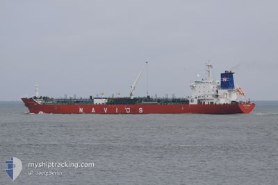
SONGA COSMOS
Oil/Chemical Tanker
Current Trip
| Time Travelled | 10 days |
|---|---|
| Remaining Time | -4 mins |
| Distance Travelled | 1004.92 nm |
| Remaining Distance | 3.52 nm |
| AVG Speed | 11.5 Knots |
| MAX Speed | 13.9 Knots |
| AVG Wind | 10.7 knots |
| MAX Wind | 20 knots |
| MIN Temp | 13.8°C / 56.84°F |
| MAX Temp | 18.7°C / 65.66°F |
| Draught | 8 m |
| Position Received | 5 m ago |
Current Position
| Longitude | 4.09938° |
|---|---|
| Latitude | 51.97298° |
| Status | Under way using engine |
| Speed | 8.7 Knots |
| Course | 115° |
| Area | North Sea |
| Station | T-AIS |
| Position Received | 5 m ago |
Info
Information
The current position of SONGA COSMOS is in North Sea with coordinates 51.97298° / 4.09938° as reported on 2024-06-26 06:07 by AIS to our vessel tracker app. The vessel's current speed is 8.7 Knots and is heading at the port of ROTTERDAM. The estimated time of arrival as calculated by vessel tracking app is 2024-06-26 06:09 LT
The vessel SONGA COSMOS (IMO: 9457024, MMSI: 248745000) is a Oil/Chemical Tanker that was built in 2010 ( 14 years old ). It's sailing under the flag of [MT] Malta.
In this page you can find informations about the vessels current position, last detected port calls, and current voyage information. If the vessels is not in coverage by AIS you will find the latest position.
The current position of SONGA COSMOS is detected by our AIS receivers and we are not responsible for the reliability of the data. The last position was recorded while the vessel was in Coverage by the Ais receivers of our vessel tracking app.
The current draught of SONGA COSMOS as reported by AIS is 8 meters
Weather
| Temperature | 18°C / 64.4°F |
|---|---|
| Wind Speed | 7 knots |
| Direction | 50° NE |
| Pressure | 1012.1 hPa |
| Humidity | 90.3 % |
| Cloud Coverage | --- |
Featured Company
Last Port Calls
| Port | Arrival | Departure | Time In Port |
|---|---|---|---|
| 2024-06-13 07:22 | 2024-06-15 17:34 | 2 d | |
| 2024-06-07 04:14 | 2024-06-09 14:42 | 2 d | |
| 2024-06-06 11:15 | 2024-06-07 03:23 | 16 h | |
| 2024-05-31 11:40 | 2024-06-02 11:56 | 2 d | |
| 2024-05-25 21:41 | 2024-05-28 21:06 | 2 d | |
| 2024-05-23 20:08 | 2024-05-23 20:52 | 44 m | |
| 2024-05-17 10:39 | 2024-05-19 13:27 | 2 d | |
| 2024-05-12 15:06 | 2024-05-13 18:46 | 1 d | |
| 2024-05-10 23:15 | 2024-05-12 12:34 | 1 d | |
| 2024-05-05 18:02 | 2024-05-06 20:40 | 1 d |
Last Trips
| Origin | Departure | Destination | Arrival | Distance | |
|---|---|---|---|---|---|
| 2024-06-09 16:42 | 2024-06-13 08:22 | 1003.03 nm | |||
| 2024-06-07 05:23 | 2024-06-07 06:14 | 2.76 nm | |||
| 2024-06-02 12:56 | 2024-06-06 13:15 | 991.28 nm | |||
| 2024-05-28 23:06 | 2024-05-31 12:40 | 471.36 nm | |||
| 2024-05-23 22:52 | 2024-05-25 23:41 | 147.38 nm | |||
| 2024-05-19 14:27 | 2024-05-23 22:08 | 413.10 nm | |||
| 2024-05-13 20:46 | 2024-05-17 11:39 | 1011.59 nm | |||
| 2024-05-12 14:34 | 2024-05-12 17:06 | 17.79 nm | |||
| 2024-05-06 22:40 | 2024-05-11 01:15 | 692.81 nm | |||
| 2024-05-04 20:08 | 2024-05-05 20:02 | 176.51 nm |
Events
| Time | Event | Details | Position / Dest | Info |
|---|---|---|---|---|
| 2024-06-26 04:16 | START Moving | 13.88 nm, North West of BROUWERSDAM |
51.93098 / 3.59753
ROTTERDAM
|
Speed: 3.3 kn Course: 122° |
| 2024-06-21 04:14 | STOP Moving | 13.94 nm, North West of BROUWERSDAM |
51.93082 / 3.59445
ROTTERDAM
|
Speed: 0.1 kn Course: 246° |
| 2024-06-21 04:14 | START Moving | 13.94 nm, North West of BROUWERSDAM |
51.93083 / 3.59445
ROTTERDAM
|
Speed: 51.2 kn Course: 330° |
| 2024-06-19 08:25 | STOP Moving | 13.9 nm, North West of BROUWERSDAM |
51.92848 / 3.59172
ROTTERDAM
|
Speed: 0.3 kn Course: 36° |
| 2024-06-19 04:40 | Change Sea Area | Dutch part of the North Sea Belgian part of the North Sea |
51.78358 / 2.68737
North Sea
ROTTERDAM
|
Speed: 10.2 kn Course: 70° |
| 2024-06-19 02:31 | Detected in Sea | Belgian part of the North Sea |
51.51532 / 2.27025
North Sea
ROTTERDAM
|
Speed: 11.4 kn Course: 38° |
| 2024-06-18 23:04 | Change Sea Area | French part of the North Sea French part of the English Channel |
51.01652 / 1.58853
North Sea
ROTTERDAM
|
Speed: 13.4 kn Course: 46° |
| 2024-06-18 19:58 | Change Sea Area | French part of the English Channel United Kingdom part of the English Channel |
50.51030 / .96873
English Channel
ROTTERDAM
|
Speed: 12.2 kn Course: 61° |
| 2024-06-18 19:58 | Status Changed | Under way using engine Default |
50.51030 / .96873
ROTTERDAM
|
Speed: 12.2 kn Course: 61° |
| 2024-06-18 19:50 | Status Changed | Default Under way using engine |
50.49672 / .92870
ROTTERDAM
|
Speed: 12.2 kn Course: 65° |