
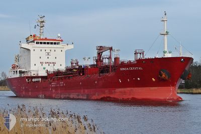
SONGA CRYSTAL
Oil/Chemical Tanker
Current Trip
OPL MALTA
| Time Travelled | 1 day |
|---|---|
| Remaining Time | --- |
| Distance Travelled | 282.59 nm |
| Remaining Distance | --- |
| AVG Speed | 11.7 Knots |
| MAX Speed | 12.3 Knots |
| AVG Wind | 5.1 knots |
| MAX Wind | 11 knots |
| MIN Temp | 16.9°C / 62.42°F |
| MAX Temp | 22.3°C / 72.14°F |
| Draught | 8.7 m |
| Position Received | 6 h, 7 m ago |
Current Position
| Longitude | 10.49134° |
|---|---|
| Latitude | 40.80154° |
| Status | Under way using engine |
| Speed | 11.6 Knots |
| Course | 161° |
| Area | Tyrrhenian Sea |
| Station | T-AIS |
| Position Received | 6 h, 7 m ago |
Info
Information
The current position of SONGA CRYSTAL is in Tyrrhenian Sea with coordinates 40.80154° / 10.49134° as reported on 2024-06-26 05:44 by AIS to our vessel tracker app. The vessel's current speed is 11.6 Knots
The vessel SONGA CRYSTAL (IMO: 9378321, MMSI: 215474000) is a Oil/Chemical Tanker that was built in 2006 ( 18 years old ). It's sailing under the flag of [MT] Malta.
In this page you can find informations about the vessels current position, last detected port calls, and current voyage information. If the vessels is not in coverage by AIS you will find the latest position.
The current position of SONGA CRYSTAL is detected by our AIS receivers and we are not responsible for the reliability of the data. The last position was recorded while the vessel was in Coverage by the Ais receivers of our vessel tracking app.
The current draught of SONGA CRYSTAL as reported by AIS is 8.7 meters
Weather
| Temperature | 22.3°C / 72.14°F |
|---|---|
| Wind Speed | 5 knots |
| Direction | 357° N |
| Pressure | 1013.5 hPa |
| Humidity | 69.1 % |
| Cloud Coverage | 6 % |
Featured Company
Last Port Calls
| Port | Arrival | Departure | Time In Port |
|---|---|---|---|
| 2024-06-24 03:09 | 2024-06-25 10:15 | 1 d | |
| 2024-06-19 23:28 | 2024-06-20 23:35 | 1 d | |
| 2024-06-14 07:01 | 2024-06-15 04:02 | 21 h | |
| 2024-06-10 22:13 | 2024-06-12 21:55 | 1 d | |
| 2024-06-06 04:22 | 2024-06-08 09:44 | 2 d | |
| 2024-06-03 10:35 | 2024-06-04 04:25 | 17 h | |
| 2024-05-21 09:24 | 2024-05-22 17:14 | 1 d | |
| 2024-05-14 05:08 | 2024-05-16 05:26 | 2 d | |
| 2024-05-05 09:48 | 2024-05-06 13:31 | 1 d | |
| 2024-05-01 16:04 | 2024-05-02 18:02 | 1 d |
Most Visited Ports (Last year)
| Port | Arrivals | |
|---|---|---|
| 5 | ||
| 5 | ||
| 4 | ||
| 3 | ||
| 3 | ||
| 3 |
Last Trips
| Origin | Departure | Destination | Arrival | Distance | |
|---|---|---|---|---|---|
| 2024-06-21 01:35 | 2024-06-24 05:09 | 908.19 nm | |||
| 2024-06-15 06:02 | 2024-06-20 01:28 | 734.10 nm | |||
| 2024-06-12 23:55 | 2024-06-14 09:01 | 384.97 nm | |||
| 2024-06-08 11:44 | 2024-06-11 00:13 | 412.97 nm | |||
| 2024-06-04 06:25 | 2024-06-06 06:22 | 432.68 nm | |||
| 2024-05-22 19:14 | 2024-06-03 12:35 | 1345.28 nm | |||
| 2024-05-16 08:26 | 2024-05-21 11:24 | 1371.67 nm | |||
| 2024-05-06 15:31 | 2024-05-14 08:08 | 1352.52 nm | |||
| 2024-05-02 20:02 | 2024-05-05 11:48 | 382.27 nm | |||
| 2024-04-30 12:36 | 2024-05-01 18:04 | 367.71 nm |
Events
| Time | Event | Details | Position / Dest | Info |
|---|---|---|---|---|
| 2024-06-26 05:44 | OUT of Coverage |
40.80154 / 10.49134
Tyrrhenian Sea
OPL MALTA
|
Speed: 11.6 kn Course: 161° |
|
| 2024-06-26 04:14 | Change Sea Area | Italian part of the Tyrrhenian Sea French part of the Tyrrhenian Sea |
41.08383 / 10.38022
Tyrrhenian Sea
OPL MALTA
|
Speed: 11.6 kn Course: 164.6° |
| 2024-06-26 04:11 | IN Coverage |
41.08383 / 10.38022
Tyrrhenian Sea
OPL MALTA
|
Speed: 11.6 kn Course: 164.6° |
|
| 2024-06-26 00:37 | Status Changed | Default Under way using engine |
41.73531 / 10.09998
OPL MALTA
|
Speed: 11.7 kn Course: 163.7° |
| 2024-06-26 00:33 | OUT of Coverage |
41.74963 / 10.09384
Tyrrhenian Sea
OPL MALTA
|
Speed: 11.7 kn Course: 163.7° |
|
| 2024-06-25 23:01 | Detected in Sea | French part of the Tyrrhenian Sea |
42.04042 / 9.97708
Tyrrhenian Sea
OPL MALTA
|
Speed: 11.7 kn Course: 163.9° |
| 2024-06-25 21:23 | Detected in Sea | Italian part of the Tyrrhenian Sea |
42.34514 / 9.85554
Tyrrhenian Sea
OPL MALTA
|
Speed: 11.6 kn Course: 166.8° |
| 2024-06-25 17:05 | Detected in Sea | French part of the Tyrrhenian Sea |
43.14518 / 9.53369
Tyrrhenian Sea
OPL MALTA
|
Speed: 11.4 kn Course: 165.1° |
| 2024-06-25 15:56 | Change Sea Area | French part of the Ligurian Sea Italian part of the Ligurian Sea |
43.35729 / 9.44000
Ligurian Sea
OPL MALTA
|
Speed: 11.7 kn Course: 161.3° |
| 2024-06-25 10:40 | ETA Changed | 2024/06/27 11:00 2024/06/27 10:00 |
44.31672 / 8.97230
OPL MALTA
|
Speed: 11.2 kn Course: 166.9° |