
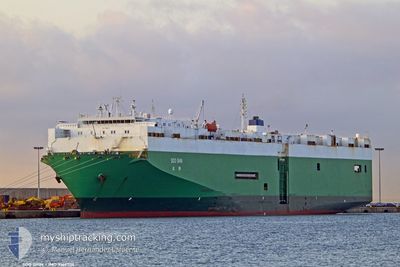
SOO SHIN
Vehicles Carrier
Current Trip
| Trip Time | 16 days |
|---|---|
| Trip Distance | 5152.23 nm |
| AVG Speed | 12.2 Knots |
| MAX Speed | 18 Knots |
| Draught | 8.1 m |
| AVG Wind | 15.3 knots |
| MAX Wind | 39.8 knots |
| MIN Temp | 1.1°C / 33.98°F |
| MAX Temp | 18.7°C / 65.66°F |
| Position Received | 1 m ago |
Current Position
| Longitude | -123.84072° |
|---|---|
| Latitude | 46.96077° |
| Status | Moored |
| Speed | |
| Course | 271° |
| Area | North Pacific Ocean |
| Station | T-AIS |
| Position Received | 1 m ago |
Info
Information
The current position of SOO SHIN is in North Pacific Ocean with coordinates 46.96077° / -123.84072° as reported on 2024-05-17 10:45 by AIS to our vessel tracker app. The vessel's current speed is 0 Knots and is currently inside the port of ABERDEEN.
The vessel SOO SHIN (IMO: 9166704, MMSI: 352001129) is a Vehicles Carrier that was built in 1998 ( 26 years old ). It's sailing under the flag of [PA] Panama.
In this page you can find informations about the vessels current position, last detected port calls, and current voyage information. If the vessels is not in coverage by AIS you will find the latest position.
The current position of SOO SHIN is detected by our AIS receivers and we are not responsible for the reliability of the data. The last position was recorded while the vessel was in Coverage by the Ais receivers of our vessel tracking app.
The current draught of SOO SHIN as reported by AIS is 8.1 meters
Weather
| Temperature | 6.7°C / 44.06°F |
|---|---|
| Wind Speed | 7 knots |
| Direction | 283° WNW |
| Pressure | 1017.8 hPa |
| Humidity | 81.9 % |
| Cloud Coverage | 6 % |
Featured Company
Last Port Calls
| Port | Arrival | Departure | Time In Port |
|---|---|---|---|
| 2024-05-15 23:02 | |||
| 2024-04-28 05:08 | 2024-04-29 00:56 | 19 h | |
| 2024-04-26 20:26 | 2024-04-27 08:18 | 11 h | |
| 2024-04-25 21:04 | 2024-04-26 09:19 | 12 h | |
| 2024-04-24 12:05 | 2024-04-25 11:06 | 23 h | |
| 2024-04-04 13:11 | 2024-04-05 01:04 | 11 h |
Most Visited Ports (Last year)
| Port | Arrivals | |
|---|---|---|
| 5 | ||
| 3 | ||
| 2 | ||
| 2 | ||
| 2 | ||
| 2 |
Last Trips
| Origin | Departure | Destination | Arrival | Distance | |
|---|---|---|---|---|---|
| 2024-04-29 08:56 | 2024-05-15 16:02 | 5152.23 nm | |||
| 2024-04-27 17:18 | 2024-04-28 13:08 | 279.53 nm | |||
| 2024-04-26 18:19 | 2024-04-27 05:26 | 133.10 nm | |||
| 2024-04-25 20:06 | 2024-04-26 06:04 | 136.83 nm | |||
| 2024-04-04 18:04 | 2024-04-24 21:05 | 5985.68 nm |
Events
| Time | Event | Details | Position / Dest | Info |
|---|---|---|---|---|
| 2024-05-16 00:28 | Status Changed | Moored Under way using engine |
46.96068 / -123.84071
[US] ABERDEEN
|
Speed: Course: 274° |
| 2024-05-15 23:02 | PORT ARRIVAL |
|
46.96023 / -123.84121
[US] ABERDEEN
|
Speed: 0.7 kn Course: 270° |
| 2024-05-15 22:45 | STOP Moving | 1.27 nm, West of ABERDEEN |
46.95932 / -123.84934
USGHR
|
Speed: 0.3 kn Course: 198° |
| 2024-05-15 16:17 | Status Changed | Under way using engine Default |
46.81385 / -124.84565
USGHR
|
Speed: 10 kn Course: 84° |
| 2024-05-15 16:14 | Status Changed | Default Under way using engine |
46.81315 / -124.85573
USGHR
|
Speed: 10.2 kn Course: 84.5° |
| 2024-05-15 16:09 | Status Changed | Under way using engine Default |
46.81172 / -124.87818
USGHR
|
Speed: 10.3 kn Course: 83° |
| 2024-05-15 16:05 | Status Changed | Default Under way using engine |
46.81055 / -124.89329
USGHR
|
Speed: 10.3 kn Course: 83.1° |
| 2024-05-15 16:00 | Status Changed | Under way using engine Default |
46.80877 / -124.91616
USGHR
|
Speed: 10.3 kn Course: 83° |
| 2024-05-15 15:18 | Status Changed | Default Under way using engine |
46.79984 / -125.08817
USGHR
|
Speed: 10 kn Course: 84.7° |
| 2024-05-15 15:05 | Status Changed | Under way using engine Default |
46.79637 / -125.14120
USGHR
|
Speed: 10 kn Course: 86° |