
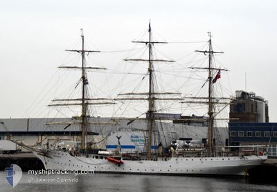
SORLANDET
Sailing Vessel
Current Trip
| Trip Time | 2 days |
|---|---|
| Trip Distance | 423.19 nm |
| AVG Speed | 7.1 Knots |
| MAX Speed | 12.7 Knots |
| Draught | 4.5 m |
| AVG Wind | 12.4 knots |
| MAX Wind | 25 knots |
| MIN Temp | 11.2°C / 52.16°F |
| MAX Temp | 14.1°C / 57.38°F |
| Position Received | Now |
Current Position
| Longitude | 7.98977° |
|---|---|
| Latitude | 58.11046° |
| Status | Moored |
| Speed | |
| Course | 101° |
| Area | Skaggerak |
| Station | T-AIS |
| Position Received | Now |
Info
Information
The current position of SORLANDET is in Skaggerak with coordinates 58.11046° / 7.98977° as reported on 2024-05-28 09:41 by AIS to our vessel tracker app. The vessel's current speed is 0 Knots and is currently inside the port of KRISTIANSAND.
The vessel SORLANDET (IMO: 5334561, MMSI: 257165000) is a Sailing Vessel that was built in 1927 ( 97 years old ). It's sailing under the flag of [NO] Norway.
In this page you can find informations about the vessels current position, last detected port calls, and current voyage information. If the vessels is not in coverage by AIS you will find the latest position.
The current position of SORLANDET is detected by our AIS receivers and we are not responsible for the reliability of the data. The last position was recorded while the vessel was in Coverage by the Ais receivers of our vessel tracking app.
The current draught of SORLANDET as reported by AIS is 4.5 meters
Weather
| Temperature | 12.7°C / 54.86°F |
|---|---|
| Wind Speed | 2 knots |
| Direction | 140° SE |
| Pressure | 1014.8 hPa |
| Humidity | 84.2 % |
| Cloud Coverage | 100 % |
Featured Company
Last Port Calls
| Port | Arrival | Departure | Time In Port |
|---|---|---|---|
| 2024-05-20 06:37 | |||
| 2024-05-05 07:23 | 2024-05-17 19:15 | 12 d | |
| 2024-04-12 21:02 | 2024-04-18 11:32 | 5 d |
Most Visited Ports (Last year)
| Port | Arrivals | |
|---|---|---|
| 12 | ||
| 4 | ||
| 3 | ||
| 2 | ||
| 1 | ||
| 1 |
Last Trips
| Origin | Departure | Destination | Arrival | Distance | |
|---|---|---|---|---|---|
| 2024-05-17 21:15 | 2024-05-20 08:37 | 423.19 nm | |||
| 2024-04-18 12:32 | 2024-05-05 09:23 | 947.04 nm | |||
| 2024-02-18 15:05 | 2024-04-12 22:02 | 1639.35 nm |
Events
| Time | Event | Details | Position / Dest | Info |
|---|---|---|---|---|
| 2024-05-20 09:31 | Status Changed | Moored Under way using engine |
58.11042 / 7.98983
[NO] KRISTIANSAND
|
Speed: Course: 98° |
| 2024-05-20 06:59 | STOP Moving |
58.11087 / 7.98792
[NO] KRISTIANSAND
|
Speed: 0.2 kn Course: 143° |
|
| 2024-05-20 06:37 | PORT ARRIVAL |
|
58.11245 / 8.00207
[NO] KRISTIANSAND
|
Speed: 2.3 kn Course: 281° |
| 2024-05-20 04:38 | START Moving | 3.65 nm, South of KYSTVEIEN |
58.05679 / 8.08904
NO KRS
|
Speed: 3.4 kn Course: 40° |
| 2024-05-20 04:36 | STOP Moving | 3.77 nm, South of KYSTVEIEN |
58.05481 / 8.08748
NO KRS
|
Speed: 0.2 kn Course: 36° |
| 2024-05-19 21:29 | Status Changed | Under way using engine Under way sailing |
57.78555 / 7.62458
NO KRS
|
Speed: 2.2 kn Course: 43° |
| 2024-05-19 19:41 | Change Sea Area | Norwegian part of the Skaggerak Norwegian part of the North Sea |
57.71681 / 7.51527
Skaggerak
NO KRS
|
Speed: 4.3 kn Course: 36.9° |
| 2024-05-19 14:33 | Status Changed | Under way sailing Under way using engine |
57.37492 / 6.94161
NO KRS
|
Speed: 4.3 kn Course: 35° |
| 2024-05-19 04:32 | Detected in Sea | Norwegian part of the North Sea |
56.65158 / 5.22180
North Sea
NO KRS
|
Speed: 8.7 kn Course: 4.2° |
| 2024-05-18 18:50 | Change Sea Area | Danish part of the North Sea German part of the North Sea |
55.30319 / 5.03090
North Sea
NO KRS
|
Speed: 8.3 kn Course: 5.9° |