
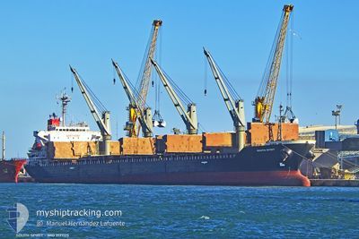
SOUTH SPIRIT
Bulk Carrier
Current Trip
| Time Travelled | 7 days |
|---|---|
| Remaining Time | 15 h, 0 mins |
| Distance Travelled | 2097.66 nm |
| Remaining Distance | 184.72 nm |
| AVG Speed | 12.2 Knots |
| MAX Speed | 15.4 Knots |
| AVG Wind | 13.3 knots |
| MAX Wind | 26.1 knots |
| MIN Temp | 13.5°C / 56.3°F |
| MAX Temp | 24.9°C / 76.82°F |
| Draught | 6.3 m |
| Position Received | 1 m ago |
Current Position
| Longitude | 25.73082° |
|---|---|
| Latitude | 39.59777° |
| Status | Under way using engine |
| Speed | 6.3 Knots |
| Course | 26.7° |
| Area | Aegean Sea |
| Station | T-AIS |
| Position Received | 1 m ago |
Info
Information
The current position of SOUTH SPIRIT is in Aegean Sea with coordinates 39.59777° / 25.73082° as reported on 2024-05-23 20:36 by AIS to our vessel tracker app. The vessel's current speed is 6.3 Knots and is heading at the port of ISTANBUL. The estimated time of arrival as calculated by vessel tracking app is 2024-05-24 11:38 LT
The vessel SOUTH SPIRIT (IMO: 9171125, MMSI: 636022894) is a Bulk Carrier that was built in 1998 ( 26 years old ). It's sailing under the flag of [LR] Liberia.
In this page you can find informations about the vessels current position, last detected port calls, and current voyage information. If the vessels is not in coverage by AIS you will find the latest position.
The current position of SOUTH SPIRIT is detected by our AIS receivers and we are not responsible for the reliability of the data. The last position was recorded while the vessel was in Coverage by the Ais receivers of our vessel tracking app.
The current draught of SOUTH SPIRIT as reported by AIS is 6.3 meters
Weather
| Temperature | 18.3°C / 64.94°F |
|---|---|
| Wind Speed | 11 knots |
| Direction | 6° N |
| Pressure | 1013.8 hPa |
| Humidity | 81.3 % |
| Cloud Coverage | 3 % |
Featured Company
Last Port Calls
| Port | Arrival | Departure | Time In Port |
|---|---|---|---|
| 2024-05-07 15:26 | 2024-05-16 16:57 | 9 d | |
| 2024-04-28 04:54 | 2024-04-28 06:10 | 1 h | |
| 2024-04-25 12:14 | 2024-04-26 03:27 | 15 h | |
| 2024-04-25 12:00 | 2024-04-25 12:10 | 10 m | |
| 2024-04-21 22:26 | 2024-04-25 11:52 | 3 d | |
| 2024-04-21 22:08 | 2024-04-21 22:20 | 11 m | |
| 2024-04-18 09:29 | 2024-04-21 22:05 | 3 d | |
| 2024-04-15 15:38 | 2024-04-15 17:15 | 1 h | |
| 2024-04-01 08:29 | 2024-04-05 21:50 | 4 d | |
| 2024-03-14 11:55 | 2024-03-18 05:44 | 3 d |
Last Trips
| Origin | Departure | Destination | Arrival | Distance | |
|---|---|---|---|---|---|
| 2024-04-28 09:10 | 2024-05-07 16:26 | 2271.19 nm | |||
| 2024-04-26 06:27 | 2024-04-28 07:54 | 346.60 nm | |||
| 2024-04-25 15:10 | 2024-04-25 15:14 | 0.83 nm | |||
| 2024-04-25 14:52 | 2024-04-25 15:00 | 7.41 nm | |||
| 2024-04-22 01:20 | 2024-04-22 01:26 | 2.61 nm | |||
| 2024-04-22 01:05 | 2024-04-22 01:08 | 1.64 nm | |||
| 2024-04-15 20:15 | 2024-04-18 12:29 | 345.27 nm | |||
| 2024-04-05 23:50 | 2024-04-15 18:38 | 1624.87 nm | |||
| 2024-03-18 07:44 | 2024-04-01 10:29 | 2057.57 nm | |||
| 2024-02-15 01:30 | 2024-03-14 13:55 | 1427.54 nm |
Events
| Time | Event | Details | Position / Dest | Info |
|---|---|---|---|---|
| 2024-05-23 14:01 | Status Changed | Under way using engine Default |
38.41078 / 24.96218
TRIST
|
Speed: 11.8 kn Course: 38° |
| 2024-05-23 13:28 | Status Changed | Default Under way using engine |
38.32578 / 24.87770
TRIST
|
Speed: 12 kn Course: 27.6° |
| 2024-05-23 02:49 | Status Changed | Under way using engine Default |
36.64495 / 23.41483
TRIST
|
Speed: 11.8 kn Course: 30° |
| 2024-05-23 02:15 | Status Changed | Default Under way using engine |
36.54623 / 23.35653
TRIST
|
Speed: 11.5 kn Course: 29.2° |
| 2024-05-23 02:01 | Status Changed | Under way using engine Default |
36.50652 / 23.32728
TRIST
|
Speed: 11.1 kn Course: 31° |
| 2024-05-23 01:27 | Status Changed | Default Under way using engine |
36.41598 / 23.25388
TRIST
|
Speed: 11.9 kn Course: 70° |
| 2024-05-23 01:21 | Detected in Sea | Greek part of the Aegean Sea |
36.40680 / 23.23198
Aegean Sea
TRIST
|
Speed: 11.9 kn Course: 70° |
| 2024-05-23 01:21 | Status Changed | Under way using engine Default |
36.40680 / 23.23198
TRIST
|
Speed: 12.7 kn Course: 72° |
| 2024-05-23 01:03 | IN Coverage |
36.40680 / 23.23198
Aegean Sea
TRIST
|
Speed: 11.9 kn Course: 70° |
|
| 2024-05-22 23:34 | OUT of Coverage |
36.36185 / 22.78202
Mediterranean Sea - Eastern Basin
TRIST
|
Speed: 11.7 kn Course: 67.4° |