
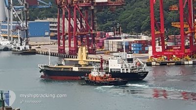
SOUTHERN ANGEL
General Cargo
Current Trip
| Time Travelled | 2 days |
|---|---|
| Remaining Time | --- |
| Distance Travelled | 690.49 nm |
| Remaining Distance | --- |
| AVG Speed | 9.7 Knots |
| MAX Speed | 11.9 Knots |
| AVG Wind | 9.3 knots |
| MAX Wind | 15 knots |
| MIN Temp | 26.1°C / 78.98°F |
| MAX Temp | 29°C / 84.2°F |
| Draught | 6.1 m |
| Position Received | 2 d ago |
Current Position
| Longitude | 122.17652° |
|---|---|
| Latitude | 25.77484° |
| Status | Under way using engine |
| Speed | 8.6 Knots |
| Course | 59.4° |
| Area | Eastern China Sea |
| Station | T-AIS |
| Position Received | 2 d ago |
Info
Information
The current position of SOUTHERN ANGEL is in Eastern China Sea with coordinates 25.77484° / 122.17652° as reported on 2024-06-25 01:10 by AIS to our vessel tracker app. The vessel's current speed is 8.6 Knots and is heading at the port of KUDAMATSU. The estimated time of arrival as calculated by vessel tracking app is 2024-06-28 18:00 LT
The vessel SOUTHERN ANGEL (IMO: 9319258, MMSI: 354587000) is a General Cargo that was built in 2004 ( 20 years old ). It's sailing under the flag of [PA] Panama.
In this page you can find informations about the vessels current position, last detected port calls, and current voyage information. If the vessels is not in coverage by AIS you will find the latest position.
The current position of SOUTHERN ANGEL is detected by our AIS receivers and we are not responsible for the reliability of the data. The last position was recorded while the vessel was in Coverage by the Ais receivers of our vessel tracking app.
The current draught of SOUTHERN ANGEL as reported by AIS is 6.1 meters
Weather
| Temperature | 26.5°C / 79.7°F |
|---|---|
| Wind Speed | 10 knots |
| Direction | 271° W |
| Pressure | 1013.5 hPa |
| Humidity | 83.1 % |
| Cloud Coverage | 100 % |
Featured Company
Last Port Calls
| Port | Arrival | Departure | Time In Port |
|---|---|---|---|
| 2024-06-23 20:58 | 2024-06-24 11:47 | 14 h | |
| 2024-06-21 22:43 | 2024-06-23 07:01 | 1 d | |
| 2024-06-20 22:19 | 2024-06-21 04:51 | 6 h | |
| 2024-06-20 02:00 | 2024-06-20 07:31 | 5 h | |
| 2024-06-14 00:08 | 2024-06-14 13:18 | 13 h | |
| 2024-06-12 21:17 | 2024-06-13 02:25 | 5 h | |
| 2024-06-11 21:53 | 2024-06-12 08:46 | 10 h | |
| 2024-05-30 09:12 | 2024-05-31 16:33 | 1 d | |
| 2024-05-28 14:06 | 2024-05-29 09:14 | 19 h | |
| 2024-05-21 22:16 | 2024-05-24 04:04 | 2 d |
Last Trips
| Origin | Departure | Destination | Arrival | Distance | |
|---|---|---|---|---|---|
| 2024-06-23 15:01 | 2024-06-24 04:58 | 141.05 nm | |||
| 2024-06-21 12:51 | 2024-06-22 06:43 | 130.40 nm | |||
| 2024-06-20 15:31 | 2024-06-21 06:19 | 121.51 nm | |||
| 2024-06-14 22:18 | 2024-06-20 10:00 | 1154.65 nm | |||
| 2024-06-13 11:25 | 2024-06-14 09:08 | 207.84 nm | |||
| 2024-06-12 17:46 | 2024-06-13 06:17 | 3.77 nm | |||
| 2024-06-01 00:33 | 2024-06-12 06:53 | 1446.33 nm | |||
| 2024-05-29 17:14 | 2024-05-30 17:12 | 230.22 nm | |||
| 2024-05-24 13:04 | 2024-05-28 22:06 | 904.17 nm | |||
| 2024-05-22 06:36 | 2024-05-22 07:16 | 2.31 nm |
Events
| Time | Event | Details | Position / Dest | Info |
|---|---|---|---|---|
| 2024-06-25 01:31 | Status Changed | Default Under way using engine |
25.80564 / 122.22642
JP KUD
|
Speed: 8.6 kn Course: 59.4° |
| 2024-06-25 01:10 | Status Changed | Under way using engine Default |
25.77484 / 122.17652
JP KUD
|
Speed: 8.5 kn Course: 55° |
| 2024-06-25 01:10 | OUT of Coverage |
25.77484 / 122.17652
Eastern China Sea
JP KUD
|
Speed: 8.6 kn Course: 59.4° |
|
| 2024-06-25 01:01 | Status Changed | Default Under way using engine |
25.76298 / 122.15575
JP KUD
|
Speed: 8.7 kn Course: 59.3° |
| 2024-06-24 23:46 | Status Changed | Under way using engine Default |
25.65750 / 121.97864
JP KUD
|
Speed: 9.3 kn Course: 55° |
| 2024-06-24 23:40 | Status Changed | Default Under way using engine |
25.64800 / 121.96101
JP KUD
|
Speed: 9.3 kn Course: 55.3° |
| 2024-06-24 23:09 | Status Changed | Under way using engine Default |
25.59836 / 121.89392
JP KUD
|
Speed: 8.9 kn Course: 66° |
| 2024-06-24 22:30 | Status Changed | Default Under way using engine |
25.55639 / 121.79254
JP KUD
|
Speed: 9.3 kn Course: 57° |
| 2024-06-24 22:15 | Draught Changed | 6.1 4.6 |
25.53422 / 121.75996
JP KUD
|
Speed: 8.9 kn Course: 55.8° |
| 2024-06-24 22:15 | Destination Changed | JP KUD TW TXG |
25.53422 / 121.75996
JP KUD
|
Speed: 8.9 kn Course: 55.8° |