
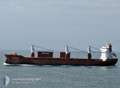
SPAARNEGRACHT
General Cargo
Current Trip
| Time Travelled | 6 days |
|---|---|
| Remaining Time | --- |
| Distance Travelled | 2478.79 nm |
| Remaining Distance | --- |
| AVG Speed | 15.2 Knots |
| MAX Speed | 19.7 Knots |
| AVG Wind | 10.8 knots |
| MAX Wind | 24.8 knots |
| MIN Temp | 9.8°C / 49.64°F |
| MAX Temp | 30.5°C / 86.9°F |
| Draught | 6.7 m |
| Position Received | 3 d ago |
Current Position
| Longitude | -78.61683° |
|---|---|
| Latitude | 31.37229° |
| Status | Under way using engine |
| Speed | 15.6 Knots |
| Course | 43.6° |
| Area | North Atlantic Ocean |
| Station | T-AIS |
| Position Received | 3 d ago |
Info
Information
The current position of SPAARNEGRACHT is in North Atlantic Ocean with coordinates 31.37229° / -78.61683° as reported on 2024-05-30 12:46 by AIS to our vessel tracker app. The vessel's current speed is 15.6 Knots and is heading at the port of HUSUM. The estimated time of arrival as calculated by vessel tracking app is 2024-06-12 22:00 LT
The vessel SPAARNEGRACHT (IMO: 9202558, MMSI: 246452000) is a General Cargo that was built in 2000 ( 24 years old ). It's sailing under the flag of [NL] Netherlands.
In this page you can find informations about the vessels current position, last detected port calls, and current voyage information. If the vessels is not in coverage by AIS you will find the latest position.
The current position of SPAARNEGRACHT is detected by our AIS receivers and we are not responsible for the reliability of the data. The last position was recorded while the vessel was in Coverage by the Ais receivers of our vessel tracking app.
The current draught of SPAARNEGRACHT as reported by AIS is 6.7 meters
Weather
| Temperature | 10.2°C / 50.36°F |
|---|---|
| Wind Speed | 11 knots |
| Direction | 271° W |
| Pressure | 1007.7 hPa |
| Humidity | 90 % |
| Cloud Coverage | 100 % |
Featured Company
Last Port Calls
| Port | Arrival | Departure | Time In Port |
|---|---|---|---|
| 2024-05-24 16:46 | 2024-05-26 22:33 | 2 d | |
| 2024-05-21 13:13 | 2024-05-21 22:25 | 9 h | |
| 2024-05-17 02:03 | 2024-05-19 06:08 | 2 d | |
| 2024-05-01 07:10 | 2024-05-04 21:41 | 3 d | |
| 2024-04-22 12:01 | 2024-04-27 16:19 | 5 d | |
| 2024-04-15 06:09 | 2024-04-19 11:46 | 4 d | |
| 2024-04-12 13:35 | 2024-04-13 20:54 | 1 d | |
| 2024-04-02 20:51 |
Most Visited Ports (Last year)
| Port | Arrivals | |
|---|---|---|
| 5 | ||
| 5 | ||
| 4 | ||
| 4 | ||
| 4 | ||
| 3 |
Last Trips
| Origin | Departure | Destination | Arrival | Distance | |
|---|---|---|---|---|---|
| 2024-05-21 18:25 | 2024-05-24 11:46 | 1005.13 nm | |||
| 2024-05-19 02:08 | 2024-05-21 09:13 | 840.67 nm | |||
| 2024-05-04 23:41 | 2024-05-16 22:03 | 4449.26 nm | |||
| 2024-04-27 18:19 | 2024-05-01 09:10 | 1171.65 nm | |||
| 2024-04-19 13:46 | 2024-04-22 14:01 | 1168.58 nm | |||
| 2024-04-13 22:54 | 2024-04-15 08:09 | 460.79 nm | |||
| 2024-04-02 16:51 | 2024-04-12 15:35 | 3666.34 nm |
Events
| Time | Event | Details | Position / Dest | Info |
|---|---|---|---|---|
| 2024-05-30 12:47 | Status Changed | Default Under way using engine |
31.37569 / -78.61299
SEHUS
|
Speed: 15.6 kn Course: 43.6° |
| 2024-05-30 12:46 | OUT of Coverage |
31.37229 / -78.61683
North Atlantic Ocean
SEHUS
|
Speed: 15.6 kn Course: 43.6° |
|
| 2024-05-30 12:10 | Draught Changed | 6.7 6 |
31.26541 / -78.74180
SEHUS
|
Speed: 15.2 kn Course: 46° |
| 2024-05-30 12:10 | ETA Changed | 2024/06/12 22:00 |
31.26541 / -78.74180
SEHUS
|
Speed: 15.2 kn Course: 46° |
| 2024-05-30 11:44 | Status Changed | Under way using engine Default |
31.18741 / -78.83528
SEHUS
|
Speed: 15.3 kn Course: 46° |
| 2024-05-30 11:39 | IN Coverage |
31.18741 / -78.83528
North Atlantic Ocean
|
Speed: 15.3 kn Course: 45.8° |
|
| 2024-05-30 06:57 | Status Changed | Default Under way using engine |
30.20333 / -79.82000
SEHUS
|
Speed: 17.7 kn Course: 13.3° |
| 2024-05-30 06:54 | OUT of Coverage |
30.19313 / -79.82760
North Atlantic Ocean
|
Speed: 17.7 kn Course: 13.3° |
|
| 2024-05-30 05:57 | Status Changed | Under way using engine Default |
29.91636 / -79.87234
SEHUS
|
Speed: 17 kn Course: 5° |
| 2024-05-30 05:39 | IN Coverage |
29.91636 / -79.87234
North Atlantic Ocean
|
Speed: 17.5 kn Course: 4.3° |