
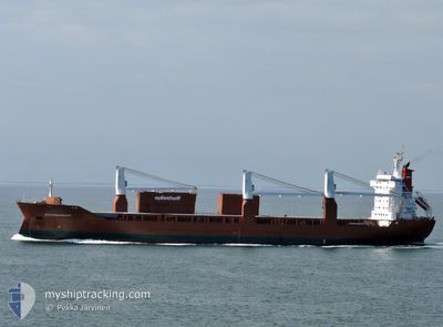
SPAARNEGRACHT
General Cargo
Current Trip
| Time Travelled | 19 h, 49 mins |
|---|---|
| Remaining Time | --- |
| Distance Travelled | 292.11 nm |
| Remaining Distance | --- |
| AVG Speed | 14.6 Knots |
| MAX Speed | 16.7 Knots |
| AVG Wind | 7 knots |
| MAX Wind | 17.7 knots |
| MIN Temp | 6.3°C / 43.34°F |
| MAX Temp | 14.7°C / 58.46°F |
| Draught | 10.6 m |
| Position Received | 1 m ago |
Current Position
| Longitude | -7.37176° |
|---|---|
| Latitude | 51.73629° |
| Status | Under way using engine |
| Speed | 16.3 Knots |
| Course | 247.2° |
| Area | Celtic Sea |
| Station | T-AIS |
| Position Received | 1 m ago |
Info
Information
The current position of SPAARNEGRACHT is in Celtic Sea with coordinates 51.73629° / -7.37176° as reported on 2024-06-29 19:59 by AIS to our vessel tracker app. The vessel's current speed is 16.3 Knots and is heading at the port of BALTIMORE. The estimated time of arrival as calculated by vessel tracking app is 2024-07-08 08:00 LT
The vessel SPAARNEGRACHT (IMO: 9202558, MMSI: 246452000) is a General Cargo that was built in 2000 ( 24 years old ). It's sailing under the flag of [NL] Netherlands.
In this page you can find informations about the vessels current position, last detected port calls, and current voyage information. If the vessels is not in coverage by AIS you will find the latest position.
The current position of SPAARNEGRACHT is detected by our AIS receivers and we are not responsible for the reliability of the data. The last position was recorded while the vessel was in Coverage by the Ais receivers of our vessel tracking app.
The current draught of SPAARNEGRACHT as reported by AIS is 10.6 meters
Weather
| Temperature | 14.4°C / 57.92°F |
|---|---|
| Wind Speed | 17 knots |
| Direction | 7° N |
| Pressure | 1014 hPa |
| Humidity | 86.2 % |
| Cloud Coverage | 100 % |
Featured Company
Last Port Calls
| Port | Arrival | Departure | Time In Port |
|---|---|---|---|
| 2024-06-28 11:13 | 2024-06-29 00:11 | 12 h | |
| 2024-06-24 23:02 | 2024-06-25 20:00 | 20 h | |
| 2024-06-14 17:53 | 2024-06-20 17:49 | 5 d | |
| 2024-05-24 16:46 | 2024-05-26 22:33 | 2 d | |
| 2024-05-21 13:13 | 2024-05-21 22:25 | 9 h | |
| 2024-05-17 02:03 | 2024-05-19 06:08 | 2 d | |
| 2024-05-01 07:10 | 2024-05-04 21:41 | 3 d | |
| 2024-04-22 12:01 | 2024-04-27 16:19 | 5 d | |
| 2024-04-15 06:09 | 2024-04-19 11:46 | 4 d | |
| 2024-04-12 13:35 | 2024-04-13 20:54 | 1 d |
Most Visited Ports (Last year)
| Port | Arrivals | |
|---|---|---|
| 5 | ||
| 4 | ||
| 4 | ||
| 4 | ||
| 4 | ||
| 3 |
Last Trips
| Origin | Departure | Destination | Arrival | Distance | |
|---|---|---|---|---|---|
| 2024-06-25 22:00 | 2024-06-28 12:13 | 953.39 nm | |||
| 2024-06-20 19:49 | 2024-06-25 01:02 | 1290.93 nm | |||
| 2024-05-26 17:33 | 2024-06-14 19:53 | 6588.92 nm | |||
| 2024-05-21 18:25 | 2024-05-24 11:46 | 1005.13 nm | |||
| 2024-05-19 02:08 | 2024-05-21 09:13 | 840.67 nm | |||
| 2024-05-04 23:41 | 2024-05-16 22:03 | 4449.26 nm | |||
| 2024-04-27 18:19 | 2024-05-01 09:10 | 1171.65 nm | |||
| 2024-04-19 13:46 | 2024-04-22 14:01 | 1168.58 nm | |||
| 2024-04-13 22:54 | 2024-04-15 08:09 | 460.79 nm | |||
| 2024-04-02 16:51 | 2024-04-12 15:35 | 3666.34 nm |
Events
| Time | Event | Details | Position / Dest | Info |
|---|---|---|---|---|
| 2024-06-29 16:52 | Change Sea Area | Irish part of the Celtic Sea Irish part of the Irish Sea and St. George's Channel |
52.13388 / -6.19354
Celtic Sea
USBAL
|
Speed: 15.3 kn Course: 232.3° |
| 2024-06-29 09:46 | Change Sea Area | Irish part of the Irish Sea and St. George's Channel United Kingdom part of the Irish Sea and St. George's Channel |
53.74154 / -5.35088
Irish Sea and St. George's Channel
USBAL
|
Speed: 16.5 kn Course: 184.3° |
| 2024-06-29 07:04 | Change Sea Area | United Kingdom part of the Irish Sea and St. George's Channel United Kingdom part of the Inner Seas off the West Coast of Scotland |
54.44056 / -5.29911
Irish Sea and St. George's Channel
USBAL
|
Speed: 15 kn Course: 186.6° |
| 2024-06-29 00:20 | Draught Changed | 10.6 10.4 |
55.96262 / -4.76276
USBAL
|
Speed: 1.8 kn Course: 262° |
| 2024-06-29 00:12 | START Moving | 1 nm, North West of GREENOCK |
55.96057 / -4.76303
USBAL
|
Speed: 3.1 kn Course: 165° |
| 2024-06-29 00:11 | PORT DEPARTURE |
|
55.95952 / -4.76265
USBAL
|
Speed: 2.8 kn Course: 157° |
| 2024-06-29 00:06 | Status Changed | Under way using engine Moored |
55.95669 / -4.76100
[GB] GREENOCK
|
Speed: 1.3 kn Course: 145° |
| 2024-06-28 23:23 | ETA Changed | 2024/07/08 08:00 2024/07/09 10:00 |
55.95572 / -4.76075
[GB] GREENOCK
|
Speed: Course: 134° |
| 2024-06-28 23:21 | ETA Changed | 2024/07/09 10:00 2024/06/28 07:00 |
55.95572 / -4.76075
[GB] GREENOCK
|
Speed: Course: 134° |
| 2024-06-28 21:04 | Draught Changed | 10.4 10.3 |
55.95577 / -4.76081
[GB] GREENOCK
|
Speed: Course: 134° |