
SPAR INDUS
Cargo
Current Trip
| Time Travelled | 19 days |
|---|---|
| Remaining Time | --- |
| Distance Travelled | 3977.24 nm |
| Remaining Distance | --- |
| AVG Speed | 8.8 Knots |
| MAX Speed | 13 Knots |
| AVG Wind | 12.6 knots |
| MAX Wind | 34.9 knots |
| MIN Temp | 8.9°C / 48.02°F |
| MAX Temp | 22°C / 71.6°F |
| Draught | 10.2 m |
| Position Received | 3 h, 18 m ago |
Current Position
| Longitude | -59.22816° |
|---|---|
| Latitude | -33.91737° |
| Status | Under way using engine |
| Speed | 8.3 Knots |
| Course | 345.9° |
| Area | Rio de La Plata |
| Station | T-AIS |
| Position Received | 3 h, 18 m ago |
Info
Information
The current position of SPAR INDUS is in Rio de La Plata with coordinates -33.91737° / -59.22816° as reported on 2024-06-06 18:48 by AIS to our vessel tracker app. The vessel's current speed is 8.3 Knots and is heading at the port of SAN NICOLAS. The estimated time of arrival as calculated by vessel tracking app is 2024-06-04 01:00 LT
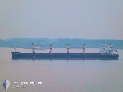
The vessel SPAR INDUS (IMO: 9734991, MMSI: 258775000) is a Cargo It's sailing under the flag of [NO] Norway.
In this page you can find informations about the vessels current position, last detected port calls, and current voyage information. If the vessels is not in coverage by AIS you will find the latest position.
The current position of SPAR INDUS is detected by our AIS receivers and we are not responsible for the reliability of the data. The last position was recorded while the vessel was in Coverage by the Ais receivers of our vessel tracking app.
The current draught of SPAR INDUS as reported by AIS is 10.2 meters
Weather
| Temperature | 21.7°C / 71.06°F |
|---|---|
| Wind Speed | 3 knots |
| Direction | 353° N |
| Pressure | 1014.8 hPa |
| Humidity | 63.5 % |
| Cloud Coverage | 94 % |
Featured Company
Last Port Calls
| Port | Arrival | Departure | Time In Port |
|---|---|---|---|
| 2024-05-13 18:31 | 2024-05-18 01:47 | 4 d | |
| 2024-04-30 04:07 | 2024-05-05 15:58 | 5 d | |
| 2024-04-08 17:53 | 2024-04-14 13:52 | 5 d |
Most Visited Ports (Last year)
| Port | Arrivals | |
|---|---|---|
| 2 | ||
| 1 | ||
| 1 | ||
| 1 | ||
| 1 | ||
| 1 |
Last Trips
| Origin | Departure | Destination | Arrival | Distance | |
|---|---|---|---|---|---|
| 2024-05-05 18:58 | 2024-05-13 20:31 | 2182.82 nm | |||
| 2024-04-14 16:52 | 2024-04-30 07:07 | 3994.50 nm | |||
| 2024-02-09 01:02 | 2024-04-08 20:53 | 4117.63 nm |
Events
| Time | Event | Details | Position / Dest | Info |
|---|---|---|---|---|
| 2024-06-06 18:48 | OUT of Coverage |
-33.91737 / -59.22816
Rio de La Plata
|
Speed: 8.3 kn Course: 345.9° |
|
| 2024-06-06 09:20 | Change Sea Area | Argentinean part of the Rio de La Plata Uruguayan part of the Rio de La Plata |
-34.65803 / -58.04743
Rio de La Plata
|
Speed: 10.3 kn Course: 284.6° |
| 2024-06-06 09:20 | Status Changed | Under way using engine Default |
-34.65845 / -58.04577
SAN NICOLAS
|
Speed: 10.5 kn Course: 288° |
| 2024-06-06 09:18 | IN Coverage |
-34.65803 / -58.04743
Rio de La Plata
|
Speed: 10.3 kn Course: 284.6° |
|
| 2024-06-06 00:06 | Status Changed | Default Under way using engine |
-35.16746 / -56.24625
SAN NICOLAS
|
Speed: 12 kn Course: 247.5° |
| 2024-06-06 00:02 | Status Changed | Under way using engine Default |
-35.16314 / -56.23295
SAN NICOLAS
|
Speed: 12.2 kn Course: 247° |
| 2024-06-06 00:02 | IN Coverage |
-35.16314 / -56.23295
Rio de La Plata
|
Speed: 12 kn Course: 247.5° |
|
| 2024-06-06 00:02 | OUT of Coverage |
-35.16314 / -56.23295
Rio de La Plata
|
Speed: 12 kn Course: 247.5° |
|
| 2024-06-05 17:34 | Status Changed | Default Under way using engine |
-35.08646 / -55.35502
SAN NICOLAS
|
Speed: 11.2 kn Course: 286.6° |
| 2024-06-05 17:22 | OUT of Coverage |
-35.09515 / -55.31377
Rio de La Plata
|
Speed: 11.2 kn Course: 286.6° |