
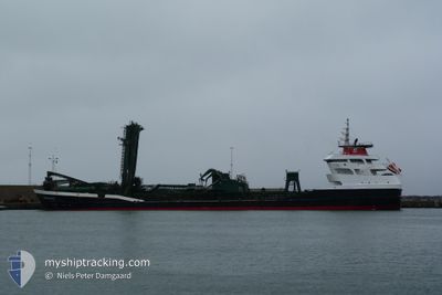
SPAUWER
Dredging or underwater ops
Current Trip
DREDGE AREA 460
| Time Travelled | 2 days |
|---|---|
| Remaining Time | --- |
| Distance Travelled | 368.90 nm |
| Remaining Distance | --- |
| AVG Speed | 7.6 Knots |
| MAX Speed | 12.6 Knots |
| AVG Wind | 16.3 knots |
| MAX Wind | 22 knots |
| MIN Temp | 9.3°C / 48.74°F |
| MAX Temp | 15.5°C / 59.9°F |
| Draught | 8.5 m |
| Position Received | 1 m ago |
Current Position
| Longitude | 0.90542° |
|---|---|
| Latitude | 50.85010° |
| Status | Under way using engine |
| Speed | 9.1 Knots |
| Course | 51.6° |
| Area | English Channel |
| Station | T-AIS |
| Position Received | 1 m ago |
Info
Information
The current position of SPAUWER is in English Channel with coordinates 50.85010° / 0.90542° as reported on 2024-06-01 05:48 by AIS to our vessel tracker app. The vessel's current speed is 9.1 Knots
The vessel SPAUWER (IMO: 9668570, MMSI: 244870072) is a Dredging or underwater ops It's sailing under the flag of [NL] Netherlands.
In this page you can find informations about the vessels current position, last detected port calls, and current voyage information. If the vessels is not in coverage by AIS you will find the latest position.
The current position of SPAUWER is detected by our AIS receivers and we are not responsible for the reliability of the data. The last position was recorded while the vessel was in Coverage by the Ais receivers of our vessel tracking app.
The current draught of SPAUWER as reported by AIS is 8.5 meters
Weather
| Temperature | 12°C / 53.6°F |
|---|---|
| Wind Speed | 18 knots |
| Direction | 358° N |
| Pressure | 1021 hPa |
| Humidity | 81.8 % |
| Cloud Coverage | 96 % |
Featured Company
Last Port Calls
| Port | Arrival | Departure | Time In Port |
|---|---|---|---|
| 2024-05-28 13:39 | 2024-05-29 15:30 | 1 d | |
| 2024-05-25 10:48 | 2024-05-25 15:06 | 4 h | |
| 2024-05-20 08:32 | 2024-05-24 06:56 | 3 d | |
| 2024-05-17 07:30 | 2024-05-17 11:39 | 4 h | |
| 2024-05-14 07:32 | 2024-05-14 13:53 | 6 h | |
| 2024-05-11 14:26 | 2024-05-11 18:10 | 3 h | |
| 2024-05-10 11:34 | 2024-05-10 15:30 | 3 h | |
| 2024-05-07 04:35 | 2024-05-08 23:30 | 1 d | |
| 2024-05-03 16:58 | 2024-05-03 22:04 | 5 h | |
| 2024-05-03 05:12 | 2024-05-03 10:33 | 5 h |
Most Visited Ports (Last year)
| Port | Arrivals | |
|---|---|---|
| 36 | ||
| 29 | ||
| 17 | ||
| 9 | ||
| 8 | ||
| 5 |
Last Trips
| Origin | Departure | Destination | Arrival | Distance | |
|---|---|---|---|---|---|
| 2024-05-25 17:06 | 2024-05-28 15:39 | 477.99 nm | |||
| 2024-05-24 08:56 | 2024-05-25 12:48 | 215.48 nm | |||
| 2024-05-17 13:39 | 2024-05-20 10:32 | 371.26 nm | |||
| 2024-05-14 15:53 | 2024-05-17 09:30 | 539.09 nm | |||
| 2024-05-11 20:10 | 2024-05-14 09:32 | 392.13 nm | |||
| 2024-05-10 17:30 | 2024-05-11 16:26 | 215.24 nm | |||
| 2024-05-09 01:30 | 2024-05-10 13:34 | 367.16 nm | |||
| 2024-05-04 00:04 | 2024-05-07 06:35 | 491.59 nm | |||
| 2024-05-03 12:33 | 2024-05-03 18:58 | 24.23 nm | |||
| 2024-05-02 23:32 | 2024-05-03 07:12 | 25.23 nm |
Events
| Time | Event | Details | Position / Dest | Info |
|---|---|---|---|---|
| 2024-05-31 20:26 | Destination Changed | DREDGE AREA 460 DREDGE AREA |
50.61932 / -.70595
DREDGE AREA 460
|
Speed: 4.5 kn Course: 88° |
| 2024-05-31 20:26 | ETA Changed | 2024/06/01 04:00 2024/05/31 23:00 |
50.61932 / -.70595
DREDGE AREA 460
|
Speed: 4.5 kn Course: 88° |
| 2024-05-31 12:15 | Change Sea Area | United Kingdom part of the English Channel French part of the English Channel |
50.15383 / -.45117
English Channel
DREDGE AREA
|
Speed: 8.7 kn Course: 328.5° |
| 2024-05-31 08:22 | Destination Changed | DREDGE AREA ROUEN PILOT |
49.67611 / -.04875
DREDGE AREA
|
Speed: 7.8 kn Course: 10.1° |
| 2024-05-31 08:22 | ETA Changed | 2024/05/31 23:00 2024/05/30 15:00 |
49.67611 / -.04875
DREDGE AREA
|
Speed: 7.8 kn Course: 10.1° |
| 2024-05-31 05:20 | START Moving | 1.86 nm, East of HONFLEUR AVANT-PORT |
49.43036 / .27881
ROUEN PILOT
|
Speed: 8.5 kn Course: 266.7° |
| 2024-05-30 16:14 | STOP Moving | 1.98 nm, East of HONFLEUR AVANT-PORT |
49.42981 / .28194
ROUEN PILOT
|
Speed: 0.3 kn Course: 88° |
| 2024-05-30 08:04 | Destination Changed | ROUEN PILOT DREDGE AREA G ST N |
50.19769 / .13213
ROUEN PILOT
|
Speed: 7.2 kn Course: 189.3° |
| 2024-05-30 08:04 | ETA Changed | 2024/05/30 15:00 2024/05/30 04:00 |
50.19769 / .13213
ROUEN PILOT
|
Speed: 7.2 kn Course: 189.3° |
| 2024-05-30 07:47 | START Moving |
50.22324 / .14335
DREDGE AREA G ST N
|
Speed: 3.1 kn Course: 167° |