
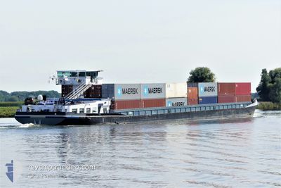
SPECTER
Cargo
Current Trip
| Time Travelled | 19 h, 16 mins |
|---|---|
| Remaining Time | 10 h, 16 mins |
| Distance Travelled | 51.13 nm |
| Remaining Distance | 64.93 nm |
| AVG Speed | 7 Knots |
| MAX Speed | 8.7 Knots |
| AVG Wind | 8.6 knots |
| MAX Wind | 10 knots |
| MIN Temp | 11.4°C / 52.52°F |
| MAX Temp | 17.3°C / 63.14°F |
| Draught | 2.5 m |
| Position Received | Now |
Current Position
| Longitude | 5.55547° |
|---|---|
| Latitude | 51.95609° |
| Status | Under way using engine |
| Speed | 6.3 Knots |
| Course | 122.2° |
| Area | North Sea |
| Station | T-AIS |
| Position Received | Now |
Info
Information
The current position of SPECTER is in North Sea with coordinates 51.95609° / 5.55547° as reported on 2024-05-27 12:45 by AIS to our vessel tracker app. The vessel's current speed is 6.3 Knots and is heading at the port of HENGELO. The estimated time of arrival as calculated by vessel tracking app is 2024-05-27 23:02 LT
The vessel SPECTER (MMSI: 244060233) is a Cargo It's sailing under the flag of [NL] Netherlands.
In this page you can find informations about the vessels current position, last detected port calls, and current voyage information. If the vessels is not in coverage by AIS you will find the latest position.
The current position of SPECTER is detected by our AIS receivers and we are not responsible for the reliability of the data. The last position was recorded while the vessel was in Coverage by the Ais receivers of our vessel tracking app.
The current draught of SPECTER as reported by AIS is 2.5 meters
Weather
| Temperature | 17.2°C / 62.96°F |
|---|---|
| Wind Speed | 8 knots |
| Direction | 243° WSW |
| Pressure | 1016.6 hPa |
| Humidity | 63.6 % |
| Cloud Coverage | 71 % |
Featured Company
Last Port Calls
| Port | Arrival | Departure | Time In Port |
|---|---|---|---|
| 2024-05-26 14:00 | 2024-05-26 17:30 | 3 h | |
| 2024-05-24 10:37 | 2024-05-26 12:03 | 2 d | |
| 2024-05-24 05:12 | 2024-05-24 10:32 | 5 h | |
| 2024-05-23 17:43 | 2024-05-24 03:47 | 10 h | |
| 2024-05-22 19:51 | 2024-05-23 03:14 | 7 h | |
| 2024-05-22 10:15 | 2024-05-22 15:08 | 4 h | |
| 2024-05-21 21:02 | 2024-05-22 04:04 | 7 h | |
| 2024-05-21 18:06 | 2024-05-21 18:44 | 37 m | |
| 2024-05-20 14:35 | 2024-05-21 03:23 | 12 h | |
| 2024-05-19 12:28 | 2024-05-20 12:36 | 1 d |
Most Visited Ports (Last year)
| Port | Arrivals | |
|---|---|---|
| 15 | ||
| 7 | ||
| 6 | ||
| 6 | ||
| 6 | ||
| 6 |
Last Trips
| Origin | Departure | Destination | Arrival | Distance | |
|---|---|---|---|---|---|
| 2024-05-26 14:03 | 2024-05-26 16:00 | 12.70 nm | |||
| 2024-05-24 12:32 | 2024-05-24 12:37 | 0.62 nm | |||
| 2024-05-24 05:47 | 2024-05-24 07:12 | 13.05 nm | |||
| 2024-05-23 05:14 | 2024-05-23 19:43 | 87.38 nm | |||
| 2024-05-22 17:08 | 2024-05-22 21:51 | 20.97 nm | |||
| 2024-05-22 06:04 | 2024-05-22 12:15 | 11.07 nm | |||
| 2024-05-21 20:44 | 2024-05-21 23:02 | 11.23 nm | |||
| 2024-05-21 05:23 | 2024-05-21 20:06 | 91.05 nm | |||
| 2024-05-20 14:36 | 2024-05-20 16:35 | 13.03 nm | |||
| 2024-05-17 13:16 | 2024-05-19 14:28 | 62.24 nm |
Events
| Time | Event | Details | Position / Dest | Info |
|---|---|---|---|---|
| 2024-05-27 11:47 | START Moving | 0.47 nm, North of MAURIK |
51.97713 / 5.41213
HENGELO
|
Speed: 5 kn Course: 71.5° |
| 2024-05-27 11:15 | STOP Moving | 0.5 nm, North West of MAURIK |
51.97518 / 5.40369
HENGELO
|
Speed: 0.2 kn Course: 511° |
| 2024-05-27 11:01 | Status Changed | Under way using engine Default |
51.97000 / 5.38667
HENGELO
|
Speed: 6 kn Course: 118° |
| 2024-05-27 11:01 | IN Coverage |
51.97000 / 5.38667
North Sea
|
Speed: 5 kn Course: 74° |
|
| 2024-05-27 10:19 | Status Changed | Default Under way using engine |
51.96333 / 5.28500
HENGELO
|
Speed: 5.9 kn Course: 86.6° |
| 2024-05-27 09:59 | OUT of Coverage |
51.97898 / 5.23917
North Sea
|
Speed: 5.9 kn Course: 86.6° |
|
| 2024-05-27 09:07 | START Moving | 1.4 nm, East of VIANEN |
51.99182 / 5.13525
HENGELO
|
Speed: 3.3 kn Course: 143.9° |
| 2024-05-27 08:42 | STOP Moving | 1.26 nm, East of VIANEN |
51.99535 / 5.13103
HENGELO
|
Speed: 0.3 kn Course: 511° |
| 2024-05-27 06:25 | START Moving | 0.97 nm, West of GROOT AMMERS |
51.91998 / 4.78928
HENGELO
|
Speed: 5.9 kn Course: 72.6° |
| 2024-05-27 06:20 | Status Changed | Under way using engine Moored |
51.92009 / 4.78658
HENGELO
|
Speed: 0.9 kn Course: 511° |