
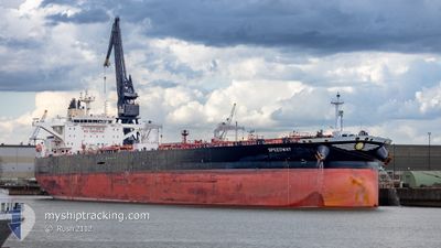
SPEEDWAY
Tanker
Current Trip
GOLA
| Time Travelled | 1 day |
|---|---|
| Remaining Time | --- |
| Distance Travelled | 117.68 nm |
| Remaining Distance | --- |
| AVG Speed | 8.1 Knots |
| MAX Speed | 12.3 Knots |
| AVG Wind | 12.5 knots |
| MAX Wind | 16.9 knots |
| MIN Temp | 24.3°C / 75.74°F |
| MAX Temp | 31.2°C / 88.16°F |
| Draught | 10.7 m |
| Position Received | 12 h, 14 m ago |
Current Position
| Longitude | -94.19552° |
|---|---|
| Latitude | 28.78315° |
| Status | Under way using engine |
| Speed | 1.3 Knots |
| Course | 253° |
| Area | Gulf of Mexico |
| Station | T-AIS |
| Position Received | 12 h, 14 m ago |
Info
Information
The current position of SPEEDWAY is in Gulf of Mexico with coordinates 28.78315° / -94.19552° as reported on 2024-05-09 08:56 by AIS to our vessel tracker app. The vessel's current speed is 1.3 Knots
The vessel SPEEDWAY (IMO: 9749506, MMSI: 241497000) is a Tanker It's sailing under the flag of [GR] Greece.
In this page you can find informations about the vessels current position, last detected port calls, and current voyage information. If the vessels is not in coverage by AIS you will find the latest position.
The current position of SPEEDWAY is detected by our AIS receivers and we are not responsible for the reliability of the data. The last position was recorded while the vessel was in Coverage by the Ais receivers of our vessel tracking app.
The current draught of SPEEDWAY as reported by AIS is 10.7 meters
Weather
| Temperature | 25.2°C / 77.36°F |
|---|---|
| Wind Speed | 13 knots |
| Direction | 131° SE |
| Pressure | 1006.2 hPa |
| Humidity | 95.6 % |
| Cloud Coverage | 89 % |
Featured Company
Last Port Calls
| Port | Arrival | Departure | Time In Port |
|---|---|---|---|
| 2024-05-06 17:57 | 2024-05-08 17:44 | 1 d | |
| 2024-04-24 02:31 | 2024-04-25 13:23 | 1 d | |
| 2024-03-09 04:27 | 2024-03-10 11:13 | 1 d |
Most Visited Ports (Last year)
| Port | Arrivals | |
|---|---|---|
| 3 | ||
| 2 | ||
| 1 | ||
| 1 | ||
| 1 | ||
| 1 |
Last Trips
| Origin | Departure | Destination | Arrival | Distance | |
|---|---|---|---|---|---|
| 2024-04-25 09:23 | 2024-05-06 12:57 | 2292.90 nm | |||
| 2024-03-10 12:13 | 2024-04-23 22:31 | 10120.69 nm | |||
| 2024-02-07 03:23 | 2024-03-09 05:27 | 7438.80 nm |
Events
| Time | Event | Details | Position / Dest | Info |
|---|---|---|---|---|
| 2024-05-09 09:27 | STOP Moving |
28.78580 / -94.20241
GOLA
|
Speed: 0.1 kn Course: 142° |
|
| 2024-05-09 09:02 | Status Changed | Default Under way using engine |
28.78411 / -94.19785
GOLA
|
Speed: 1.3 kn Course: 253° |
| 2024-05-09 08:56 | OUT of Coverage |
28.78315 / -94.19552
Gulf of Mexico
GOLA
|
Speed: 1.3 kn Course: 298.1° |
|
| 2024-05-09 08:55 | Status Changed | Under way using engine Default |
28.78294 / -94.19505
GOLA
|
Speed: 1.5 kn Course: 266° |
| 2024-05-09 08:38 | IN Coverage |
28.78297 / -94.19513
Gulf of Mexico
GOLA
|
Speed: 1.3 kn Course: 298.6° |
|
| 2024-05-09 07:55 | Status Changed | Default Under way using engine |
28.71770 / -94.16653
GOLA
|
Speed: 5.2 kn Course: 340.9° |
| 2024-05-09 07:46 | Status Changed | Under way using engine Default |
28.70666 / -94.16241
GOLA
|
Speed: 3.7 kn Course: 340° |
| 2024-05-09 07:46 | OUT of Coverage |
28.70666 / -94.16241
Gulf of Mexico
GOLA
|
Speed: 5.2 kn Course: 340.9° |
|
| 2024-05-09 07:02 | Status Changed | Default Under way using engine |
28.66922 / -94.14720
GOLA
|
Speed: 1.4 kn Course: 349° |
| 2024-05-09 06:54 | Status Changed | Under way using engine Default |
28.66710 / -94.14564
GOLA
|
Speed: 2.3 kn Course: 339° |