
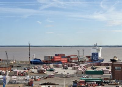
SPICA J
Container Ship
Current Trip
| Time Travelled | 19 h, 36 mins |
|---|---|
| Remaining Time | 22 h, 27 mins |
| Distance Travelled | 281.61 nm |
| Remaining Distance | 429.02 nm |
| AVG Speed | 14.1 Knots |
| MAX Speed | 15.5 Knots |
| AVG Wind | 12.5 knots |
| MAX Wind | 17.9 knots |
| MIN Temp | 14.2°C / 57.56°F |
| MAX Temp | 17.4°C / 63.32°F |
| Draught | 7.3 m |
| Position Received | 5 m ago |
Current Position
| Longitude | -5.88434° |
|---|---|
| Latitude | 47.89011° |
| Status | Under way using engine |
| Speed | 14.8 Knots |
| Course | 344.4° |
| Area | Celtic Sea |
| Station | T-AIS |
| Position Received | 5 m ago |
Info
Information
The current position of SPICA J is in Celtic Sea with coordinates 47.89011° / -5.88434° as reported on 2024-06-09 16:50 by AIS to our vessel tracker app. The vessel's current speed is 14.8 Knots and is heading at the port of DUBLIN. The estimated time of arrival as calculated by vessel tracking app is 2024-06-10 15:23 LT
The vessel SPICA J (IMO: 9355460, MMSI: 305115000) is a Container Ship that was built in 2007 ( 17 years old ). It's sailing under the flag of [AG] Antigua Barbuda.
In this page you can find informations about the vessels current position, last detected port calls, and current voyage information. If the vessels is not in coverage by AIS you will find the latest position.
The current position of SPICA J is detected by our AIS receivers and we are not responsible for the reliability of the data. The last position was recorded while the vessel was in Coverage by the Ais receivers of our vessel tracking app.
The current draught of SPICA J as reported by AIS is 7.3 meters
Weather
| Temperature | 14.1°C / 57.38°F |
|---|---|
| Wind Speed | 14 knots |
| Direction | 346° NNW |
| Pressure | 1017.6 hPa |
| Humidity | 69.4 % |
| Cloud Coverage | --- |
Featured Company
Last Port Calls
| Port | Arrival | Departure | Time In Port |
|---|---|---|---|
| 2024-06-08 06:35 | 2024-06-08 21:20 | 14 h | |
| 2024-06-05 08:01 | 2024-06-06 10:02 | 1 d | |
| 2024-06-03 15:59 | 2024-06-04 17:30 | 1 d | |
| 2024-05-31 18:08 | 2024-06-01 12:12 | 18 h | |
| 2024-05-28 19:12 | 2024-05-29 07:10 | 11 h | |
| 2024-05-27 09:38 | 2024-05-28 18:34 | 1 d | |
| 2024-05-27 03:11 | 2024-05-27 09:18 | 6 h | |
| 2024-05-25 15:35 | 2024-05-26 00:56 | 9 h | |
| 2024-05-23 21:19 | 2024-05-24 12:56 | 15 h | |
| 2024-05-22 09:57 | 2024-05-22 15:36 | 5 h |
Last Trips
| Origin | Departure | Destination | Arrival | Distance | |
|---|---|---|---|---|---|
| 2024-06-06 11:02 | 2024-06-08 08:35 | 699.71 nm | |||
| 2024-06-04 18:30 | 2024-06-05 09:01 | 119.70 nm | |||
| 2024-06-01 14:12 | 2024-06-03 16:59 | 618.17 nm | |||
| 2024-05-29 09:10 | 2024-05-31 20:08 | 798.46 nm | |||
| 2024-05-28 20:34 | 2024-05-28 21:12 | 2.59 nm | |||
| 2024-05-27 11:18 | 2024-05-27 11:38 | 2.02 nm | |||
| 2024-05-26 02:56 | 2024-05-27 05:11 | 263.63 nm | |||
| 2024-05-24 13:56 | 2024-05-25 17:35 | 110.43 nm | |||
| 2024-05-22 16:36 | 2024-05-23 22:19 | 374.45 nm | |||
| 2024-05-21 13:19 | 2024-05-22 10:57 | 327.18 nm |
Events
| Time | Event | Details | Position / Dest | Info |
|---|---|---|---|---|
| 2024-06-09 16:46 | Status Changed | Under way using engine Default |
47.87512 / -5.87807
IEDUB
|
Speed: 14.8 kn Course: 348° |
| 2024-06-09 16:31 | IN Coverage |
47.87512 / -5.87807
Celtic Sea
IEDUB
|
Speed: 14.8 kn Course: 344.5° |
|
| 2024-06-09 15:49 | Status Changed | Default Under way using engine |
47.64796 / -5.79441
IEDUB
|
Speed: 14.8 kn Course: 341.9° |
| 2024-06-09 15:19 | Change Sea Area | French part of the Celtic Sea French part of the Bay of Biscay |
47.52924 / -5.73186
Celtic Sea
IEDUB
|
Speed: 14.8 kn Course: 341.9° |
| 2024-06-09 15:19 | Status Changed | Under way using engine Default |
47.52924 / -5.73186
IEDUB
|
Speed: 14.6 kn Course: 343° |
| 2024-06-09 15:19 | IN Coverage |
47.52924 / -5.73186
Celtic Sea
IEDUB
|
Speed: 14.8 kn Course: 341.9° |
|
| 2024-06-09 15:19 | OUT of Coverage |
47.52924 / -5.73186
Celtic Sea
IEDUB
|
Speed: 14.8 kn Course: 341.9° |
|
| 2024-06-09 10:24 | Status Changed | Default Under way using engine |
46.41167 / -5.16167
IEDUB
|
Speed: 14.5 kn Course: 340.7° |
| 2024-06-09 10:18 | OUT of Coverage |
46.38968 / -5.15086
Bay of Biscay
IEDUB
|
Speed: 14.5 kn Course: 340.7° |
|
| 2024-06-09 10:18 | Status Changed | Under way using engine Default |
46.38849 / -5.15027
IEDUB
|
Speed: 14 kn Course: 341° |