
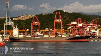
SPIL NIRMALA
Container Ship
Current Trip
TWKHH>>TWTXG
| Time Travelled | 6 h, 0 mins |
|---|---|
| Remaining Time | --- |
| Distance Travelled | 36.72 nm |
| Remaining Distance | --- |
| AVG Speed | 17.7 Knots |
| MAX Speed | 18.2 Knots |
| AVG Wind | 23.7 knots |
| MAX Wind | 28.4 knots |
| MIN Temp | 22.8°C / 73.04°F |
| MAX Temp | 24.4°C / 75.92°F |
| Draught | 10.4 m |
| Position Received | 1 d ago |
Current Position
| Longitude | 119.98587° |
|---|---|
| Latitude | 22.94107° |
| Status | Under way using engine |
| Speed | 16.7 Knots |
| Course | 345° |
| Area | South China Sea |
| Station | T-AIS |
| Position Received | 1 d ago |
Info
Information
The current position of SPIL NIRMALA is in South China Sea with coordinates 22.94107° / 119.98587° as reported on 2024-05-27 06:51 by AIS to our vessel tracker app. The vessel's current speed is 16.7 Knots
The vessel SPIL NIRMALA (IMO: 9367803, MMSI: 352978233) is a Container Ship that was built in 2008 ( 16 years old ). It's sailing under the flag of [PA] Panama.
In this page you can find informations about the vessels current position, last detected port calls, and current voyage information. If the vessels is not in coverage by AIS you will find the latest position.
The current position of SPIL NIRMALA is detected by our AIS receivers and we are not responsible for the reliability of the data. The last position was recorded while the vessel was in Coverage by the Ais receivers of our vessel tracking app.
The current draught of SPIL NIRMALA as reported by AIS is 10.4 meters
Weather
| Temperature | 25.2°C / 77.36°F |
|---|---|
| Wind Speed | 19 knots |
| Direction | 20° NNE |
| Pressure | 1006.2 hPa |
| Humidity | 79.1 % |
| Cloud Coverage | 60 % |
Featured Company
Last Port Calls
| Port | Arrival | Departure | Time In Port |
|---|---|---|---|
| 2024-05-27 21:28 | 2024-05-29 00:09 | 1 d | |
| 2024-05-26 14:04 | 2024-05-27 05:06 | 15 h | |
| 2024-05-18 08:09 | 2024-05-19 00:51 | 16 h | |
| 2024-05-16 11:04 | 2024-05-16 22:59 | 11 h | |
| 2024-05-15 02:51 | 2024-05-15 17:09 | 14 h | |
| 2024-05-05 21:37 | 2024-05-06 14:14 | 16 h | |
| 2024-05-04 21:31 | 2024-05-05 13:28 | 15 h | |
| 2024-04-27 07:46 | 2024-04-27 18:50 | 11 h | |
| 2024-04-25 10:14 | 2024-04-25 22:37 | 12 h | |
| 2024-04-24 01:15 | 2024-04-24 17:28 | 16 h |
Last Trips
| Origin | Departure | Destination | Arrival | Distance | |
|---|---|---|---|---|---|
| 2024-05-27 13:06 | 2024-05-28 05:28 | 147.69 nm | |||
| 2024-05-19 08:51 | 2024-05-26 22:04 | 2072.65 nm | |||
| 2024-05-17 06:59 | 2024-05-18 16:09 | 488.21 nm | |||
| 2024-05-16 01:09 | 2024-05-16 19:04 | 236.52 nm | |||
| 2024-05-06 22:14 | 2024-05-15 10:51 | 2363.03 nm | |||
| 2024-05-05 21:28 | 2024-05-06 05:37 | 127.96 nm | |||
| 2024-04-28 02:50 | 2024-05-05 05:31 | 2060.52 nm | |||
| 2024-04-26 06:37 | 2024-04-27 15:46 | 488.51 nm | |||
| 2024-04-25 01:28 | 2024-04-25 18:14 | 238.83 nm | |||
| 2024-04-16 01:54 | 2024-04-24 09:15 | 2334.83 nm |
Events
| Time | Event | Details | Position / Dest | Info |
|---|---|---|---|---|
| 2024-05-29 00:09 | PORT DEPARTURE |
|
24.29542 / 120.48943
TWKHH>>TWTXG
|
Speed: 8.7 kn Course: 291° |
| 2024-05-28 23:55 | START Moving |
24.27833 / 120.52333
[TW] TAICHUNG
|
Speed: 4 kn Course: -1° |
|
| 2024-05-27 22:07 | STOP Moving |
24.27695 / 120.52495
[TW] TAICHUNG
|
Speed: Course: 329° |
|
| 2024-05-27 21:28 | PORT ARRIVAL |
|
24.28702 / 120.51273
[TW] TAICHUNG
|
Speed: 8 kn Course: 79° |
| 2024-05-27 21:12 | START Moving | 3.19 nm, North West of TAICHUNG |
24.28667 / 120.47500
TWKHH>>TWTXG
|
Speed: 4 kn Course: -1° |
| 2024-05-27 20:48 | STOP Moving | 3.51 nm, North West of TAICHUNG |
24.28673 / 120.46747
TWKHH>>TWTXG
|
Speed: Course: 123° |
| 2024-05-27 20:23 | START Moving | 4.66 nm, North West of TAICHUNG |
24.28950 / 120.44445
TWKHH>>TWTXG
|
Speed: 5 kn Course: 145° |
| 2024-05-27 19:54 | STOP Moving | 5.43 nm, North West of TAICHUNG |
24.29948 / 120.43455
TWKHH>>TWTXG
|
Speed: 0.2 kn Course: 185° |
| 2024-05-27 06:57 | Status Changed | Default Under way using engine |
22.96880 / 119.97675
TWKHH>>TWTXG
|
Speed: 16.7 kn Course: 345° |
| 2024-05-27 06:51 | OUT of Coverage |
22.94107 / 119.98587
South China Sea
TWKHH>>TWTXG
|
Speed: 16.7 kn Course: 345° |