
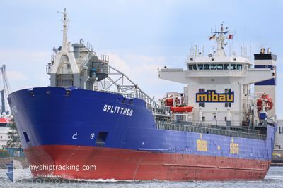
SPLITTNES
Self Discharging Bulk Carrier
Current Trip
| Time Travelled | 14 h, 23 mins |
|---|---|
| Remaining Time | --- |
| Distance Travelled | 160.84 nm |
| Remaining Distance | --- |
| AVG Speed | 11.8 Knots |
| MAX Speed | 14.3 Knots |
| AVG Wind | 10.5 knots |
| MAX Wind | 14 knots |
| MIN Temp | 12.6°C / 54.68°F |
| MAX Temp | 20.1°C / 68.18°F |
| Draught | 6.3 m |
| Position Received | 1 m ago |
Current Position
| Longitude | 6.24554° |
|---|---|
| Latitude | 55.99012° |
| Status | Under way using engine |
| Speed | 10.7 Knots |
| Course | 346.2° |
| Area | North Sea |
| Station | T-AIS |
| Position Received | 1 m ago |
Info
Information
The current position of SPLITTNES is in North Sea with coordinates 55.99012° / 6.24554° as reported on 2024-05-19 04:02 by AIS to our vessel tracker app. The vessel's current speed is 10.7 Knots and is heading at the port of JELSA. The estimated time of arrival as calculated by vessel tracking app is 2024-05-20 00:30 LT
The vessel SPLITTNES (IMO: 9101730, MMSI: 304219000) is a Self Discharging Bulk Carrier that was built in 1994 ( 30 years old ). It's sailing under the flag of [AG] Antigua Barbuda.
In this page you can find informations about the vessels current position, last detected port calls, and current voyage information. If the vessels is not in coverage by AIS you will find the latest position.
The current position of SPLITTNES is detected by our AIS receivers and we are not responsible for the reliability of the data. The last position was recorded while the vessel was in Coverage by the Ais receivers of our vessel tracking app.
The current draught of SPLITTNES as reported by AIS is 6.3 meters
Weather
| Temperature | 12.7°C / 54.86°F |
|---|---|
| Wind Speed | 10 knots |
| Direction | 40° NE |
| Pressure | 1013.4 hPa |
| Humidity | 83.8 % |
| Cloud Coverage | 7 % |
Featured Company
Last Port Calls
| Port | Arrival | Departure | Time In Port |
|---|---|---|---|
| 2024-05-17 19:55 | 2024-05-18 13:41 | 17 h | |
| 2024-05-12 16:07 | 2024-05-13 12:37 | 20 h | |
| 2024-05-06 11:38 | 2024-05-07 07:06 | 19 h | |
| 2024-04-29 20:44 | 2024-04-30 21:38 | 1 d | |
| 2024-04-24 05:22 | 2024-04-25 06:12 | 1 d | |
| 2024-04-21 20:48 | 2024-04-22 06:20 | 9 h | |
| 2024-04-18 21:24 | 2024-04-19 15:39 | 18 h | |
| 2024-04-13 21:03 | 2024-04-14 21:28 | 1 d | |
| 2024-04-11 13:31 | 2024-04-11 21:17 | 7 h | |
| 2024-04-07 15:35 | 2024-04-08 12:35 | 20 h |
Last Trips
| Origin | Departure | Destination | Arrival | Distance | |
|---|---|---|---|---|---|
| 2024-05-13 14:37 | 2024-05-17 21:55 | 814.96 nm | |||
| 2024-05-07 09:06 | 2024-05-12 18:07 | 818.81 nm | |||
| 2024-04-30 22:38 | 2024-05-06 13:38 | 835.10 nm | |||
| 2024-04-25 07:12 | 2024-04-29 21:44 | 861.07 nm | |||
| 2024-04-22 08:20 | 2024-04-24 06:22 | 424.24 nm | |||
| 2024-04-19 17:39 | 2024-04-21 22:48 | 404.74 nm | |||
| 2024-04-14 22:28 | 2024-04-18 23:24 | 816.71 nm | |||
| 2024-04-11 23:17 | 2024-04-13 22:03 | 429.43 nm | |||
| 2024-04-08 14:35 | 2024-04-11 15:31 | 558.85 nm | |||
| 2024-04-05 10:33 | 2024-04-07 17:35 | 519.62 nm |
Events
| Time | Event | Details | Position / Dest | Info |
|---|---|---|---|---|
| 2024-05-19 02:29 | Change Sea Area | Danish part of the North Sea German part of the North Sea |
55.71383 / 6.39791
North Sea
NOJEL
|
Speed: 11.2 kn Course: 342° |
| 2024-05-19 02:28 | Status Changed | Under way using engine Default |
55.71284 / 6.39848
NOJEL
|
Speed: 11.3 kn Course: 345° |
| 2024-05-19 02:28 | IN Coverage |
55.71383 / 6.39791
North Sea
NOJEL
|
Speed: 11.2 kn Course: 342° |
|
| 2024-05-19 00:22 | Status Changed | Default Under way using engine |
55.31499 / 6.59976
NOJEL
|
Speed: 12 kn Course: 344.3° |
| 2024-05-19 00:20 | OUT of Coverage |
55.30859 / 6.60293
North Sea
NOJEL
|
Speed: 12 kn Course: 344.3° |
|
| 2024-05-18 22:38 | Status Changed | Under way using engine Default |
54.99544 / 6.82595
NOJEL
|
Speed: 12.1 kn Course: 329° |
| 2024-05-18 22:34 | Status Changed | Default Under way using engine |
54.98435 / 6.83751
NOJEL
|
Speed: 12.1 kn Course: 327.5° |
| 2024-05-18 22:31 | Status Changed | Under way using engine Default |
54.97486 / 6.84802
NOJEL
|
Speed: 12 kn Course: 329° |
| 2024-05-18 22:10 | Status Changed | Default Under way using engine |
54.91544 / 6.91286
NOJEL
|
Speed: 12.1 kn Course: 327.8° |
| 2024-05-18 21:52 | Status Changed | Under way using engine Default |
54.86348 / 6.96976
NOJEL
|
Speed: 12 kn Course: 327° |