
SPRIT
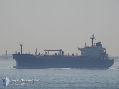
Oil/Chemical Tanker
Current Trip
| Time Travelled | --- |
|---|---|
| Remaining Time | --- |
| Distance Travelled | --- |
| Remaining Distance | --- |
| AVG Speed | --- |
| MAX Speed | --- |
| AVG Wind | --- |
| MAX Wind | --- |
| MIN Temp | --- |
| MAX Temp | --- |
| Draught | 7 m |
| Position Received | 1 m ago |
Current Position
| Longitude | 34.68323° |
|---|---|
| Latitude | 36.46869° |
| Status | Under way using engine |
| Speed | 0.2 Knots |
| Course | 142° |
| Area | Mediterranean Sea - Eastern Basin |
| Station | T-AIS |
| Position Received | 1 m ago |
Info
Information
The current position of SPRIT is in Mediterranean Sea - Eastern Basin with coordinates 36.46869° / 34.68323° as reported on 2024-06-27 13:39 by AIS to our vessel tracker app. The vessel's current speed is 0.2 Knots
The vessel SPRIT (IMO: 9248796, MMSI: 630001102) is a Oil/Chemical Tanker that was built in 2003 ( 21 years old ). It's sailing under the flag of [GW] Guinea-Bissau.
In this page you can find informations about the vessels current position, last detected port calls, and current voyage information. If the vessels is not in coverage by AIS you will find the latest position.
The current position of SPRIT is detected by our AIS receivers and we are not responsible for the reliability of the data. The last position was recorded while the vessel was in Coverage by the Ais receivers of our vessel tracking app.
The current draught of SPRIT as reported by AIS is 7 meters
Weather
| Temperature | 28.3°C / 82.94°F |
|---|---|
| Wind Speed | 10 knots |
| Direction | 203° SSW |
| Pressure | 1004.1 hPa |
| Humidity | 74.9 % |
| Cloud Coverage | --- |
Featured Company
Last Port Calls
| Port | Arrival | Departure | Time In Port |
|---|---|---|---|
| 2024-06-11 21:35 | |||
| 2024-06-07 22:26 | 2024-06-07 23:51 | 1 h | |
| 2024-05-21 08:34 | 2024-05-23 04:48 | 1 d | |
| 2024-04-18 21:16 |
Most Visited Ports (Last year)
| Port | Arrivals | |
|---|---|---|
| 3 | ||
| 2 |
Last Trips
| Origin | Departure | Destination | Arrival | Distance | |
|---|---|---|---|---|---|
| 2024-06-08 02:51 | 2024-06-12 00:35 | 442.11 nm | |||
| 2024-05-23 07:48 | 2024-06-08 01:26 | 2213.51 nm | |||
| 2024-04-19 00:16 | 2024-05-21 11:34 | 3093.82 nm |
Events
| Time | Event | Details | Position / Dest | Info |
|---|---|---|---|---|
| 2024-06-27 12:57 | STOP Moving | 19.76 nm, South of MERSIN |
36.46830 / 34.67940
FOR ORDER
|
Speed: 0.3 kn Course: 138° |
| 2024-06-27 12:55 | START Moving | 19.71 nm, South of MERSIN |
36.46908 / 34.68016
FOR ORDER
|
Speed: 42.7 kn Course: 45° |
| 2024-06-27 12:13 | STOP Moving | 19.69 nm, South of MERSIN |
36.46910 / 34.67518
FOR ORDER
|
Speed: 0.2 kn Course: 129° |
| 2024-06-27 12:11 | START Moving | 19.73 nm, South of MERSIN |
36.46843 / 34.67486
FOR ORDER
|
Speed: 10.5 kn Course: 2.9° |
| 2024-06-27 06:11 | IN Coverage |
36.46097 / 34.64280
Mediterranean Sea - Eastern Basin
|
Speed: Course: 62.3° |
|
| 2024-06-27 01:47 | OUT of Coverage |
36.45838 / 34.65507
Mediterranean Sea - Eastern Basin
|
Speed: Course: 279.1° |
|
| 2024-06-27 01:47 | IN Coverage |
36.45838 / 34.65507
Mediterranean Sea - Eastern Basin
|
Speed: Course: 279.1° |
|
| 2024-06-26 20:06 | OUT of Coverage |
36.49050 / 34.76502
Mediterranean Sea - Eastern Basin
|
Speed: 0.3 kn Course: 332.7° |
|
| 2024-06-26 20:05 | IN Coverage |
36.49041 / 34.76509
Mediterranean Sea - Eastern Basin
|
Speed: 0.3 kn Course: 333.3° |
|
| 2024-06-26 18:34 | OUT of Coverage |
36.48259 / 34.76912
Mediterranean Sea - Eastern Basin
|
Speed: Course: 345.5° |