
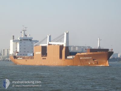
SPUIGRACHT
General Cargo
Current Trip
| Time Travelled | 12 days |
|---|---|
| Remaining Time | 6 h, 34 mins |
| Distance Travelled | 4013.78 nm |
| Remaining Distance | 89.32 nm |
| AVG Speed | 14.2 Knots |
| MAX Speed | 18.2 Knots |
| AVG Wind | 11.5 knots |
| MAX Wind | 34 knots |
| MIN Temp | 11.3°C / 52.34°F |
| MAX Temp | 25°C / 77°F |
| Draught | 10.8 m |
| Position Received | 2 m ago |
Current Position
| Longitude | -76.17670° |
|---|---|
| Latitude | 37.78696° |
| Status | Under way using engine |
| Speed | 13.3 Knots |
| Course | 6.5° |
| Area | North Atlantic Ocean |
| Station | T-AIS |
| Position Received | 2 m ago |
Info
Information
The current position of SPUIGRACHT is in North Atlantic Ocean with coordinates 37.78696° / -76.17670° as reported on 2024-06-01 04:32 by AIS to our vessel tracker app. The vessel's current speed is 13.3 Knots and is heading at the port of BALTIMORE. The estimated time of arrival as calculated by vessel tracking app is 2024-06-01 11:08 LT
The vessel SPUIGRACHT (IMO: 9202534, MMSI: 245261000) is a General Cargo that was built in 2001 ( 23 years old ). It's sailing under the flag of [NL] Netherlands.
In this page you can find informations about the vessels current position, last detected port calls, and current voyage information. If the vessels is not in coverage by AIS you will find the latest position.
The current position of SPUIGRACHT is detected by our AIS receivers and we are not responsible for the reliability of the data. The last position was recorded while the vessel was in Coverage by the Ais receivers of our vessel tracking app.
The current draught of SPUIGRACHT as reported by AIS is 10.8 meters
Weather
| Temperature | 16.4°C / 61.52°F |
|---|---|
| Wind Speed | 6 knots |
| Direction | 267° W |
| Pressure | 1023.7 hPa |
| Humidity | 54.8 % |
| Cloud Coverage | --- |
Featured Company
Last Port Calls
| Port | Arrival | Departure | Time In Port |
|---|---|---|---|
| 2024-05-18 17:08 | 2024-05-19 19:18 | 1 d | |
| 2024-05-12 12:40 | 2024-05-15 12:45 | 3 d | |
| 2024-05-03 16:45 | 2024-05-04 13:28 | 20 h | |
| 2024-04-28 09:38 | 2024-04-30 20:33 | 2 d | |
| 2024-04-21 07:18 | 2024-04-22 18:26 | 1 d | |
| 2024-04-09 12:29 | 2024-04-10 18:25 | 1 d | |
| 2024-04-01 21:20 | 2024-04-08 19:44 | 6 d |
Most Visited Ports (Last year)
| Port | Arrivals | |
|---|---|---|
| 6 | ||
| 5 | ||
| 4 | ||
| 3 | ||
| 2 | ||
| 2 |
Last Trips
| Origin | Departure | Destination | Arrival | Distance | |
|---|---|---|---|---|---|
| 2024-05-15 15:45 | 2024-05-18 19:08 | 1190.78 nm | |||
| 2024-05-04 15:28 | 2024-05-12 15:40 | 1295.08 nm | |||
| 2024-04-30 22:33 | 2024-05-03 18:45 | 998.48 nm | |||
| 2024-04-22 19:26 | 2024-04-28 11:38 | 1137.88 nm | |||
| 2024-04-10 14:25 | 2024-04-21 08:18 | 3618.54 nm | |||
| 2024-04-08 15:44 | 2024-04-09 08:29 | 202.57 nm | |||
| 2024-03-18 22:00 | 2024-04-01 17:20 | 4332.52 nm |
Events
| Time | Event | Details | Position / Dest | Info |
|---|---|---|---|---|
| 2024-06-01 00:45 | ETA Changed | 2025/05/31 23:59 2024/06/01 20:00 |
37.03042 / -76.05900
USBAL
|
Speed: 13.7 kn Course: 322.6° |
| 2024-05-31 23:48 | Status Changed | Under way using engine Default |
36.90777 / -75.90249
USBAL
|
Speed: 9.9 kn Course: 320° |
| 2024-05-31 23:44 | Status Changed | Default Under way using engine |
36.89902 / -75.89332
USBAL
|
Speed: 10 kn Course: 319° |
| 2024-05-31 23:37 | Change Sea Area | United States part of the North Atlantic Ocean United Kingdom part of the Celtic Sea |
36.88414 / -75.87733
North Atlantic Ocean
USBAL
|
Speed: 10 kn Course: 313° |
| 2024-05-31 23:37 | Status Changed | Under way using engine Default |
36.88414 / -75.87733
USBAL
|
Speed: 10.2 kn Course: 304° |
| 2024-05-31 23:20 | IN Coverage |
36.88414 / -75.87733
North Atlantic Ocean
USBAL
|
Speed: 10 kn Course: 313° |
|
| 2024-05-22 16:43 | Status Changed | Default Under way using engine |
49.37745 / -5.44074
USBAL
|
Speed: 13.6 kn Course: 242.1° |
| 2024-05-22 16:37 | Status Changed | Under way using engine Default |
49.38784 / -5.41055
USBAL
|
Speed: 13.4 kn Course: 242° |
| 2024-05-22 16:37 | OUT of Coverage |
49.38784 / -5.41055
Celtic Sea
USBAL
|
Speed: 13.6 kn Course: 242.1° |
|
| 2024-05-22 16:10 | Detected in Sea | United Kingdom part of the Celtic Sea |
49.43351 / -5.27591
Celtic Sea
USBAL
|
Speed: 14 kn Course: 242.4° |