
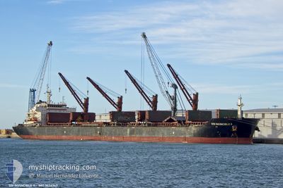
SSI INVINCIBLE II
Bulk Carrier
Current Trip
| Time Travelled | 5 days |
|---|---|
| Remaining Time | --- |
| Distance Travelled | 290.06 nm |
| Remaining Distance | --- |
| AVG Speed | 8.7 Knots |
| MAX Speed | 8.7 Knots |
| AVG Wind | 3.5 knots |
| MAX Wind | 15 knots |
| MIN Temp | 19.2°C / 66.56°F |
| MAX Temp | 26.6°C / 79.88°F |
| Draught | 9.3 m |
| Position Received | 3 h, 13 m ago |
Current Position
| Longitude | 28.77541° |
|---|---|
| Latitude | 44.14156° |
| Status | At anchor |
| Speed | |
| Course | 82° |
| Area | Black Sea |
| Station | T-AIS |
| Position Received | 3 h, 13 m ago |
Info
Information
The current position of SSI INVINCIBLE II is in Black Sea with coordinates 44.14156° / 28.77541° as reported on 2024-06-06 07:36 by AIS to our vessel tracker app. The vessel's current speed is 0 Knots
The vessel SSI INVINCIBLE II (IMO: 9434747, MMSI: 538005208) is a Bulk Carrier that was built in 2013 ( 11 years old ). It's sailing under the flag of [MH] Marshall Is.
In this page you can find informations about the vessels current position, last detected port calls, and current voyage information. If the vessels is not in coverage by AIS you will find the latest position.
The current position of SSI INVINCIBLE II is detected by our AIS receivers and we are not responsible for the reliability of the data. The last position was recorded while the vessel was in Coverage by the Ais receivers of our vessel tracking app.
The current draught of SSI INVINCIBLE II as reported by AIS is 9.3 meters
Weather
| Temperature | 22.1°C / 71.78°F |
|---|---|
| Wind Speed | 11 knots |
| Direction | 168° SSE |
| Pressure | 1015.8 hPa |
| Humidity | 74.3 % |
| Cloud Coverage | 70 % |
Featured Company
Last Trips
| Origin | Departure | Destination | Arrival | Distance | |
|---|---|---|---|---|---|
| 2024-05-27 20:41 | 2024-05-29 00:35 | 83.01 nm | |||
| 2024-04-20 03:52 | 2024-05-20 20:14 | 8429.73 nm | |||
| 2024-04-20 03:52 | 2024-05-17 07:26 | 7524.47 nm | |||
| 2024-04-14 17:33 | 2024-04-15 09:55 | 184.92 nm | |||
| 2024-04-02 16:55 | 2024-04-11 15:41 | 678.99 nm |
Events
| Time | Event | Details | Position / Dest | Info |
|---|---|---|---|---|
| 2024-06-06 07:39 | Status Changed | Default At anchor |
44.14159 / 28.77547
ROCND
|
Speed: Course: 82° |
| 2024-06-06 07:36 | OUT of Coverage |
44.14156 / 28.77541
Black Sea
|
Speed: Course: 353.6° |
|
| 2024-06-06 07:21 | Status Changed | At anchor Default |
44.14105 / 28.77574
ROCND
|
Speed: 0.2 kn Course: 49° |
| 2024-06-06 07:09 | IN Coverage |
44.14105 / 28.77574
Black Sea
|
Speed: 0.2 kn Course: 324.6° |
|
| 2024-06-06 05:57 | OUT of Coverage |
44.14000 / 28.77742
Black Sea
|
Speed: 0.2 kn Course: 265.8° |
|
| 2024-06-06 05:05 | ETA Changed | 2024/06/03 02:00 2024/06/01 23:00 |
44.14137 / 28.78008
ROCND
|
Speed: 0.1 kn Course: 292° |
| 2024-06-06 04:57 | IN Coverage |
44.14134 / 28.78012
Black Sea
|
Speed: Course: 166.6° |
|
| 2024-06-05 20:08 | OUT of Coverage |
44.14369 / 28.77785
Black Sea
|
Speed: 0.1 kn Course: 42.7° |
|
| 2024-06-05 20:08 | IN Coverage |
44.14369 / 28.77785
Black Sea
|
Speed: 0.1 kn Course: 42.7° |
|
| 2024-06-04 21:29 | OUT of Coverage |
44.14261 / 28.77491
Black Sea
|
Speed: 0.1 kn Course: 162.9° |