
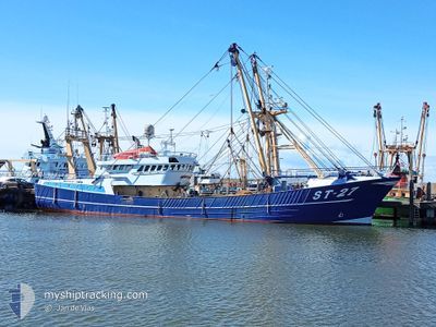
ST27 JACOB GRIETJE
Trawler
Current Trip
FISHING GROUNDS
| Time Travelled | 2 days |
|---|---|
| Remaining Time | --- |
| Distance Travelled | 13.80 nm |
| Remaining Distance | --- |
| AVG Speed | 9.3 Knots |
| MAX Speed | 11.7 Knots |
| AVG Wind | 17 knots |
| MAX Wind | 17 knots |
| MIN Temp | 14.5°C / 58.1°F |
| MAX Temp | 14.7°C / 58.46°F |
| Draught | 5 m |
| Position Received | 2 d ago |
Current Position
| Longitude | 4.48814° |
|---|---|
| Latitude | 52.94952° |
| Status | Engaged in Fishing |
| Speed | 11.7 Knots |
| Course | 308.7° |
| Area | North Sea |
| Station | T-AIS |
| Position Received | 2 d ago |
Info
Information
The current position of ST27 JACOB GRIETJE is in North Sea with coordinates 52.94952° / 4.48814° as reported on 2024-06-17 01:38 by AIS to our vessel tracker app. The vessel's current speed is 11.7 Knots
The vessel ST27 JACOB GRIETJE (IMO: 9021502, MMSI: 211411630) is a Trawler that was built in 1991 ( 33 years old ). It's sailing under the flag of [DE] Germany.
In this page you can find informations about the vessels current position, last detected port calls, and current voyage information. If the vessels is not in coverage by AIS you will find the latest position.
The current position of ST27 JACOB GRIETJE is detected by our AIS receivers and we are not responsible for the reliability of the data. The last position was recorded while the vessel was in Coverage by the Ais receivers of our vessel tracking app.
The current draught of ST27 JACOB GRIETJE as reported by AIS is 5 meters
Weather
| Temperature | 14.7°C / 58.46°F |
|---|---|
| Wind Speed | 17 knots |
| Direction | 208° SSW |
| Pressure | 1006.4 hPa |
| Humidity | 83 % |
| Cloud Coverage | 99 % |
Featured Company
Last Port Calls
| Port | Arrival | Departure | Time In Port |
|---|---|---|---|
| 2024-06-14 01:21 | 2024-06-17 00:11 | 2 d | |
| 2024-06-07 12:26 | 2024-06-10 00:03 | 2 d | |
| 2024-05-31 08:21 | 2024-06-03 00:59 | 2 d | |
| 2024-05-24 18:28 | 2024-05-26 23:59 | 2 d | |
| 2024-05-16 22:56 | 2024-05-20 20:17 | 3 d | |
| 2024-05-10 16:26 | 2024-05-13 00:14 | 2 d | |
| 2024-05-03 12:03 | 2024-05-06 00:30 | 2 d | |
| 2024-04-26 18:12 | 2024-04-29 00:10 | 2 d | |
| 2024-04-10 13:54 | 2024-04-22 14:05 | 12 d | |
| 2024-04-05 19:52 | 2024-04-07 23:52 | 2 d |
Last Trips
| Origin | Departure | Destination | Arrival | Distance | |
|---|---|---|---|---|---|
| 2024-06-10 02:03 | 2024-06-14 03:21 | 34.72 nm | |||
| 2024-06-03 02:59 | 2024-06-07 14:26 | 142.14 nm | |||
| 2024-05-27 01:59 | 2024-05-31 10:21 | 25.15 nm | |||
| 2024-05-20 22:17 | 2024-05-24 20:28 | 25.79 nm | |||
| 2024-05-13 02:14 | 2024-05-17 00:56 | 39.10 nm | |||
| 2024-05-06 02:30 | 2024-05-10 18:26 | 115.96 nm | |||
| 2024-04-29 02:10 | 2024-05-03 14:03 | 55.01 nm | |||
| 2024-04-22 16:05 | 2024-04-26 20:12 | 85.72 nm | |||
| 2024-04-08 01:52 | 2024-04-10 15:54 | 110.38 nm | |||
| 2024-04-01 22:19 | 2024-04-05 21:52 | 227.23 nm |
Events
| Time | Event | Details | Position / Dest | Info |
|---|---|---|---|---|
| 2024-06-17 01:38 | OUT of Coverage |
52.94952 / 4.48814
North Sea
|
Speed: 11.7 kn Course: 308.7° |
|
| 2024-06-17 00:11 | PORT DEPARTURE |
|
52.96690 / 4.78723
FISHING GROUNDS
|
Speed: 6.5 kn Course: 357° |
| 2024-06-17 00:01 | START Moving |
52.95365 / 4.78193
[NL] DEN HELDER
|
Speed: 4.4 kn Course: 319° |
|
| 2024-06-16 11:14 | IN Coverage |
52.95195 / 4.78346
North Sea
[NL] DEN HELDER
|
Speed: Course: 226.9° |
|
| 2024-06-16 09:39 | OUT of Coverage |
52.95200 / 4.78350
North Sea
[NL] DEN HELDER
|
Speed: Course: 226.9° |
|
| 2024-06-14 01:21 | STOP Moving |
52.95199 / 4.78343
[NL] DEN HELDER
|
Speed: Course: 137° |
|
| 2024-06-14 01:21 | PORT ARRIVAL |
|
52.95199 / 4.78343
[NL] DEN HELDER
|
Speed: 2.9 kn Course: 137° |
| 2024-06-14 00:21 | Destination Changed | FISHING GROUNDS NIEUWE DIEP |
52.90584 / 4.64063
FISHING GROUNDS
|
Speed: 10.5 kn Course: 67.1° |
| 2024-06-14 00:01 | IN Coverage |
52.91365 / 4.55002
North Sea
|
Speed: 10.9 kn Course: 113.4° |
|
| 2024-06-10 01:31 | OUT of Coverage |
52.99546 / 4.44396
North Sea
|
Speed: 10.2 kn Course: 319.6° |