
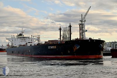
STAMOS
Crude Oil Tanker
Current Trip
| Time Travelled | 57 days |
|---|---|
| Remaining Time | --- |
| Distance Travelled | 6577.90 nm |
| Remaining Distance | --- |
| AVG Speed | 9.7 Knots |
| MAX Speed | 20.5 Knots |
| AVG Wind | 13 knots |
| MAX Wind | 28 knots |
| MIN Temp | 10.4°C / 50.72°F |
| MAX Temp | 26.2°C / 79.16°F |
| Draught | 8 m |
| Position Received | 1 m ago |
Current Position
| Longitude | 2.06011° |
|---|---|
| Latitude | 52.31211° |
| Status | Restricted manoeuverability |
| Speed | |
| Course | 6° |
| Area | North Sea |
| Station | T-AIS |
| Position Received | 1 m ago |
Info
Information
The current position of STAMOS is in North Sea with coordinates 52.31211° / 2.06011° as reported on 2024-06-03 04:50 by AIS to our vessel tracker app. The vessel's current speed is 0 Knots and is heading at the port of SOUTHWOLD. The estimated time of arrival as calculated by vessel tracking app is 2024-06-01 23:00 LT
The vessel STAMOS (IMO: 9592276, MMSI: 248148000) is a Crude Oil Tanker that was built in 2012 ( 12 years old ). It's sailing under the flag of [MT] Malta.
In this page you can find informations about the vessels current position, last detected port calls, and current voyage information. If the vessels is not in coverage by AIS you will find the latest position.
The current position of STAMOS is detected by our AIS receivers and we are not responsible for the reliability of the data. The last position was recorded while the vessel was in Coverage by the Ais receivers of our vessel tracking app.
The current draught of STAMOS as reported by AIS is 8 meters
Weather
| Temperature | 13°C / 55.4°F |
|---|---|
| Wind Speed | 8 knots |
| Direction | 232° SW |
| Pressure | 1021.1 hPa |
| Humidity | 89.1 % |
| Cloud Coverage | 95 % |
Featured Company
Most Visited Ports (Last year)
| Port | Arrivals | |
|---|---|---|
| 2 | ||
| 1 | ||
| 1 | ||
| 1 | ||
| 1 | ||
| 1 |
Events
| Time | Event | Details | Position / Dest | Info |
|---|---|---|---|---|
| 2024-06-02 17:13 | STOP Moving | 13.81 nm, East of SOUTHWOLD |
52.31198 / 2.05834
GB SWD
|
Speed: 0.3 kn Course: 35° |
| 2024-06-02 09:35 | START Moving | 4.68 nm, South East of LOWESTOFT |
52.40468 / 1.79929
GB SWD
|
Speed: 3.2 kn Course: 120° |
| 2024-06-02 08:53 | STOP Moving | 4.82 nm, South East of LOWESTOFT |
52.40092 / 1.79569
GB SWD
|
Speed: 0.3 kn Course: 293° |
| 2024-06-02 06:56 | Status Changed | Restricted manoeuverability At anchor |
52.42101 / 1.82861
GB SWD
|
Speed: 3.7 kn Course: 112° |
| 2024-06-02 05:24 | START Moving | 6.27 nm, North East of SOUTHWOLD |
52.37657 / 1.83421
GB SWD
|
Speed: 3.1 kn Course: 357° |
| 2024-06-02 02:05 | Status Changed | At anchor Default |
52.37296 / 1.83398
GB SWD
|
Speed: 0.4 kn Course: 358° |
| 2024-06-02 02:02 | Status Changed | Default At anchor |
52.37282 / 1.83492
GB SWD
|
Speed: 0.2 kn Course: 4° |
| 2024-06-01 23:20 | Status Changed | At anchor Under way using engine |
52.37675 / 1.83790
GB SWD
|
Speed: 0.6 kn Course: 242° |
| 2024-06-01 23:18 | Status Changed | Under way using engine At anchor |
52.37671 / 1.83835
GB SWD
|
Speed: 0.5 kn Course: 245° |
| 2024-06-01 23:17 | Status Changed | At anchor Under way using engine |
52.37680 / 1.83823
GB SWD
|
Speed: 0.3 kn Course: 242° |