
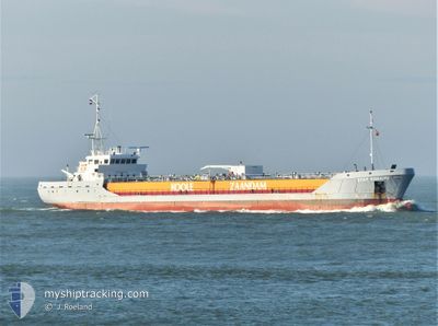
STAR BONAIRE
Edible Oil Tanker
Current Trip
| Trip Time | 17 h, 5 mins |
|---|---|
| Trip Distance | 169.92 nm |
| AVG Speed | 9.6 Knots |
| MAX Speed | 12.1 Knots |
| Draught | 5.5 m |
| AVG Wind | 11.7 knots |
| MAX Wind | 20 knots |
| MIN Temp | 12.2°C / 53.96°F |
| MAX Temp | 15.7°C / 60.26°F |
| Position Received | 4 m ago |
Current Position
| Longitude | 0.25433° |
|---|---|
| Latitude | 51.46867° |
| Status | Moored |
| Speed | |
| Course | 124° |
| Area | North Sea |
| Station | T-AIS |
| Position Received | 4 m ago |
Info
Information
The current position of STAR BONAIRE is in North Sea with coordinates 51.46867° / 0.25433° as reported on 2024-05-27 14:41 by AIS to our vessel tracker app. The vessel's current speed is 0 Knots and is currently inside the port of PURFLEET.
The vessel STAR BONAIRE (IMO: 9148453, MMSI: 246359000) is a Edible Oil Tanker that was built in 1997 ( 27 years old ). It's sailing under the flag of [NL] Netherlands.
In this page you can find informations about the vessels current position, last detected port calls, and current voyage information. If the vessels is not in coverage by AIS you will find the latest position.
The current position of STAR BONAIRE is detected by our AIS receivers and we are not responsible for the reliability of the data. The last position was recorded while the vessel was in Coverage by the Ais receivers of our vessel tracking app.
The current draught of STAR BONAIRE as reported by AIS is 5.5 meters
Weather
| Temperature | 15.9°C / 60.62°F |
|---|---|
| Wind Speed | 11 knots |
| Direction | 220° SW |
| Pressure | 1014.3 hPa |
| Humidity | 57.5 % |
| Cloud Coverage | 100 % |
Featured Company
Last Port Calls
| Port | Arrival | Departure | Time In Port |
|---|---|---|---|
| 2024-05-27 11:13 | |||
| 2024-05-26 10:15 | 2024-05-26 18:08 | 7 h | |
| 2024-05-25 14:56 | 2024-05-26 09:55 | 18 h | |
| 2024-05-25 03:04 | 2024-05-25 14:06 | 11 h | |
| 2024-05-23 07:48 | 2024-05-24 10:44 | 1 d | |
| 2024-05-21 22:36 | 2024-05-22 14:40 | 16 h | |
| 2024-05-20 11:46 | 2024-05-21 21:26 | 1 d | |
| 2024-05-16 21:54 | 2024-05-17 21:02 | 23 h | |
| 2024-05-13 17:38 | 2024-05-14 02:31 | 8 h | |
| 2024-05-12 13:46 | 2024-05-13 16:22 | 1 d |
Most Visited Ports (Last year)
| Port | Arrivals | |
|---|---|---|
| 24 | ||
| 22 | ||
| 20 | ||
| 19 | ||
| 18 | ||
| 11 |
Last Trips
| Origin | Departure | Destination | Arrival | Distance | |
|---|---|---|---|---|---|
| 2024-05-26 20:08 | 2024-05-27 12:13 | 169.92 nm | |||
| 2024-05-26 11:55 | 2024-05-26 12:15 | 0.49 nm | |||
| 2024-05-25 16:06 | 2024-05-25 16:56 | 10.10 nm | |||
| 2024-05-24 11:44 | 2024-05-25 05:04 | 158.79 nm | |||
| 2024-05-22 16:40 | 2024-05-23 08:48 | 171.20 nm | |||
| 2024-05-21 23:26 | 2024-05-22 00:36 | 9.89 nm | |||
| 2024-05-17 22:02 | 2024-05-20 13:46 | 756.35 nm | |||
| 2024-05-14 04:31 | 2024-05-16 22:54 | 745.11 nm | |||
| 2024-05-13 18:22 | 2024-05-13 19:38 | 10.24 nm | |||
| 2024-05-09 22:48 | 2024-05-12 15:46 | 402.06 nm |
Events
| Time | Event | Details | Position / Dest | Info |
|---|---|---|---|---|
| 2024-05-27 12:37 | Status Changed | Moored Under way using engine |
51.46867 / .25433
[GB] PURFLEET
|
Speed: Course: 124° |
| 2024-05-27 11:19 | STOP Moving |
51.46808 / .25278
[GB] PURFLEET
|
Speed: 0.3 kn Course: 106° |
|
| 2024-05-27 11:13 | PORT ARRIVAL |
|
51.46677 / .25710
[GB] PURFLEET
|
Speed: 2.8 kn Course: 289° |
| 2024-05-27 03:22 | Status Changed | Under way using engine Default |
51.63683 / 1.96070
PURFLEET
|
Speed: 8.5 kn Course: 234° |
| 2024-05-27 03:10 | IN Coverage |
51.63683 / 1.96070
North Sea
PURFLEET
|
Speed: 8.7 kn Course: 234.3° |
|
| 2024-05-27 01:51 | Status Changed | Default Under way using engine |
51.77410 / 2.25655
PURFLEET
|
Speed: 9.6 kn Course: 230.8° |
| 2024-05-27 01:49 | Status Changed | Under way using engine Default |
51.77660 / 2.26173
PURFLEET
|
Speed: 9 kn Course: 232° |
| 2024-05-27 01:49 | OUT of Coverage |
51.77660 / 2.26173
North Sea
PURFLEET
|
Speed: 9.6 kn Course: 230.8° |
|
| 2024-05-27 01:43 | Status Changed | Default Under way using engine |
51.78667 / 2.28500
PURFLEET
|
Speed: 9.9 kn Course: 231.1° |
| 2024-05-27 00:27 | Change Sea Area | United Kingdom part of the North Sea Dutch part of the North Sea |
51.91470 / 2.56788
North Sea
PURFLEET
|
Speed: 10.8 kn Course: 234.7° |