
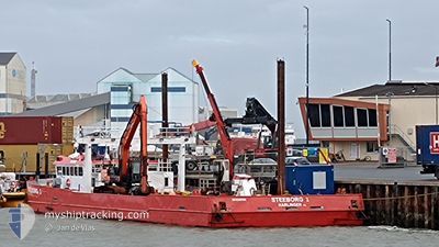
STEEBORG 1
Dredging or underwater ops
Current Trip
NOORDERSPRUIT
| Time Travelled | 15 days |
|---|---|
| Remaining Time | --- |
| Distance Travelled | 21.24 nm |
| Remaining Distance | --- |
| AVG Speed | 5.6 Knots |
| MAX Speed | 7.2 Knots |
| AVG Wind | 14.5 knots |
| MAX Wind | 26 knots |
| MIN Temp | 10.3°C / 50.54°F |
| MAX Temp | 18°C / 64.4°F |
| Draught | 0.8 m |
| Position Received | 1 m ago |
Current Position
| Longitude | 5.83887° |
|---|---|
| Latitude | 53.43598° |
| Status | Restricted manoeuverability |
| Speed | 0.1 Knots |
| Course | 226° |
| Area | North Sea |
| Station | T-AIS |
| Position Received | 1 m ago |
Info
Information
The current position of STEEBORG 1 is in North Sea with coordinates 53.43598° / 5.83887° as reported on 2024-06-26 00:59 by AIS to our vessel tracker app. The vessel's current speed is 0.1 Knots
The vessel STEEBORG 1 (MMSI: 244870150) is a Dredging or underwater ops It's sailing under the flag of [NL] Netherlands.
In this page you can find informations about the vessels current position, last detected port calls, and current voyage information. If the vessels is not in coverage by AIS you will find the latest position.
The current position of STEEBORG 1 is detected by our AIS receivers and we are not responsible for the reliability of the data. The last position was recorded while the vessel was in Coverage by the Ais receivers of our vessel tracking app.
The current draught of STEEBORG 1 as reported by AIS is 0.8 meters
Weather
| Temperature | 17.7°C / 63.86°F |
|---|---|
| Wind Speed | 12 knots |
| Direction | 53° NE |
| Pressure | 1014.9 hPa |
| Humidity | 91.9 % |
| Cloud Coverage | --- |
Featured Company
Last Port Calls
| Port | Arrival | Departure | Time In Port |
|---|---|---|---|
| 2024-06-10 11:06 | 2024-06-10 13:10 | 2 h | |
| 2024-05-27 10:05 | 2024-05-28 11:59 | 1 d | |
| 2024-05-13 11:43 | 2024-05-14 14:53 | 1 d | |
| 2024-04-29 14:09 | 2024-04-30 16:44 | 1 d | |
| 2024-04-21 11:59 | |||
| 2024-04-01 14:38 | 2024-04-04 09:12 | 2 d |
Most Visited Ports (Last year)
| Port | Arrivals | |
|---|---|---|
| 15 | ||
| 13 | ||
| 6 |
Last Trips
| Origin | Departure | Destination | Arrival | Distance | |
|---|---|---|---|---|---|
| 2024-05-28 13:59 | 2024-06-10 13:06 | 19.12 nm | |||
| 2024-05-14 16:53 | 2024-05-27 12:05 | 3.63 nm | |||
| 2024-04-30 18:44 | 2024-05-13 13:43 | 5.18 nm | |||
| 2024-04-21 13:59 | 2024-04-29 16:09 | 2.67 nm | |||
| 2024-03-19 14:29 | 2024-04-01 16:38 | 3.58 nm |
Events
| Time | Event | Details | Position / Dest | Info |
|---|---|---|---|---|
| 2024-06-25 10:27 | Status Changed | Restricted manoeuverability Under way using engine |
53.43603 / 5.83820
NOORDERSPRUIT
|
Speed: Course: 229° |
| 2024-06-25 10:01 | STOP Moving | 3.27 nm, East of AMELAND |
53.43601 / 5.83819
NOORDERSPRUIT
|
Speed: Course: 224° |
| 2024-06-25 09:53 | ETA Changed | 2024/06/25 13:00 2025/05/10 17:00 |
53.43244 / 5.84946
NOORDERSPRUIT
|
Speed: 6.4 kn Course: 328.3° |
| 2024-06-25 09:23 | START Moving | 5.28 nm, South East of AMELAND |
53.39782 / 5.87952
NOORDERSPRUIT
|
Speed: 5.5 kn Course: 36.9° |
| 2024-06-25 09:21 | Status Changed | Under way using engine Moored |
53.39569 / 5.87767
NOORDERSPRUIT
|
Speed: Course: 325° |
| 2024-06-25 09:15 | Destination Changed | NOORDERSPRUIT HOLWERD |
53.39545 / 5.87795
NOORDERSPRUIT
|
Speed: Course: 325° |
| 2024-06-25 09:14 | IN Coverage |
53.39545 / 5.87795
North Sea
|
Speed: Course: 325° |
|
| 2024-06-24 14:26 | Destination Changed | HOLWERD AMELAND |
53.43451 / 5.83319
HOLWERD
|
Speed: 0.7 kn Course: 228° |
| 2024-06-24 12:25 | Destination Changed | AMELAND NOORDER SPRUIT |
53.43451 / 5.83319
AMELAND
|
Speed: 0.7 kn Course: 228° |
| 2024-06-22 08:28 | OUT of Coverage |
53.43451 / 5.83319
North Sea
|
Speed: 0.7 kn Course: 228° |