
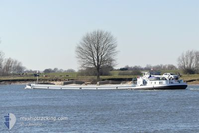
STELLA MARIS
Cargo
Current Trip
| Trip Time | 5 h, 31 mins |
|---|---|
| Trip Distance | 22.91 nm |
| AVG Speed | 5.9 Knots |
| MAX Speed | 7.2 Knots |
| Draught | 0.1 m |
| AVG Wind | 10.8 knots |
| MAX Wind | 12 knots |
| MIN Temp | 13.9°C / 57.02°F |
| MAX Temp | 16.8°C / 62.24°F |
| Position Received | 14 h, 43 m ago |
Current Position
| Longitude | 3.89285° |
|---|---|
| Latitude | 51.51293° |
| Status | Under way using engine |
| Speed | 1.6 Knots |
| Course | --- |
| Area | North Sea |
| Station | T-AIS |
| Position Received | 14 h, 43 m ago |
Info
Information
The current position of STELLA MARIS is in North Sea with coordinates 51.51293° / 3.89285° as reported on 2024-05-23 13:04 by AIS to our vessel tracker app. The vessel's current speed is 1.6 Knots and is currently inside the port of GOES.
The vessel STELLA MARIS (MMSI: 244890951) is a Cargo It's sailing under the flag of [NL] Netherlands.
In this page you can find informations about the vessels current position, last detected port calls, and current voyage information. If the vessels is not in coverage by AIS you will find the latest position.
The current position of STELLA MARIS is detected by our AIS receivers and we are not responsible for the reliability of the data. The last position was recorded while the vessel was in Coverage by the Ais receivers of our vessel tracking app.
The current draught of STELLA MARIS as reported by AIS is 0.1 meters
Weather
| Temperature | 12.6°C / 54.68°F |
|---|---|
| Wind Speed | --- |
| Direction | 297° WNW |
| Pressure | 1017.1 hPa |
| Humidity | 87.5 % |
| Cloud Coverage | 100 % |
Featured Company
Last Port Calls
| Port | Arrival | Departure | Time In Port |
|---|---|---|---|
| 2024-05-23 12:39 | |||
| 2024-05-22 17:54 | 2024-05-23 07:08 | 13 h | |
| 2024-05-16 17:47 | 2024-05-17 07:38 | 13 h | |
| 2024-05-14 15:04 | 2024-05-15 10:02 | 18 h | |
| 2024-05-13 21:08 | 2024-05-14 14:45 | 17 h | |
| 2024-05-13 15:44 | 2024-05-13 15:57 | 13 m | |
| 2024-05-13 10:35 | 2024-05-13 13:18 | 2 h | |
| 2024-05-13 09:34 | 2024-05-13 10:00 | 26 m | |
| 2024-05-09 18:21 | 2024-05-13 08:32 | 3 d | |
| 2024-05-08 20:02 | 2024-05-09 04:39 | 8 h |
Last Trips
| Origin | Departure | Destination | Arrival | Distance | |
|---|---|---|---|---|---|
| 2024-05-23 09:08 | 2024-05-23 14:39 | 22.91 nm | |||
| 2024-05-17 09:38 | 2024-05-22 19:54 | 190.23 nm | |||
| 2024-05-15 12:02 | 2024-05-16 19:47 | 67.41 nm | |||
| 2024-05-14 16:45 | 2024-05-14 17:04 | 1.71 nm | |||
| 2024-05-13 17:57 | 2024-05-13 23:08 | 30.10 nm | |||
| 2024-05-13 15:18 | 2024-05-13 17:44 | 19.55 nm | |||
| 2024-05-13 12:00 | 2024-05-13 12:35 | 2.30 nm | |||
| 2024-05-13 10:32 | 2024-05-13 11:34 | 4.80 nm | |||
| 2024-05-09 06:39 | 2024-05-09 20:21 | 92.80 nm | |||
| 2024-05-06 12:15 | 2024-05-08 22:02 | 142.70 nm |
Events
| Time | Event | Details | Position / Dest | Info |
|---|---|---|---|---|
| 2024-05-23 13:08 | Status Changed | Default Under way using engine |
51.51150 / 3.89300
[NL] GOES
|
Speed: 1.6 kn Course: 511° |
| 2024-05-23 13:08 | STOP Moving |
51.51150 / 3.89300
[NL] GOES
|
Speed: Course: -1° |
|
| 2024-05-23 13:04 | OUT of Coverage |
51.51293 / 3.89285
North Sea
[NL] GOES
|
Speed: 1.6 kn Course: 182.4° |
|
| 2024-05-23 12:39 | PORT ARRIVAL |
|
51.52547 / 3.89603
[NL] GOES
|
Speed: 1.8 kn Course: 511° |
| 2024-05-23 11:55 | START Moving | 0.17 nm, West of HET SAS |
51.53739 / 3.92107
GOES HAVENS
|
Speed: 3.4 kn Course: 268.9° |
| 2024-05-23 11:30 | STOP Moving | 0.08 nm, East of HET SAS |
51.53767 / 3.92764
GOES HAVENS
|
Speed: Course: 511° |
| 2024-05-23 09:42 | IN Coverage |
51.62370 / 4.06332
North Sea
|
Speed: 5.7 kn Course: 235.3° |
|
| 2024-05-23 08:27 | Status Changed | Default Under way using engine |
51.66184 / 4.16155
GOES HAVENS
|
Speed: 7.1 kn Course: 249.4° |
| 2024-05-23 07:53 | OUT of Coverage |
51.64091 / 4.24151
North Sea
|
Speed: 7.1 kn Course: 249.4° |
|
| 2024-05-23 07:12 | Status Changed | Under way using engine Default |
51.66112 / 4.36459
GOES HAVENS
|
Speed: Course: -1° |