
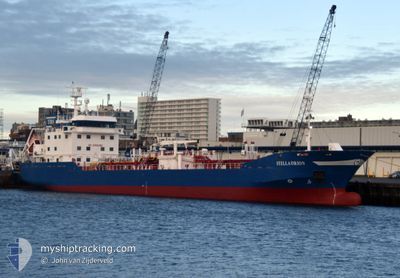
STELLA ORION
Oil/Chemical Tanker
Current Trip
| Time Travelled | 10 days |
|---|---|
| Remaining Time | 6 h, 29 mins |
| Distance Travelled | 1865.64 nm |
| Remaining Distance | 78.01 nm |
| AVG Speed | 11.5 Knots |
| MAX Speed | 16.1 Knots |
| AVG Wind | 14.7 knots |
| MAX Wind | 30 knots |
| MIN Temp | 7.8°C / 46.04°F |
| MAX Temp | 19.1°C / 66.38°F |
| Draught | 6.3 m |
| Position Received | 2 m ago |
Current Position
| Longitude | 9.24211° |
|---|---|
| Latitude | 58.18692° |
| Status | Under way using engine |
| Speed | 12.2 Knots |
| Course | 41.6° |
| Area | Skaggerak |
| Station | T-AIS |
| Position Received | 2 m ago |
Info
Information
The current position of STELLA ORION is in Skaggerak with coordinates 58.18692° / 9.24211° as reported on 2024-06-20 12:18 by AIS to our vessel tracker app. The vessel's current speed is 12.2 Knots and is heading at the port of SANDEFJORD. The estimated time of arrival as calculated by vessel tracking app is 2024-06-20 18:49 LT
The vessel STELLA ORION (IMO: 9265251, MMSI: 246553000) is a Oil/Chemical Tanker that was built in 2004 ( 20 years old ). It's sailing under the flag of [NL] Netherlands.
In this page you can find informations about the vessels current position, last detected port calls, and current voyage information. If the vessels is not in coverage by AIS you will find the latest position.
The current position of STELLA ORION is detected by our AIS receivers and we are not responsible for the reliability of the data. The last position was recorded while the vessel was in Coverage by the Ais receivers of our vessel tracking app.
The current draught of STELLA ORION as reported by AIS is 6.3 meters
Weather
| Temperature | 13.9°C / 57.02°F |
|---|---|
| Wind Speed | 26 knots |
| Direction | 231° SW |
| Pressure | 1015.9 hPa |
| Humidity | 86 % |
| Cloud Coverage | 18 % |
Featured Company
Last Port Calls
| Port | Arrival | Departure | Time In Port |
|---|---|---|---|
| 2024-06-09 04:47 | 2024-06-09 22:33 | 17 h | |
| 2024-06-07 10:46 | 2024-06-08 01:07 | 14 h | |
| 2024-06-05 12:26 | 2024-06-06 20:16 | 1 d | |
| 2024-06-03 22:58 | 2024-06-05 12:18 | 1 d | |
| 2024-05-31 01:35 | 2024-06-03 22:23 | 3 d | |
| 2024-05-30 06:51 | 2024-05-31 01:28 | 18 h | |
| 2024-05-29 08:44 | 2024-05-30 06:25 | 21 h | |
| 2024-05-28 12:13 | 2024-05-29 08:32 | 20 h | |
| 2024-05-18 18:58 | 2024-05-19 14:55 | 19 h | |
| 2024-04-30 09:00 | 2024-05-18 16:27 | 18 d |
Most Visited Ports (Last year)
| Port | Arrivals | |
|---|---|---|
| 16 | ||
| 11 | ||
| 6 | ||
| 6 | ||
| 5 | ||
| 5 |
Last Trips
| Origin | Departure | Destination | Arrival | Distance | |
|---|---|---|---|---|---|
| 2024-06-08 02:07 | 2024-06-09 06:47 | 167.39 nm | |||
| 2024-06-06 22:16 | 2024-06-07 11:46 | 163.79 nm | |||
| 2024-06-05 14:18 | 2024-06-05 14:26 | 0.88 nm | |||
| 2024-06-04 00:23 | 2024-06-04 00:58 | 3.87 nm | |||
| 2024-05-31 03:28 | 2024-05-31 03:35 | 1.54 nm | |||
| 2024-05-30 08:25 | 2024-05-30 08:51 | 4.50 nm | |||
| 2024-05-29 10:32 | 2024-05-29 10:44 | 0.99 nm | |||
| 2024-05-19 16:55 | 2024-05-28 14:13 | 1826.76 nm | |||
| 2024-05-18 18:27 | 2024-05-18 20:58 | 26.14 nm | |||
| 2024-04-27 09:04 | 2024-04-30 11:00 | 523.23 nm |
Events
| Time | Event | Details | Position / Dest | Info |
|---|---|---|---|---|
| 2024-06-20 08:14 | Change Sea Area | Norwegian part of the Skaggerak Danish part of the Skaggerak |
57.58488 / 8.31213
Skaggerak
NLDZL > NOTRF
|
Speed: 11.8 kn Course: 34.9° |
| 2024-06-20 07:11 | Change Sea Area | Danish part of the Skaggerak Danish part of the North Sea |
57.41591 / 8.08151
Skaggerak
NLDZL > NOTRF
|
Speed: 12 kn Course: 36.8° |
| 2024-06-19 21:06 | ETA Changed | 2024/06/20 15:00 2024/06/20 17:00 |
55.86959 / 6.60839
NLDZL > NOTRF
|
Speed: 8.5 kn Course: 4.3° |
| 2024-06-19 20:09 | Status Changed | Under way using engine Default |
55.71384 / 6.58979
NLDZL > NOTRF
|
Speed: 9.5 kn Course: 6° |
| 2024-06-19 20:09 | IN Coverage |
55.71666 / 6.59018
North Sea
NLDZL > NOTRF
|
Speed: 9.6 kn Course: 3.5° |
|
| 2024-06-19 19:03 | Status Changed | Default Under way using engine |
55.54161 / 6.55998
NLDZL > NOTRF
|
Speed: 9.7 kn Course: 6.1° |
| 2024-06-19 18:57 | Status Changed | Under way using engine Default |
55.52626 / 6.55694
NLDZL > NOTRF
|
Speed: 10.3 kn Course: 8° |
| 2024-06-19 18:57 | OUT of Coverage |
55.52626 / 6.55694
North Sea
NLDZL > NOTRF
|
Speed: 9.7 kn Course: 6.1° |
|
| 2024-06-19 18:43 | Status Changed | Default Under way using engine |
55.49027 / 6.54976
NLDZL > NOTRF
|
Speed: 9.7 kn Course: 7.1° |
| 2024-06-19 18:39 | Status Changed | Under way using engine Default |
55.47990 / 6.54773
NLDZL > NOTRF
|
Speed: 8.9 kn Course: 9° |