
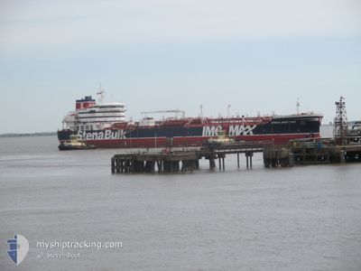
STENA IMPRIMIS
Tanker
Current Trip
| Time Travelled | 10 days |
|---|---|
| Remaining Time | --- |
| Distance Travelled | 3323.85 nm |
| Remaining Distance | --- |
| AVG Speed | 12.3 Knots |
| MAX Speed | 15.4 Knots |
| AVG Wind | 13.9 knots |
| MAX Wind | 33 knots |
| MIN Temp | 10.6°C / 51.08°F |
| MAX Temp | 23.8°C / 74.84°F |
| Draught | 10.2 m |
| Position Received | 7 d ago |
Current Position
| Longitude | -17.45187° |
|---|---|
| Latitude | 46.33984° |
| Status | Under way using engine |
| Speed | 12.1 Knots |
| Course | 253.7° |
| Area | North Atlantic Ocean |
| Station | T-AIS |
| Position Received | 7 d ago |
Info
Information
The current position of STENA IMPRIMIS is in North Atlantic Ocean with coordinates 46.33984° / -17.45187° as reported on 2024-06-13 03:27 by AIS to our vessel tracker app. The vessel's current speed is 12.1 Knots and is heading at the port of PORT EVERGLADES. The estimated time of arrival as calculated by vessel tracking app is 2024-06-23 12:00 LT
The vessel STENA IMPRIMIS (IMO: 9797395, MMSI: 232010295) is a Tanker It's sailing under the flag of [GB] United Kingdom.
In this page you can find informations about the vessels current position, last detected port calls, and current voyage information. If the vessels is not in coverage by AIS you will find the latest position.
The current position of STENA IMPRIMIS is detected by our AIS receivers and we are not responsible for the reliability of the data. The last position was recorded while the vessel was in Coverage by the Ais receivers of our vessel tracking app.
The current draught of STENA IMPRIMIS as reported by AIS is 10.2 meters
Weather
| Temperature | 24.5°C / 76.1°F |
|---|---|
| Wind Speed | 10 knots |
| Direction | 93° E |
| Pressure | 1025.9 hPa |
| Humidity | 66.1 % |
| Cloud Coverage | 46 % |
Featured Company
Last Port Calls
| Port | Arrival | Departure | Time In Port |
|---|---|---|---|
| 2024-06-05 20:35 | 2024-06-09 22:44 | 4 d | |
| 2024-06-01 20:42 | 2024-06-04 01:17 | 2 d | |
| 2024-05-21 08:12 | 2024-05-22 16:45 | 1 d | |
| 2024-05-20 20:38 | 2024-05-21 07:19 | 10 h | |
| 2024-05-11 02:18 | 2024-05-11 18:26 | 16 h | |
| 2024-05-07 18:30 | 2024-05-08 23:08 | 1 d | |
| 2024-04-28 08:38 | 2024-04-29 09:05 | 1 d | |
| 2024-04-18 09:07 | 2024-04-19 09:07 | 1 d | |
| 2024-04-15 12:45 | 2024-04-18 06:38 | 2 d | |
| 2024-04-12 03:58 | 2024-04-14 02:34 | 1 d |
Most Visited Ports (Last year)
| Port | Arrivals | |
|---|---|---|
| 4 | ||
| 4 | ||
| 2 | ||
| 2 | ||
| 2 | ||
| 2 |
Last Trips
| Origin | Departure | Destination | Arrival | Distance | |
|---|---|---|---|---|---|
| 2024-06-04 02:17 | 2024-06-05 22:35 | 199.55 nm | |||
| 2024-05-22 18:45 | 2024-06-01 21:42 | 2196.08 nm | |||
| 2024-05-21 09:19 | 2024-05-21 10:12 | 2.00 nm | |||
| 2024-05-11 20:26 | 2024-05-20 22:38 | 901.86 nm | |||
| 2024-05-09 01:08 | 2024-05-11 04:18 | 629.86 nm | |||
| 2024-04-29 11:05 | 2024-05-07 20:30 | 2005.81 nm | |||
| 2024-04-19 11:07 | 2024-04-28 10:38 | 122.35 nm | |||
| 2024-04-18 08:38 | 2024-04-18 11:07 | 19.47 nm | |||
| 2024-04-14 03:34 | 2024-04-15 14:45 | 174.48 nm | |||
| 2024-03-24 09:39 | 2024-04-12 04:58 | 5007.83 nm |
Events
| Time | Event | Details | Position / Dest | Info |
|---|---|---|---|---|
| 2024-06-13 03:34 | Status Changed | Default Under way using engine |
46.33333 / -17.48333
USPEF
|
Speed: 12.1 kn Course: 253.7° |
| 2024-06-13 03:27 | OUT of Coverage |
46.33984 / -17.45187
North Atlantic Ocean
USPEF
|
Speed: 12.1 kn Course: 253.7° |
|
| 2024-06-13 02:00 | Change Sea Area | High seas of the North Atlantic Ocean United Kingdom part of the English Channel |
46.44663 / -17.07726
North Atlantic Ocean
USPEF
|
Speed: 12.1 kn Course: 249.2° |
| 2024-06-13 02:00 | Status Changed | Under way using engine Default |
46.44663 / -17.07726
USPEF
|
Speed: 12 kn Course: 249° |
| 2024-06-13 01:49 | IN Coverage |
46.44663 / -17.07726
North Atlantic Ocean
USPEF
|
Speed: 12.1 kn Course: 249.2° |
|
| 2024-06-11 08:07 | Status Changed | Default Under way using engine |
49.69077 / -4.58359
USPEF
|
Speed: 12.1 kn Course: 253.1° |
| 2024-06-11 08:02 | OUT of Coverage |
49.69535 / -4.55975
English Channel
USPEF
|
Speed: 12.1 kn Course: 253.1° |
|
| 2024-06-11 07:52 | Status Changed | Under way using engine Default |
49.70496 / -4.51022
USPEF
|
Speed: 12.2 kn Course: 255° |
| 2024-06-11 07:39 | Status Changed | Default Under way using engine |
49.71653 / -4.44411
USPEF
|
Speed: 12.2 kn Course: 255.3° |
| 2024-06-11 03:45 | Detected in Sea | United Kingdom part of the English Channel |
49.94856 / -3.12577
English Channel
USPEF
|
Speed: 14.8 kn Course: 254.9° |