
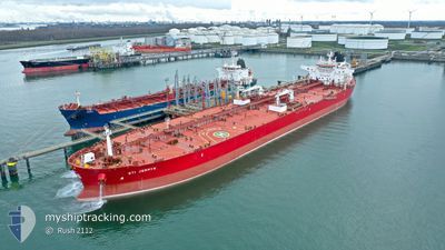
STI JERMYN
Tanker
Current Trip
EGSKT
| Time Travelled | 11 days |
|---|---|
| Remaining Time | --- |
| Distance Travelled | 3196.15 nm |
| Remaining Distance | --- |
| AVG Speed | 12.9 Knots |
| MAX Speed | 17.3 Knots |
| AVG Wind | 9 knots |
| MAX Wind | 21.8 knots |
| MIN Temp | 12.4°C / 54.32°F |
| MAX Temp | 21.3°C / 70.34°F |
| Draught | 9 m |
| Position Received | 1 d ago |
Current Position
| Longitude | 20.21807° |
|---|---|
| Latitude | 34.41303° |
| Status | Under way using engine |
| Speed | 13.3 Knots |
| Course | 110.3° |
| Area | Mediterranean Sea - Eastern Basin |
| Station | T-AIS |
| Position Received | 1 d ago |
Info
Information
The current position of STI JERMYN is in Mediterranean Sea - Eastern Basin with coordinates 34.41303° / 20.21807° as reported on 2024-05-25 22:18 by AIS to our vessel tracker app. The vessel's current speed is 13.3 Knots
The vessel STI JERMYN (IMO: 9722596, MMSI: 538006357) is a Tanker It's sailing under the flag of [MH] Marshall Is.
In this page you can find informations about the vessels current position, last detected port calls, and current voyage information. If the vessels is not in coverage by AIS you will find the latest position.
The current position of STI JERMYN is detected by our AIS receivers and we are not responsible for the reliability of the data. The last position was recorded while the vessel was in Coverage by the Ais receivers of our vessel tracking app.
The current draught of STI JERMYN as reported by AIS is 9 meters
Weather
| Temperature | 21.7°C / 71.06°F |
|---|---|
| Wind Speed | 15 knots |
| Direction | 327° NNW |
| Pressure | 1012.2 hPa |
| Humidity | 76.8 % |
| Cloud Coverage | --- |
Featured Company
Last Port Calls
| Port | Arrival | Departure | Time In Port |
|---|---|---|---|
| 2024-05-14 07:29 | 2024-05-15 16:23 | 1 d | |
| 2024-04-16 01:29 | 2024-04-17 13:01 | 1 d | |
| 2024-03-25 05:34 | 2024-03-26 16:18 | 1 d | |
| 2024-03-13 18:02 | 2024-03-14 23:03 | 1 d |
Most Visited Ports (Last year)
| Port | Arrivals | |
|---|---|---|
| 4 | ||
| 2 | ||
| 2 | ||
| 2 | ||
| 1 | ||
| 1 |
Last Trips
| Origin | Departure | Destination | Arrival | Distance | |
|---|---|---|---|---|---|
| 2024-04-17 08:01 | 2024-05-14 09:29 | 5159.83 nm | |||
| 2024-03-26 17:18 | 2024-04-15 20:29 | 5336.89 nm | |||
| 2024-03-14 20:33 | 2024-03-25 06:34 | 2684.19 nm | |||
| 2024-02-28 23:58 | 2024-03-13 15:32 | 2789.78 nm |
Events
| Time | Event | Details | Position / Dest | Info |
|---|---|---|---|---|
| 2024-05-25 22:29 | Status Changed | Default Under way using engine |
34.39758 / 20.26854
EGSKT
|
Speed: 13.3 kn Course: 110.3° |
| 2024-05-25 22:18 | OUT of Coverage |
34.41303 / 20.21807
Mediterranean Sea - Eastern Basin
EGSKT
|
Speed: 13.3 kn Course: 110.3° |
|
| 2024-05-25 21:42 | Status Changed | Under way using engine Default |
34.45993 / 20.06861
EGSKT
|
Speed: 13.1 kn Course: 111° |
| 2024-05-25 21:34 | IN Coverage |
34.45993 / 20.06861
Mediterranean Sea - Eastern Basin
EGSKT
|
Speed: 13.1 kn Course: 111.3° |
|
| 2024-05-25 16:34 | Status Changed | Default Under way using engine |
34.87223 / 18.80372
EGSKT
|
Speed: 13.1 kn Course: 112.4° |
| 2024-05-25 16:29 | OUT of Coverage |
34.87885 / 18.78457
Mediterranean Sea - Eastern Basin
EGSKT
|
Speed: 13.1 kn Course: 112.4° |
|
| 2024-05-25 16:09 | Detected in Sea | Libyan part of the Mediterranean Sea - Eastern Basin |
34.90764 / 18.70034
Mediterranean Sea - Eastern Basin
EGSKT
|
Speed: 13.2 kn Course: 112.4° |
| 2024-05-25 16:08 | Status Changed | Under way using engine Default |
34.90901 / 18.69625
EGSKT
|
Speed: 13 kn Course: 112° |
| 2024-05-25 16:08 | IN Coverage |
34.90764 / 18.70034
Mediterranean Sea - Eastern Basin
EGSKT
|
Speed: 13.2 kn Course: 112.4° |
|
| 2024-05-25 10:58 | OUT of Coverage |
35.31780 / 17.43377
Mediterranean Sea - Eastern Basin
EGSKT
|
Speed: 12.8 kn Course: 109.9° |