
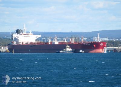
STI SELATAR
Tanker
Current Trip
| Time Travelled | 3 days |
|---|---|
| Remaining Time | 17 h, 22 mins |
| Distance Travelled | 429.23 nm |
| Remaining Distance | 223.64 nm |
| AVG Speed | 12 Knots |
| MAX Speed | 13.9 Knots |
| AVG Wind | 7 knots |
| MAX Wind | 15.3 knots |
| MIN Temp | 32.1°C / 89.78°F |
| MAX Temp | 36.7°C / 98.06°F |
| Draught | 14.4 m |
| Position Received | 1 m ago |
Current Position
| Longitude | 54.42707° |
|---|---|
| Latitude | 26.01742° |
| Status | Under way using engine |
| Speed | 12.7 Knots |
| Course | 99° |
| Area | Persian Gulf |
| Station | T-AIS |
| Position Received | 1 m ago |
Info
Information
The current position of STI SELATAR is in Persian Gulf with coordinates 26.01742° / 54.42707° as reported on 2024-06-27 18:18 by AIS to our vessel tracker app. The vessel's current speed is 12.7 Knots and is heading at the port of FUJAIRAH. The estimated time of arrival as calculated by vessel tracking app is 2024-06-28 11:41 LT
The vessel STI SELATAR (IMO: 9729245, MMSI: 538005642) is a Tanker It's sailing under the flag of [MH] Marshall Is.
In this page you can find informations about the vessels current position, last detected port calls, and current voyage information. If the vessels is not in coverage by AIS you will find the latest position.
The current position of STI SELATAR is detected by our AIS receivers and we are not responsible for the reliability of the data. The last position was recorded while the vessel was in Coverage by the Ais receivers of our vessel tracking app.
The current draught of STI SELATAR as reported by AIS is 14.4 meters
Weather
| Temperature | 32.1°C / 89.78°F |
|---|---|
| Wind Speed | 1 knots |
| Direction | 295° WNW |
| Pressure | 996.3 hPa |
| Humidity | 74.2 % |
| Cloud Coverage | 1 % |
Featured Company
Last Port Calls
| Port | Arrival | Departure | Time In Port |
|---|---|---|---|
| 2024-06-23 01:30 | 2024-06-24 16:24 | 1 d | |
| 2024-04-26 22:23 | 2024-04-29 17:03 | 2 d | |
| 2024-04-21 20:53 | 2024-04-23 12:26 | 1 d |
Most Visited Ports (Last year)
| Port | Arrivals | |
|---|---|---|
| 2 | ||
| 2 | ||
| 2 | ||
| 1 | ||
| 1 | ||
| 1 |
Events
| Time | Event | Details | Position / Dest | Info |
|---|---|---|---|---|
| 2024-06-27 13:55 | ETA Changed | 2024/06/28 13:30 2024/06/28 12:00 |
26.13215 / 53.46170
FUJAIRAH
|
Speed: 12.5 kn Course: 97° |
| 2024-06-27 00:04 | ETA Changed | 2024/06/28 12:00 2024/06/28 14:00 |
27.30068 / 50.96601
FUJAIRAH
|
Speed: 11.9 kn Course: 151° |
| 2024-06-26 20:49 | Status Changed | Under way using engine Default |
27.84855 / 50.61755
FUJAIRAH
|
Speed: 11.8 kn Course: 144° |
| 2024-06-26 20:34 | Draught Changed | 14.4 8.8 |
27.91081 / 50.56810
FUJAIRAH
|
Speed: 11.8 kn Course: 145° |
| 2024-06-26 20:34 | Destination Changed | FUJAIRAH MINA AL AHMADI |
27.91081 / 50.56810
FUJAIRAH
|
Speed: 11.8 kn Course: 145° |
| 2024-06-26 20:34 | ETA Changed | 2024/06/28 14:00 2024/06/22 19:00 |
27.91081 / 50.56810
FUJAIRAH
|
Speed: 11.8 kn Course: 145° |
| 2024-06-26 20:30 | Status Changed | Default Under way using engine |
27.89762 / 50.57840
FUJAIRAH
|
Speed: 11.8 kn Course: 145° |
| 2024-06-26 20:25 | Status Changed | Under way using engine Default |
27.91081 / 50.56810
MINA AL AHMADI
|
Speed: 11.8 kn Course: 146° |
| 2024-06-26 20:02 | Status Changed | Default Under way using engine |
27.97132 / 50.52195
MINA AL AHMADI
|
Speed: 11.7 kn Course: 146° |
| 2024-06-26 20:02 | Status Changed | Under way using engine Default |
27.97361 / 50.52024
MINA AL AHMADI
|
Speed: 11.9 kn Course: 155° |