
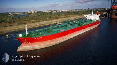
STI SOLACE
Tanker
Current Trip
| Time Travelled | 14 days |
|---|---|
| Remaining Time | 53 mins |
| Distance Travelled | 3348.85 nm |
| Remaining Distance | 17.96 nm |
| AVG Speed | 12.4 Knots |
| MAX Speed | 12.4 Knots |
| AVG Wind | 14.3 knots |
| MAX Wind | 30 knots |
| MIN Temp | 11.7°C / 53.06°F |
| MAX Temp | 32.5°C / 90.5°F |
| Draught | 9 m |
| Position Received | 26 m ago |
Current Position
| Longitude | 32.19551° |
|---|---|
| Latitude | 31.52545° |
| Status | Under way using engine |
| Speed | 12.5 Knots |
| Course | 126.9° |
| Area | Mediterranean Sea - Eastern Basin |
| Station | T-AIS |
| Position Received | 26 m ago |
Info
Information
The current position of STI SOLACE is in Mediterranean Sea - Eastern Basin with coordinates 31.52545° / 32.19551° as reported on 2024-06-27 07:19 by AIS to our vessel tracker app. The vessel's current speed is 12.5 Knots and is heading at the port of PORT SAID. The estimated time of arrival as calculated by vessel tracking app is 2024-06-27 08:39 LT
The vessel STI SOLACE (IMO: 9708588, MMSI: 538006077) is a Tanker It's sailing under the flag of [MH] Marshall Is.
In this page you can find informations about the vessels current position, last detected port calls, and current voyage information. If the vessels is not in coverage by AIS you will find the latest position.
The current position of STI SOLACE is detected by our AIS receivers and we are not responsible for the reliability of the data. The last position was recorded while the vessel was in Coverage by the Ais receivers of our vessel tracking app.
The current draught of STI SOLACE as reported by AIS is 9 meters
Weather
| Temperature | 26°C / 78.8°F |
|---|---|
| Wind Speed | 6 knots |
| Direction | 291° WNW |
| Pressure | 1007 hPa |
| Humidity | 80.9 % |
| Cloud Coverage | --- |
Featured Company
Most Visited Ports (Last year)
| Port | Arrivals | |
|---|---|---|
| 3 | ||
| 3 | ||
| 2 | ||
| 2 | ||
| 1 | ||
| 1 |
Events
| Time | Event | Details | Position / Dest | Info |
|---|---|---|---|---|
| 2024-06-27 07:16 | Status Changed | Under way using engine Default |
31.53264 / 32.18491
PORT SAID
|
Speed: 12.5 kn Course: 132° |
| 2024-06-27 07:10 | Status Changed | Default Under way using engine |
31.54695 / 32.16580
PORT SAID
|
Speed: 12.6 kn Course: 134° |
| 2024-06-27 05:55 | Status Changed | Under way using engine Default |
31.75751 / 31.95125
PORT SAID
|
Speed: 14.3 kn Course: 129° |
| 2024-06-27 05:18 | Status Changed | Default Under way using engine |
31.84582 / 31.81106
PORT SAID
|
Speed: 13.9 kn Course: 139.3° |
| 2024-06-27 04:05 | Status Changed | Under way using engine Default |
32.02002 / 31.58344
PORT SAID
|
Speed: 11.7 kn Course: 126° |
| 2024-06-27 03:35 | Status Changed | Default Under way using engine |
32.07459 / 31.48948
PORT SAID
|
Speed: 11.7 kn Course: 126° |
| 2024-06-26 21:16 | Status Changed | Under way using engine Default |
32.55408 / 29.90002
PORT SAID
|
Speed: 13.9 kn Course: 106° |
| 2024-06-26 21:10 | Status Changed | Default Under way using engine |
32.56026 / 29.87441
PORT SAID
|
Speed: 13.8 kn Course: 106.1° |
| 2024-06-26 19:30 | Status Changed | Under way using engine Default |
32.66230 / 29.43804
PORT SAID
|
Speed: 13.6 kn Course: 105° |
| 2024-06-26 19:26 | Status Changed | Default Under way using engine |
32.66639 / 29.41999
PORT SAID
|
Speed: 13.6 kn Course: 104.3° |